Gjirokaster, Albania - City Map
Looking for an easy-to-use, pocket city map that you can carry around with you, wherever you go without having to juggle with foldable maps that quickly turn into a complete mess? The Glob: us city maps is all you'll need to have the whole city within arm's reach: crystal-clear maps, at a comfortable scale, with all the points of interest included, plus a handy streets index, so that you'll never miss a thing again. So, are you ready for your next adventure?
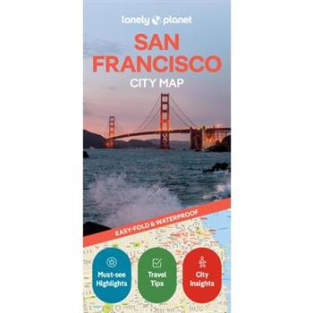
Lonely Planet San Francisco City Map
Experience your dream trip with Lonely Planet's San Francisco City Map, the ultimate travel tool to help you plan and navigate your way around amazing local sights, landmarks and attractions.Visit the chilling Alcatraz, hop aboard a cable car for a ride over San Francisco hills, find 360-degree views from Coit Tower, and decide where you want to go next and what you want to see in each of the city's exciting neighborhoods.Inside Lonely Planet's San Francisco City Map: Full color map in a durable easy-fold formatWaterproof and packaged in a handy slipcaseAlphanumeric grid to find points of interest easilyPublic transport explained to help you get aroundTop picks of must-see highlights including Chinatown Alleyways, Exploratorium, and Golden Gate ParkEssential travel tips and nuts and bolts information on food, drink & nightlife, and moneyBeautiful photography and bonus zoomed-in map ofHaight StreetCovers: The Castro, Chinatown, Civic Center, Cole Valley, Cow Hollow, Financial District (FiDi), Fisherman's Wharf, Hayes Valley, Jackson Square, Japantown, Lower Haight, The Marina, The Mission, Mission Bay, Nob Hill, North Beach, Pacific Heights, Presidio, The Richmond, Russian Hill, The Sunset, South of Market (SoMa), The Tenderloin, Union Square, Upper Haight, Western Addition Get ready for your next adventure with Lonely Planet's San Francisco City Map, the ultimate navigation tool to help you explore San Francisco's well-known attractions and best-kept secrets.
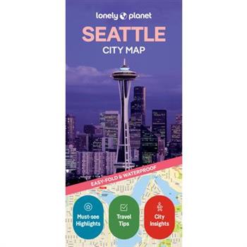
Lonely Planet Seattle City Map
Experience your dream trip with Lonely Planet's Seattle City Map, the ultimate travel tool to help you plan and navigate your way around amazing local sights, landmarks and attractions.Ride to the top of the Space Needle, explore the Museum of Pop Culture, roam Discovery Park, and decide where you want to go next and what you want to see in each of the city's exciting neighborhoods.Inside Lonely Planet's Seattle City Map: Full color map in a durable easy-fold formatWaterproof and packaged in a handy slipcaseAlphanumeric grid to find points of interest easilyPublic transport explained to help you get aroundTop picks of must-see highlights including the Museum of Flight, Green Lake Park and Pike Market PlaceEssential travel tips and nuts and bolts information on money, family travel, food & drinkBeautiful photography and bonus zoomed-in map ofGreater Seattle and Queen AnneCovers: Ballard, Belltown, Capitol Hill, Central District, Denny Triangle, Downtown, Eastlake, First Hill, Fremont, International District, Little Saigon, Lower Queen Anne, Madison Park, Madison Valley, Madrona, Montlake, Phinney Ridge, Pioneer Square, Portage Bay, Queen Anne, Seattle Center, Sodo, South Lake Union, The Waterfront, U District, Wallingford, West Edge, Westlake Get ready for your next adventure with Lonely Planet's Seattle City Map, the ultimate navigation tool to help you explore Seattle's well-known attractions and best-kept secrets.
Great Lakes in 50 Maps
A new way of looking at the largest freshwater system on Earth.The Great Lakes region is not a primary regional identity―most people would identify as a midwesterner or Ohioan or even a Rust Belt first. In Great Lakes in 50 Maps, cartographer and author of Detroit in 50 Maps Alex B. Hill explores what actually is distinctive about the wide swath of the US and Canada and presents new ways of looking at the inland seas, from the region's production of pumpkins and maple syrup to mapping where businesses use "Great Lakes" in their name and more. This far-ranging visual guide offers a fresh look even for lifelong residents. Split into four categories―history & culture, ecological, infrastructure, and physical―these maps guide readers on a curated and quirky history, from its importance to the Underground Railroad to how climate change is affecting the lakes' present and future.Similar to Belt Publishing's ever-popular city-based 50 Maps series, Great Lakes in 50 Maps appeals to both those who call the region home and to everyone who is curious about one of our country's greatest natural resources.
DK Top 10 New Orleans
Make the most of your trip to New Orleans with this Top 10 guide. Planning is a breeze with our simple lists of ten, covering the very best that New Orleans has to offer and ensuring that you don't miss a thing. Best of all, the pocket-friendly format is light and easily portable; the perfect companion while out and about. Inside this guide to New Orleans, you'll find: Top 10 lists of New Orleans's must-sees and must-dos, including devouring heaving plates of gumbo, admiring pieces in the New Orleans Museum of Art and listening to live music on Bourbon StreetNew Orleans's most interesting areas, with the best places for sightseeing, food and drink, and shoppingThemed lists, including the best architectural highlights, museums and galleries, live music venues, regional dishes and much moreBrand-new itineraries, perfect for a day trip, a weekend or a weekA laminated pull-out map of New Orleans, plus five full-color area mapsDK's Top 10 travel guides have been helping travellers to make the most of their breaks since 2002. Looking for more on New Orleans's culture, history and attractions? Try our DK New Orleans travel guide.
DK Top 10 Cornwall and Devon
Make the most of your trip to Cornwall and Devon with this Top 10 guide. Planning is a breeze with our simple lists of ten, covering the very best that Cornwall and Devon has to offer and ensuring that you don't miss a thing. Best of all, the pocket-friendly format is light and easily portable; the perfect companion while out and about.Inside this guide to Cornwall and Devon, you'll find: Top 10 lists of Cornwall and Devon's must-sees and must-dos, including visiting beautiful Dartmoor, exploring the vibrant Eden Project and taking a boat trip around the Isles of ScillyCornwall and Devon's most interesting areas, with the best places for sightseeing, food and drink, and shoppingThemed lists, including the best museums, historic houses and castles, beaches, pubs and much moreBrand-new itineraries, perfect for a day trip, a weekend or a weekA laminated pull-out map of Cornwall and Devon, plus five full-color area mapsDK's Top 10 travel guides have been helping travellers to make the most of their breaks since 2002.Looking for more on Cornwall and Devon's culture, history and attractions? Try our DK England's South Coast travel guide.
DK Top 10 Andalucia and the Costa del Sol
Make the most of your trip to Andaluc穩a and the Costa del Sol with this Top 10 guide. Planning is a breeze with our simple lists of ten, covering the very best that Andaluc穩a and the Costa del Sol has to offer and ensuring that you don't miss a thing. Best of all, the pocket-friendly format is light and easily portable; the perfect companion while out and about. Inside this guide to Andaluc穩a and the Cost del Sol, you'll find: Top 10 lists of Andaluc穩a and the Costa del Sol's must-sees and must-dos, including visiting La Mezquita, exploring the Alhambra and marvelling at the beautiful tiles in the Plaza de Espa簽aAndaluc穩a and the Costa del Sol's most interesting areas, with the best places for sightseeing, food and drink, and shoppingThemed lists, including the best nature reserves, Andaluc穩an dishes, villages, flamenco and much moreEasy-to-follow itineraries, perfect for a day trip, a weekend or a weekA laminated pull-out map of Andaluc穩a and the Costa del Sol, plus six full-color area mapsDK's Top 10 travel guides have been helping travellers to make the most of their breaks since 2002. Looking for more on Andaluc穩a's culture, history and attractions? Try our DK Seville and Andaluc穩a travel guide.
DK New Orleans
Make your trip to New Orleans extraordinary Sipping classic cocktails at a jazz club. Joining in the fun at Mardi Gras. Taking a stroll along the legendary Bourbon Street. Whatever your dream trip involves, this DK travel guide is the perfect companion. Our updated guide brings New Orleans to life, transporting you there like no other travel guide does with expert-led insights, trusted travel advice, detailed breakdowns of all the must-see sights, photographs on practically every page, and our hand-drawn illustrations, which take you inside the city's buildings and neighbourhoods. You'll discover: - our pick of New Orleans's must-sees and top experiences- beautiful photography and detailed illustrations, taking you to the heart of New Orleans- the best spots to eat, drink, shop and stay- detailed maps and walks which make navigating the region easy- easy-to-follow itineraries- expert advice: get ready, get around and stay safe- colour-coded chapters to each part of New Orleans- a lightweight format, so you can take it with you wherever you go Want the best of New Orleans in your pocket? Try Top 10 New Orleans.
Atlas of the World
The only world atlas updated annually, Oxford's Atlas of the World is the most authoritative atlas on the market. Full of crisp, clear cartography of urban areas and natural landscapes around the globe, the Atlas contains maps of cities and regions at carefully selected scales that give a striking view of the Earth's surface. The volume opens with a detailed survey of world statistics, a six-page feature examining global cities with information on urban growth, city design, informal settlements, and sustainability, and an immersive collection of satellite images of Earth, including stunning new photographs specially sourced and processed for this atlas. The Atlas continues with a Gazetteer of Nations, comprehensively updated to provide a concise overview of the geography, politics, economy, and history of every country in the world. The extensive thematic World Geography section is beautifully illustrated with charts, maps, and graphs on diverse topics of geographic significance, including climate change, Earth's atmosphere, conflict and cooperation, biodiversity, tourism and travel, and global health. New data covers current topics such as migration and inequality. The hundreds of city and world maps that form the body of the Atlas have been thoroughly updated for this 32nd edition. Providing the finest global coverage available, the Atlas of the World offers a diverse collection of information and cartography of unrivaled accuracy and clarity, presented in an uncommonly beautiful volume.
Lonely Planet Lisbon City Map
Durable and waterproof, with a handy slipcase and an easy-fold format, Lonely Planet's Lisbon City Map is your conveniently sized passport to travelling with ease. With this easy-to-use, full-colour navigation tool in your back pocket, you can truly get to the heart of Lisbon, so begin your journey now!Durable and waterproofEasy-fold format and convenient sizeHandy slipcaseFull colour and easy to useExtensive street and site indexImages and information about top city attractionsHandy transport mapsWalking tour routesPractical travel tips and directoryItinerary suggestionsCovers Basilica da Estrela, Castelo de Sao Jorge, Convento do Carmo, Elevador de Santa Justa, Igreja, Museu Calouste Gulbenkian, Museu Nacional de Arte Antiga, Museu Sao Roque, Nucleo Arqueologico da Rue dos Correeiros, Praca do Comercio, Tram 28Looking for more extensive coverage? Check out Lonely Planet's Portugal, our most comprehensive guidebook to the country, covering the top sights and most authentic offbeat experiences. Or check out Lonely Planet'sPocket Lisbon, a handy-sized guide focused on the can't-miss experiences for a quick trip.About Lonely Planet: Lonely Planet, a Red Ventures Company, is the world's number one travel guidebook brand. Providing both inspiring and trustworthy information for every kind of traveller since 1973, Lonely Planet reaches hundreds of millions of travellers each year online and in print and helps them unlock amazing experiences. Visit us at lonelyplanet.com and join our community of followers on Facebook (facebook.com/lonelyplanet), Twitter (@lonelyplanet), Instagram (instagram.com/lonelyplanet), and TikTok (@lonelyplanet).'Lonely Planet. It's on everyone's bookshelves; it's in every traveller's hands. It's on mobile phones. It's on the Internet. It's everywhere, and it's telling entire generations of people how to travel the world.' Fairfax Media (Australia)
Lonely Planet Portugal Planning Map
Durable and waterproof, with a handy slipcase and an easy-fold format, Lonely Planet's Portugal Planning Map is your essential navigation tool. This full-colour map features accompanying images and information about top attractions, itinerary suggestions, a transport guide, themed lists and practical travel tips.Durable and waterproofEasy-fold format and convenient sizeHandy slipcaseFull colour and easy to useBefore-you-go infoBeautiful imageryTailored itinerariesCan't-miss regional highlightsDetailed town indexTransport plannerThemed listsCovers Aveiro, Batalha, Beaches of the Algarve, Braga, Cabo de Sao Vicente, Cascais, Coimbra, Evora, Ilha de Tavira, Lisbon, Maarvao, Mertola, Obidos, Parque Natural da Ria Formosa, Parque Natural da Serra da Estrela, Parque Natural das Serras de Aire e Candeeiros, Porto, Rio Douro Valley, Sintra, Looking for more extensive coverage? Check out Lonely Planet's Portugal, our most comprehensive guidebook to Portugal, covering the top sights and most authentic offbeat experiences. Or check out Lonely Planet'sExperience Portugal, a concise visual guide highlighting the top experiences of Portugal.About Lonely Planet: Lonely Planet, a Red Ventures Company, is the world's number one travel guidebook brand. Providing both inspiring and trustworthy information for every kind of traveller since 1973, Lonely Planet reaches hundreds of millions of travellers each year online and in print and helps them unlock amazing experiences. Visit us at lonelyplanet.com and join our community of followers on Facebook (facebook.com/lonelyplanet), Twitter (@lonelyplanet), Instagram (instagram.com/lonelyplanet), and TikTok (@lonelyplanet).'Lonely Planet. It's on everyone's bookshelves; it's in every traveller's hands. It's on mobile phones. It's on the Internet. It's everywhere, and it's telling entire generations of people how to travel the world.' Fairfax Media (Australia)
Irish Ordnance Survey Maps
The Ordnance Survey maps of Ireland have been a touchstone for historians, geographers and local historians alike in the 200 years since the organization was founded. In this work, Paul Mulligan of Trinity College Dublin, has put together an accessible guide for new researchers to help them make the most of this wonderful resource.
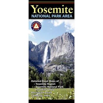
Yosemite National Park Area
Domes and spires soar thousands of feet above the floor of Yosemite Valley while some of the world's highest waterfalls plunge over its cliffs. Make the most of your trip to Yosemite with this map, featuring a detailed regional map of the central Sierras, a "closer-in" map of the entire Yosemite Park, and a magnified view of Yosemite Valley. Includes a Recreation Guide and index.
Wyoming Recreation Map
The Wyoming Recreation Map is a folded map version of the Recreation Guide pages within Benchmark's Wyoming Road & Recreation Atlas. One side provides a full state map that features Public & Tribal Lands, extensive highway detail, point-to-point mileages, recreation attractions, campgrounds, parks and wildlife areas, fishing access points, and hunting units (GMU). The reverse side features enlarged maps of Central Yellowstone and Grand Teton / Jackson, and includes statewide categorized POI listings with helpful descriptions, current contact information, and map grid references.Map Scale = 1:750,000Sheet Size = 34" x 27"Folded Size = 4" x 9"
Lonely Planet Havana City Map
Experience your dream trip with Lonely Planet's Havana City Map, the ultimate travel tool to help you plan and navigate your way around amazing local sights, landmarks and attractions.Explore the neighborhood of Fusterlandia, a masterpiece of kaleidoscopic colours; roam car-free Calle Mercaderes; people-watch at Plaza Vieja; and decide where you want to go next and what you want to see in each of the city's exciting neighborhoods.Inside Lonely Planet's Havana City Map: Full colour map in a durable easy-fold formatWaterproof and packaged in a handy slipcaseAlphanumeric grid to find points of interest easilyPublic transport explained to help you get aroundTop picks of must-see highlights including Castillo de la Real Fuerza; Capitolio Nacional; and Museo de la CiudadEssential travel tips and nuts and bolts information on money, food & drink, Centro Habana streetlife, and moreBeautiful photography and bonus zoomed-in map of VerdadoCovers: Habana Vieja, Parque Historico Militar Morro Cabana, Centro Habana, Vedado, Playa & Marianao, Playas del Este Get ready for your next adventure with Lonely Planet's Havana City Map, the ultimate navigation tool to help you explore Havana's well-known attractions and best-kept secrets.
Atlas of Borders
There are borders that are easily crossed and borders that are entirely impassable; there are visible borders--sometimes demarcated by fences, walls, flags, and posts--and invisible borders--not seen on a physical map and oftentimes restrictive of access to targeted populations; there are land borders, maritime, political, and cultural borders... Presenting 70 case studies through maps and infographics, two experts in geopolitics reflect on the modern world through the lens of border lines, helping readers make sense of a complex world. Atlas of Borders addresses conflicts in Ukraine and the Middle East, the repercussions of Brexit, the Covid-19 pandemic, and the migration of peoples around the globe. Featuring up-to-date maps, the book also covers the aquatic borders of the Svalbard Islands, the borders of the eastern Mediterranean and the Blue Line dividing Lebanon and Israel. In a confusing and at times chaotic world that seemingly defies interpretation, this atlas sheds light on larger issues behind the lines that separate or connect us.
Lonely Planet Washington DC City Map
Durable and waterproof, with a handy slipcase and an easy-fold format, Lonely Planet's Washington, DC City Map is your conveniently sized passport to traveling with ease. With this easy-to-use, full-color navigation tool in your back pocket, you can truly get to the heart of Washington, DC, so begin your journey now!Durable and waterproofEasy-fold format and convenient sizeHandy slipcaseFull color and easy to useExtensive street and site indexImages and information about top city attractionsHandy transport mapsWalking tour routesPractical travel tips and directoryItinerary suggestionsCovers Adams Morgan, Arlington, Bloomingdale, Capitol Hill, Chinatown, Courthouse, Dupont Circle, Georgetown, Kalorama, Le Droit Park, Logan Circle, National Mall, Penn Quarter, Rosslyn, Shaw, Southeast DC, Southwest DC, Upper Northeast DC, White House Area and Foggy BottomCheck out Lonely Planet's Washington, DC, our most comprehensive guidebook to the city, covering the top sights and most authentic offbeat experiences. Or check out Lonely Planet's Pocket Washington, DC, a handy-sized guide focused on the can't-miss experiences for a quick trip.About Lonely Planet: Lonely Planet, a Red Ventures Company, is the world's number one travel guidebook brand. Providing both inspiring and trustworthy information for every kind of traveler since 1973, Lonely Planet reaches hundreds of millions of travelers each year online and in print and helps them unlock amazing experiences. Visit us at lonelyplanet.com and join our community of followers on Facebook (facebook.com/lonelyplanet), Twitter (@lonelyplanet), Instagram (instagram.com/lonelyplanet), and TikTok (@lonelyplanet).'Lonely Planet. It's on everyone's bookshelves; it's in every traveler's hands. It's on mobile phones. It's on the Internet. It's everywhere, and it's telling entire generations of people how to travel the world.' Fairfax Media (Australia)
Indonesia Travel Map Sixth Edition
The Indonesia Travel Map from Periplus is designed as a convenient, easy-to-use tool for travelers. This map, created using durable coated paper, is made to open and fold multiple times, whether it's the entire map that you want to view or one panel at a time. Following highways and byways, this map will show you how to maneuver your way to banks, gardens, hotels, golf courses, museums, monuments, restaurants, churches and temples, movie theaters, shopping centers and more! This 6th edition includes maps and plans that are scaled to: Area Maps: Western Indonesia 1:4,000,000 Eastern Indonesia 1:4,000,000 Jakarta Area 1:250,000 Bali 1:500,000 South Bali 1:100,000City Plan: Central Jakarta 1:30,000Periplus Travel Maps cover most of the major cities and travel destinations in the Asia-Pacific region. The series includes an amazing variety of fascinating destinations, from the multifaceted subcontinent of India to the bustling city-state of Singapore and the 'western style' metropolis of Sydney to the Asian charms of Bali. All titles are continuously updated, ensuring they keep up with the considerable changes in this fast-developing part of the world. This extensive geographical reach and attention to detail mean that Periplus Travel Maps are the natural first choice for anyone traveling in the region.
Lonely Planet the Travel Atlas
Discover the ultimate world atlas for globetrotters with detailed maps to every country on Earth so you can plan your next adventure. This paperback edition of Lonely Planet's first dedicated atlas makes it easy to plot and plan your next big trip and discover remarkable places en route. Featuring one map for each region; large-scale maps of areas within the region; detailed city maps; suggested two-day to two-week itineraries showcasing the best sights; and more!Inside The Travel Atlas: Explore 205 comprehensive maps across 195 countries Discover one main map for each country and region, complete maps of areas within each region and detailed city mapsFeatures travel itineraries ranging from two days to two weeks so you don't miss a thingRecommended sightsand activities including the best places in each region to eat and drink, shop; hike; places of interest; and moreInsightful planning tools, climate information and details on transport hubs to help you get there Presented in a beautiful paperback format with a new cover illustrated by Taiwanese artist Whooli Chen The Travel Atlas is a must-have cartographic companion for travellers who want to plan their next big adventure and discover remarkable places around the planet.
Lonely Planet Chicago City Map
Durable and waterproof, with a handy slipcase and an easy-fold format, Lonely Planet's Chicago City Map is your conveniently sized passport to traveling with ease. With this easy-to-use, full-color navigation tool in your back pocket, you can truly get to the heart of Chicago, so begin your journey now!Durable and waterproofEasy-fold format and convenient sizeHandy slipcaseFull color and easy to useExtensive street and site indexImages and information about top city attractionsHandy transport mapsWalking tour routesPractical travel tips and directoryItinerary suggestionsCovers Cabrini-Green, Central Station, Dearborn Park, Gold Coast, Illinois Center, MuseumCampus, Navy Pier, Near North, River North, Gallery District, South Loop, Streeterville, The LoopCheck out Lonely Planet's Chicago, our most comprehensive guidebook to the city, covering the top sights and most authentic offbeat experiences. Or check out Lonely Planet's Pocket Chicago, a handy-sized guide focused on the can't-miss experiences for a quick trip.About Lonely Planet: Lonely Planet, a Red Ventures Company, is the world's number one travel guidebook brand. Providing both inspiring and trustworthy information for every kind of traveler since 1973, Lonely Planet reaches hundreds of millions of travelers each year online and in print and helps them unlock amazing experiences. Visit us at lonelyplanet.com and join our community of followers on Facebook (facebook.com/lonelyplanet), Twitter (@lonelyplanet), Instagram (instagram.com/lonelyplanet), and TikTok (@lonelyplanet).'Lonely Planet. It's on everyone's bookshelves; it's in every traveler's hands. It's on mobile phones. It's on the Internet. It's everywhere, and it's telling entire generations of people how to travel the world.' Fairfax Media (Australia)
Lonely Planet Boston City Map
Durable and waterproof, with a handy slipcase and an easy-fold format, Lonely Planet's Boston City Map is your conveniently sized passport to traveling with ease. With this easy-to-use, full-color navigation tool in your back pocket, you can truly get to the heart of Boston, so begin your journey now!Durable and waterproofEasy-fold format and convenient sizeHandy slipcaseFull color and easy to useExtensive street and site indexImages and information about top city attractionsHandy transport mapsWalking tour routesPractical travel tips and directoryItinerary suggestionsCovers Allston, Back Bay, Bay Village, Central Square, Chinatown, Fenway, Financial District, Harvard Square, Kendall Square, Kenmore Square, Leather District, Liberty Square, North End, Seaport District, South Boston, South End, Technology Square, Theater District, Waterfront, West EndCheck out Lonely Planet's Boston, our most comprehensive guidebook to the city, covering the top sights and most authentic offbeat experiences. Or check out Lonely Planet's Pocket Boston, a handy-sized guide focused on the can't-miss experiences for a quick trip.About Lonely Planet: Lonely Planet, a Red Ventures Company, is the world's number one travel guidebook brand. Providing both inspiring and trustworthy information for every kind of traveler since 1973, Lonely Planet reaches hundreds of millions of travelers each year online and in print and helps them unlock amazing experiences. Visit us at lonelyplanet.com and join our community of followers on Facebook (facebook.com/lonelyplanet), Twitter (@lonelyplanet), Instagram (instagram.com/lonelyplanet), and TikTok (@lonelyplanet).'Lonely Planet. It's on everyone's bookshelves; it's in every traveler's hands. It's on mobile phones. It's on the Internet. It's everywhere, and it's telling entire generations of people how to travel the world.' Fairfax Media (Australia)
Malaysia Travel Map Eighth Edition
The Malaysia Travel Map from Periplus is designed as a convenient, easy-to-use tool for travelers. This map, created using durable coated paper, is made to open and fold multiple times, whether it's the entire map that you want to view or one panel at a time. Following highways and byways, this map will show you how to maneuver your way to banks, gardens, hotels, golf courses, museums, monuments, restaurants, churches and temples, movie theaters, shopping centers and more! This 8th edition includes updated maps and plans that are scaled to: Area Maps: Peninsular Malaysia 1:1,500,000Sabah & Sarawak 1:2,000,000Malaysia 1:6,500,000Greater KL Area 1: 230,000Johor Bahru & Singapore 1:200,000Melaka Area 1:200,000Penang Island 1:80,000City Plans: KL Centre, Melaka 1:15,000Kuching 1:17,500Central Johor Bahru 1:20,000Georgetown 1:25,000Kota Kinabalu 1:30,000This updated edition also features many new expressways and even malls, including: LalaportTropicana Garden MallPavilion Bukit JalilIKEA CherasMy Town Shopping MallQuayside Mall118 MallThe Exchange TRXEcohill Walk MallDatum MallD'immersione Avenue8 ConlayKSL Esplanade MallPeriplus Travel Maps cover most of the major cities and travel destinations in the Asia-Pacific region. The series includes an amazing variety of fascinating destinations, from the multifaceted subcontinent of India to the bustling city-state of Singapore and the 'western style' metropolis of Sydney to the Asian charms of Bali. All titles are continuously updated, ensuring they keep up with the considerable changes in this fast-developing part of the world. This extensive geographical reach and attention to detail mean that Periplus Travel Maps are the natural first choice for anyone traveling in the region.
Michelin Map Germany: Southwest Map 545
MICHELIN Germany Southwest Regional Map scale 1/300,000 will provide you with an extensive coverage of primary, secondary and scenic routes for this region. In addition to Michelin's clear and accurate mapping, this regional map includes all the practical information for a trouble free journey, including major town plans as well as tourism information. Picturesque routes are bordered by a green border. With MICHELIN Regional Maps, find more than just your way! MICHELIN REGIONAL MAPS include practical information for a trouble free journey and show primary & secondary road networks. Administrative boundariesScenic routes and tourist sightsPlace name indexTime and distance chartsPlans for a selection of major townsPractical information: danger alerts, service stations, picnic areas
Rand McNally Folded Map: San Francisco Bay Area Regional Map
Rand McNally Easy to Fold: Montana, Wyoming Laminated Map
Michelin Map Spain: North, Pais Vasco, Euskadi, Navarra, La Rioja Map 573
Michelin regional maps each contain practical road and route information. Special Michelin reads-like-a-book format for easy use in folding and unfolding. Useful information for planning trips, including gas stations, 24-hour service stations, toll gates, rest areas and service plazas. Clear, precise cartography. Icons pinpoint important travel information.
Michelin Map Italy: South
MICHELIN Italy South Regional Map scale 1/400,000 will provide you with an extensive coverage of primary, secondary and scenic routes for this region. In addition to Michelin's clear and accurate mapping, this regional map includes all the practical information for a trouble free journey, including major town plans as well as tourism information. Picturesque routes are bordered by a green border. With MICHELIN Regional Maps, find more than just your way! MICHELIN REGIONAL MAPS include practical information for a trouble free journey and show primary & secondary road networks. Administrative boundariesScenic routes and tourist sightsPlace name indexTime and distance chartsPlans for a selection of major townsPractical information: danger alerts, service stations, picnic areas
Collins World Atlas: Paperback Edition
A new, fully updated edition of this bestselling atlas of the world. Great value and contains all the world maps you need in a budget atlas, for family, study and business use. Explore our planet; - Clear maps giving balanced worldwide coverage - Key statistics and flags for every country of the world - World time zones maps [ Discover more than 10,000 places Mapping updates include: - Extensive updates to place names in Ukraine and Kazakhstan - New flags for Honduras and Kyrgyzstan - Currency change for Croatia (now Euro) and Zimbabwe (Zimbabwe Gold) - Mt Blanc height changed (4806 m)
Lonely Planet New Zealand Planning Map
Chart your dream trip to New Zealand with Lonely Planet's New Zealand Planning Map, the ultimate travel tool to help you navigate your way around this amazing country.Sip Sauvignon Blanc in the Marlborough Wine Region, spot whales and dolphins in Kaikoura, explore the mountainous wilderness of Fiordland, and decide where to go and what to see next on a route that works for you.Inside Lonely Planet's New Zealand Planning Map: Full colour map in a durable easy-fold formatWaterproof and packaged in a handy slipcaseAlphanumeric grid to find points of interest easilyTransport planner with average travel times to help you get aroundTop picks of must-see highlights including the best adventure activities, Māori culture, wine regions, beautiful beaches, wilderness areas, foodie experiences, Essential travel tips and nuts and bolts information on big events, and Māori words and phrasesBeautiful photography and detailed mappingCovers: Auckland, Bay of Islands, Hauraki Gulf, Waiheke Island, Rotorua, Bay of Plenty, Coromandel Peninsula, Wellington, Abel Tasman National Park, Marlborough Wine Region, Taupo, Tongariro Alpine Crossing, Matamata, Waitomo, Otago Peninsula, Banks Peninsula, Christchurch, Kaikoura, Queenstown, Wanaka, Fiordland, Stewart Island, Aoraki/Mt Cook National Park, Tranzalpine Railway, South Island glaciers Get ready for your next adventure with Lonely Planet's New Zealand Planning Map, the ultimate navigation tool to inspire your upcoming trip and take you to the heart of New Zealand - your way.


