House of God: Kirtland Temple Stories and Revelations
The Kirtland Temple stands as one of the most significant landmarks in the history of The Church of Jesus Christ of Latter-day Saints, where faith, sacrifice, and divine manifestations intersected to shape the Restoration of the gospel. This book offers a deep dive into the remarkable events surrounding the construction of this竅+House of God. Through meticulous research and compelling storytelling, this book explores: The divine appearances of the Savior, Moses, Elias, and Elijah in the Kirtland Temple The extraordinary miracles and manifestations that occurred before and after these sacred events The challenges, sacrifices, and unwavering faith of the early Saints The enduring legacy and doctrinal significance of the Kirtland Temple in the Restoration Released amidst renewed interest following President Russell M. Nelson's announcement in 2024, this volume will inspire readers with stories of faith and divine guidance that continue to resonate across generations.
Maps of the World Quiz Book
The Maps of the World Quiz Book is the ultimate activity book to improve your navigation and investigative skills, one map at a time. Forget crosswords or Sudoku, this is the ultimate fun mindful activity that lets you test your brain while you learn a bit more about the world around you! Featuring 45 maps that cover subjects and places from around the globe, this book includes a range of historical, modern and fictional maps that will please any map aficionado. Each map comes with three different levels of questions under the headings Easy, Medium and Difficult, and all answers are included at the back of the book. In our digital world, the ability to read a map is being lost, yet it remains an important and basic skill. The questions in this book don't require any prior cartographic knowledge, you just need sharp eyesight and brainpower to solve the puzzles. And with different levels of difficulty, it will suit the whole family! In no time you'll be expanding your knowledge and navigating your way through streets, geographic wonders and amazing facts via maps from around the world.
Lonely Planet New Zealand's North Island Planning Map
Chart your dream trip to New Zealand's North Island with Lonely Planet's New Zealand's North Island Planning Map, the ultimate travel tool to help you navigate your way around this amazing part of the world.Explore the stunning Bay of Islands, immerse yourself in Wellington's super-cool arts and music scenes, sip wine in the sunny Hawke's Bay region and decide where to go and what to see next on a route that works for you.Inside Lonely Planet's New Zealand's North Island Planning Map: Full colour map in a durable easy-fold formatWaterproof and packaged in a handy slipcaseAlphanumeric grid to find points of interest easilyTransport planner with average travel times to help you get aroundTop picks of must-see highlights including the best beautiful beaches, hiking & wilderness, Māori culture, outdoor adventures, historic sites, art galleriesEssential travel tips and nuts and bolts information on Māori greetings and words, freedom camping, and costsBeautiful photography and detailed mappingCovers: New Zealand's North Island including Auckland and Wellington Get ready for your next adventure with Lonely Planet's New Zealand's North Island Planning Map, the ultimate navigation tool to inspire your upcoming trip and take you to the heart of New Zealand's North Island - your way.
Lonely Planet New Zealand's South Island Planning Map
Chart your dream trip to New Zealand's South Island with Lonely Planet's New Zealand's South Island Planning Map, the ultimate travel tool to help you navigate your way around this amazing part of the world.Drive along the Great Coast Road, spot seals and dolphins in Milford Sound, scout street art in Christchurch and decide where to go and what to see next on a route that works for you.Inside Lonely Planet's New Zealand's South Island Planning Map: Full colour map in a durable easy-fold formatWaterproof and packaged in a handy slipcaseAlphanumeric grid to find points of interest easilyTransport planner with average travel times to help you get aroundTop picks of must-see highlights including the best beautiful beaches, tramping trails, Māori culture, outdoor adventures, skiing & snowboarding, wine regionsEssential travel tips and nuts and bolts information on Māori greetings and words, freedom camping, and costsBeautiful photography and detailed mappingCovers: New Zealand's South Island including Queenstown and Christchurch Get ready for your next adventure with Lonely Planet's New Zealand's South Island Planning Map, the ultimate navigation tool to inspire your upcoming trip and take you to the heart of New Zealand's South Island - your way.
Lonely Planet Vietnam Planning Map
Chart your dream trip to Vietnam with Lonely Planet's Vietnam Planning Map, the ultimate travel tool to help you navigate your way around this amazing country.Go abseiling in Dalat, find picture-perfect white sand beaches in Phu Quoc, feast on delicious traditional dishes in Ho Chi Minh City, and decide where to go and what to see next on a route that works for you.Inside Lonely Planet's Vietnam Planning Map: Full colour map in a durable easy-fold formatWaterproof and packaged in a handy slipcaseAlphanumeric grid to find points of interest easilyTransport planner with average travel times to help you get aroundTop picks of must-see highlights including the best culinary delights, tombs & temples, historic sites, beautiful beaches, spectacular treks and outdoor actionEssential travel tips and nuts and bolts information on when to go, daily costs, and opening hours of servicesBeautiful photography and detailed mappingCovers: Hanoi, Halong Bay, Ha Giang Province, Sapa, Hoi An, Phong Nha-Ke Bang National Park, Hue, DMZ, Con Dao Islands, Mui Ne, Bai Xep, Ho Chi Minh City, Cu Chi, Cat Tien National Park, Dalat, Kon Tum, Phu Quoc Island, Can Tho, Sam Mountain Get ready for your next adventure with Lonely Planet's Vietnam Planning Map, the ultimate navigation tool to inspire your upcoming trip and take you to the heart of Vietnam - your way.
California National Parks [Map Pack Bundle]
- Waterproof - Tear-Resistant - Topographic MapsThe nine iconic National Parks in the varied landscape of California are all combined in this single easy to purchase product. The Map Pack Bundle includes 8 maps that cover 9 parks (Sequoia and Kings Canyons National Parks are combined because they share a long border). From Yosemite's towering walls to the depths of Death Valley each park is covered in wonderful detail. These eight maps are the perfect tool to use when visiting the Golden State of California.Buy the Map Pack and save 20%!The California National Park Map Pack includes: Map 252:: Channel Islands National ParkMap 221:: Death Valley National ParkMap 226:: Joshua Tree National ParkMap 268:: Lassen Volcanic National ParkMap 270:: Pinnacles National ParkMap 218:: Redwood National ParkMap 205:: Sequoia and Kings Canyon National ParksMap 206:: Yosemite National ParkEvery Trails Illustrated map is printed on "Backcountry Tough" waterproof, tear-resistant paper. A full UTM grid is printed on the map to aid with GPS navigation.Sheet Size = 25.5" x 37.75"Folded Size = 4.25" x 9.25"
A Modern Atlas
"A Modern Atlas" by Alexander George Findlay is a comprehensive collection of maps, providing a detailed geographical overview. This atlas serves as a valuable resource for historians, geographers, and anyone interested in the world's regions and their representations. With detailed cartography and a wealth of geographical information, this atlas is a vital reference tool, showcasing both the physical and political landscapes. This historic work offers insights into the world as it was understood at the time of its publication, making it a significant addition to any collection of geographical literature.This work has been selected by scholars as being culturally important, and is part of the knowledge base of civilization as we know it. This work was reproduced from the original artifact, and remains as true to the original work as possible. Therefore, you will see the original copyright references, library stamps (as most of these works have been housed in our most important libraries around the world), and other notations in the work.This work is in the public domain in the United States of America, and possibly other nations. Within the United States, you may freely copy and distribute this work, as no entity (individual or corporate) has a copyright on the body of the work.As a reproduction of a historical artifact, this work may contain missing or blurred pages, poor pictures, errant marks, etc. Scholars believe, and we concur, that this work is important enough to be preserved, reproduced, and made generally available to the public. We appreciate your support of the preservation process, and thank you for being an important part of keeping this knowledge alive and relevant.
Lonely Planet Florida & the South Planning Map
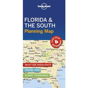
Chart your dream trip to Florida & the South with Lonely Planet's Florida & the South Planning Map, the ultimate travel tool to help you navigate your way around this amazing part of the world.Get to grips with some of the biggest country music hits in Nashville; go wild on the rides at Walt Disney World Resort; dig into sensational food and celebrate Mardi Gras in style in New Orleans; and decide where to go and what to see next on a route that works for you.Inside Lonely Planet's Florida & the South Planning Map: Full colour map in a durable easy-fold formatWaterproof and packaged in a handy slipcaseAlphanumeric grid to find points of interest easilyTransport planner with average travel times to help you get aroundTop picks of must-see highlights including the best beaches, culinary delights, great outdoors, Americana attractions, historical sights, live musicEssential travel tips and nuts and bolts information on manners, tipping, daily costsBeautiful photography and detailed mappingCovers: Florida; Tennessee & Kentucky; The Carolinas; Mississippi, Louisiana & Arkansas; Georgia & Alabama Get ready for your next adventure with Lonely Planet's Florida & the South Planning Map, the ultimate navigation tool to inspire your upcoming trip and take you to the heart of Florida & the South - your way.
Statistical Atlas Of The United States
Dive into a comprehensive snapshot of the United States with the "Statistical Atlas Of The United States." Compiled by the United States Bureau of the Census and enriched by the contributions of Charles Swift Sloane, Evelyn L. Yeomans, and Katharine T. West, this atlas offers a detailed statistical overview of America. This resource provides invaluable insights into the demographic, economic, and social landscapes of the nation during the period it represents. Ideal for historians, researchers, economists, and anyone interested in understanding the statistical underpinnings of American society, this atlas serves as a vital reference tool. Explore a wealth of data presented in accessible formats, revealing key trends and patterns that have shaped the United States. Whether you're studying historical changes, conducting research, or simply curious about the statistical profile of America, the "Statistical Atlas Of The United States" is an essential addition to your collection.This work has been selected by scholars as being culturally important, and is part of the knowledge base of civilization as we know it. This work was reproduced from the original artifact, and remains as true to the original work as possible. Therefore, you will see the original copyright references, library stamps (as most of these works have been housed in our most important libraries around the world), and other notations in the work.This work is in the public domain in the United States of America, and possibly other nations. Within the United States, you may freely copy and distribute this work, as no entity (individual or corporate) has a copyright on the body of the work.As a reproduction of a historical artifact, this work may contain missing or blurred pages, poor pictures, errant marks, etc. Scholars believe, and we concur, that this work is important enough to be preserved, reproduced, and made generally available to the public. We appreciate your support of the preservation process, and thank you for being an important part of keeping this knowledge alive and relevant.
Delorme Atlas & Gazetteer New Hampshire/Vermont
Johann Schoner's Globe of 1515
The first detailed study of the terrestrial globe of Johann Schoner (1477-1547), a cosmographer and teacher of mathematics in Nurnberg, which he made as part of the first pair of celestial and terrestrial globes in 1515. The globe is not much younger than the earliest surviving terrestrial globe from 1492. The globe is an important part of early 16th-cent. cartography, and an important chapter in the cartographic history of the New World. Transcribing all of the toponyms and legends on the globe has entailed an examination of textual, catographic, and graphical sources which has shed light on the relationship of the globe to maps, globes, and books of the period. "A work of consummate scholarship." Illustrations.
Stanford's New London Guide
Explore London with confidence using "Stanford's New London Guide," a meticulously crafted companion featuring detailed maps to help you navigate the city's intricate streets and discover its hidden gems. Perfect for both first-time visitors and seasoned travelers, this guide provides essential information on landmarks, transportation, and local customs.Published by Edward Stanford Ltd, renowned for their cartographic expertise, this guide ensures accuracy and reliability, making it an invaluable resource for planning your London adventure. Uncover the rich history and vibrant culture of one of the world's most iconic cities.This work has been selected by scholars as being culturally important, and is part of the knowledge base of civilization as we know it. This work was reproduced from the original artifact, and remains as true to the original work as possible. Therefore, you will see the original copyright references, library stamps (as most of these works have been housed in our most important libraries around the world), and other notations in the work.This work is in the public domain in the United States of America, and possibly other nations. Within the United States, you may freely copy and distribute this work, as no entity (individual or corporate) has a copyright on the body of the work.As a reproduction of a historical artifact, this work may contain missing or blurred pages, poor pictures, errant marks, etc. Scholars believe, and we concur, that this work is important enough to be preserved, reproduced, and made generally available to the public. We appreciate your support of the preservation process, and thank you for being an important part of keeping this knowledge alive and relevant.
Piloting Directions For The West Coast Of Scotland, From The Mull Of Cantire To Cape Wrath
"Piloting Directions For The West Coast Of Scotland, From The Mull Of Cantire To Cape Wrath" is a historical sailing guide by John William Norie. This book offers invaluable directions and insights for navigating the intricate and often challenging waters along Scotland's west coast. Covering the region from the Mull of Cantire to Cape Wrath, it provides essential information for mariners, including detailed navigational instructions, descriptions of coastal landmarks, and advice on avoiding hazards. Originally intended for practical use by sailors and navigators, this volume offers a glimpse into the maritime practices and geographical knowledge of the time. It remains a valuable resource for historians, maritime enthusiasts, and anyone interested in the nautical history of Scotland.This work has been selected by scholars as being culturally important, and is part of the knowledge base of civilization as we know it. This work was reproduced from the original artifact, and remains as true to the original work as possible. Therefore, you will see the original copyright references, library stamps (as most of these works have been housed in our most important libraries around the world), and other notations in the work.This work is in the public domain in the United States of America, and possibly other nations. Within the United States, you may freely copy and distribute this work, as no entity (individual or corporate) has a copyright on the body of the work.As a reproduction of a historical artifact, this work may contain missing or blurred pages, poor pictures, errant marks, etc. Scholars believe, and we concur, that this work is important enough to be preserved, reproduced, and made generally available to the public. We appreciate your support of the preservation process, and thank you for being an important part of keeping this knowledge alive and relevant.
Stanford's New London Guide
Explore London with confidence using "Stanford's New London Guide," a meticulously crafted companion featuring detailed maps to help you navigate the city's intricate streets and discover its hidden gems. Perfect for both first-time visitors and seasoned travelers, this guide provides essential information on landmarks, transportation, and local customs.Published by Edward Stanford Ltd, renowned for their cartographic expertise, this guide ensures accuracy and reliability, making it an invaluable resource for planning your London adventure. Uncover the rich history and vibrant culture of one of the world's most iconic cities.This work has been selected by scholars as being culturally important, and is part of the knowledge base of civilization as we know it. This work was reproduced from the original artifact, and remains as true to the original work as possible. Therefore, you will see the original copyright references, library stamps (as most of these works have been housed in our most important libraries around the world), and other notations in the work.This work is in the public domain in the United States of America, and possibly other nations. Within the United States, you may freely copy and distribute this work, as no entity (individual or corporate) has a copyright on the body of the work.As a reproduction of a historical artifact, this work may contain missing or blurred pages, poor pictures, errant marks, etc. Scholars believe, and we concur, that this work is important enough to be preserved, reproduced, and made generally available to the public. We appreciate your support of the preservation process, and thank you for being an important part of keeping this knowledge alive and relevant.
A Book About London
"A Book About London: The Streets Of London. An Alphabetical Index To The Principal Streets, Squares, Parks, And Thoroughfares" by William Henry Davenport Adams is a meticulously compiled guide to the thoroughfares of London. This book offers readers an alphabetical index to the principal streets, squares, and parks of London, providing insights into the city's layout and landmarks. Originally published in the late 19th century, this volume serves as a valuable historical resource for those interested in the urban development and social geography of Victorian London. It is an essential companion for historians, researchers, and anyone fascinated by the rich tapestry of London's past.This work has been selected by scholars as being culturally important, and is part of the knowledge base of civilization as we know it. This work was reproduced from the original artifact, and remains as true to the original work as possible. Therefore, you will see the original copyright references, library stamps (as most of these works have been housed in our most important libraries around the world), and other notations in the work.This work is in the public domain in the United States of America, and possibly other nations. Within the United States, you may freely copy and distribute this work, as no entity (individual or corporate) has a copyright on the body of the work.As a reproduction of a historical artifact, this work may contain missing or blurred pages, poor pictures, errant marks, etc. Scholars believe, and we concur, that this work is important enough to be preserved, reproduced, and made generally available to the public. We appreciate your support of the preservation process, and thank you for being an important part of keeping this knowledge alive and relevant.
Piloting Directions For The West Coast Of Scotland, From The Mull Of Cantire To Cape Wrath
"Piloting Directions For The West Coast Of Scotland, From The Mull Of Cantire To Cape Wrath" is a historical sailing guide by John William Norie. This book offers invaluable directions and insights for navigating the intricate and often challenging waters along Scotland's west coast. Covering the region from the Mull of Cantire to Cape Wrath, it provides essential information for mariners, including detailed navigational instructions, descriptions of coastal landmarks, and advice on avoiding hazards. Originally intended for practical use by sailors and navigators, this volume offers a glimpse into the maritime practices and geographical knowledge of the time. It remains a valuable resource for historians, maritime enthusiasts, and anyone interested in the nautical history of Scotland.This work has been selected by scholars as being culturally important, and is part of the knowledge base of civilization as we know it. This work was reproduced from the original artifact, and remains as true to the original work as possible. Therefore, you will see the original copyright references, library stamps (as most of these works have been housed in our most important libraries around the world), and other notations in the work.This work is in the public domain in the United States of America, and possibly other nations. Within the United States, you may freely copy and distribute this work, as no entity (individual or corporate) has a copyright on the body of the work.As a reproduction of a historical artifact, this work may contain missing or blurred pages, poor pictures, errant marks, etc. Scholars believe, and we concur, that this work is important enough to be preserved, reproduced, and made generally available to the public. We appreciate your support of the preservation process, and thank you for being an important part of keeping this knowledge alive and relevant.
Asiatic Pilot
"Asiatic Pilot, Volume 1" is a comprehensive navigational guide originally produced by the United States Hydrographic Office. This meticulously detailed volume provides essential sailing directions, hydrographic information, and other critical data for maritime navigation in Asiatic waters. A valuable resource for mariners, historians, and anyone interested in the historical aspects of nautical travel and exploration. This historical text offers insights into maritime practices and geographical knowledge of the time, making it a unique and informative read.This work has been selected by scholars as being culturally important, and is part of the knowledge base of civilization as we know it. This work was reproduced from the original artifact, and remains as true to the original work as possible. Therefore, you will see the original copyright references, library stamps (as most of these works have been housed in our most important libraries around the world), and other notations in the work.This work is in the public domain in the United States of America, and possibly other nations. Within the United States, you may freely copy and distribute this work, as no entity (individual or corporate) has a copyright on the body of the work.As a reproduction of a historical artifact, this work may contain missing or blurred pages, poor pictures, errant marks, etc. Scholars believe, and we concur, that this work is important enough to be preserved, reproduced, and made generally available to the public. We appreciate your support of the preservation process, and thank you for being an important part of keeping this knowledge alive and relevant.
B. Bradshaw's ABC Dictionary to the United States, Canada, & Mexico, Showing the Most Important Towns and Points of Interest
Explore the United States, Canada, and Mexico with "B. Bradshaw's ABC Dictionary." This historical travel guide, originally published in the late 19th century, offers a fascinating glimpse into the transportation and landmarks of a bygone era. Featuring detailed maps, routes, and points of interest, this dictionary provides a unique window into the world of travel before the age of automobiles and airplanes. Discover the most important towns and steamship routes that shaped the North American experience. Perfect for history buffs, travel enthusiasts, and anyone interested in the evolution of transportation, "B. Bradshaw's ABC Dictionary" is a valuable addition to any collection. Delve into the past and uncover the historical landscape of North America.This work has been selected by scholars as being culturally important, and is part of the knowledge base of civilization as we know it. This work was reproduced from the original artifact, and remains as true to the original work as possible. Therefore, you will see the original copyright references, library stamps (as most of these works have been housed in our most important libraries around the world), and other notations in the work.This work is in the public domain in the United States of America, and possibly other nations. Within the United States, you may freely copy and distribute this work, as no entity (individual or corporate) has a copyright on the body of the work.As a reproduction of a historical artifact, this work may contain missing or blurred pages, poor pictures, errant marks, etc. Scholars believe, and we concur, that this work is important enough to be preserved, reproduced, and made generally available to the public. We appreciate your support of the preservation process, and thank you for being an important part of keeping this knowledge alive and relevant.
Report of the Commissioners of the Topographical Survey and Map of Massachusetts
This is the "Report of the Commissioners of the Topographical Survey and Map of Massachusetts," documenting the commission's work. Detailing the methods and progress of mapping Massachusetts, it offers insights into the geographical understanding and surveying techniques of the time. It serves as a valuable resource for historians, geographers, and anyone interested in the historical cartography of Massachusetts.This work has been selected by scholars as being culturally important, and is part of the knowledge base of civilization as we know it. This work was reproduced from the original artifact, and remains as true to the original work as possible. Therefore, you will see the original copyright references, library stamps (as most of these works have been housed in our most important libraries around the world), and other notations in the work.This work is in the public domain in the United States of America, and possibly other nations. Within the United States, you may freely copy and distribute this work, as no entity (individual or corporate) has a copyright on the body of the work.As a reproduction of a historical artifact, this work may contain missing or blurred pages, poor pictures, errant marks, etc. Scholars believe, and we concur, that this work is important enough to be preserved, reproduced, and made generally available to the public. We appreciate your support of the preservation process, and thank you for being an important part of keeping this knowledge alive and relevant.
Lonely Planet Copenhagen City Map
Experience your dream trip with Lonely Planet's Copenhagen City Map, the ultimate travel tool to help you plan and navigate your way around amazing local sights, landmarks and attractions.Swim in a harbour bath like Islands Brygge Havnebadet, ride rollercoasters in Tivoli Gardens, wander around the extraordinary treasure box of Rosenborg Slot, and decide where you want to go next and what you want to see in each of the city's exciting neighbourhoods.Inside Lonely Planet's Copenhagen City Map: Full colour map in a durable easy-fold formatWaterproof and packaged in a handy slipcaseAlphanumeric grid to find points of interest easilyPublic transport explained to help you get aroundTop picks of must-see highlights including the Little Mermaid, Marmorkirken, and Designmuseum DanmarkEssential travel tips and nuts and bolts information on local transport, family travel, money, food and drink, walking tourBeautiful photography and bonus zoomed-in map ofNyhavnCovers: Christianshavn, Frederiksberg, Frederiksstaden, Latin Quarter, Nyhavn, N繪rrebro, N繪rreport, ?sterport, Slotsholmen, Str繪get, Tivoli, VesterbroGet ready for your next adventure with Lonely Planet's Copenhagen City Map, the ultimate navigation tool to help you explore Copenhagen's well-known attractions and best-kept secrets.
Lonely Planet Prague City Map
Experience your dream trip with Lonely Planet's Prague City Map, the ultimate travel tool to help you plan and navigate your way around amazing local sights, landmarks and attractions.Step into Prague Castle to discover the tales of Bohemian Kings; marvel at the historic St Vitus Cathedral, Czechia's most important religious building; visit Europe's oldest surviving Jewish graveyard, the evocative Old Jewish Cemetery; and decide where you want to go next and what you want to see in each of the city's exciting neighbourhoods.Inside Lonely Planet's Prague City Map: Full colour map in a durable easy-fold formatWaterproof and packaged in a handy slipcaseAlphanumeric grid to find points of interest easilyPublic transport explained to help you get aroundTop picks of must-see highlights including St Nicholas Hill, Charles Bridge and the Convent of St AgnesEssential travel tips and nuts and bolts information on local transport, money, language, food specialities and moreBeautiful photography and bonus zoomed-in map ofHolesovice & ZizkovCovers: Prague Castle, Hradčany, Mal獺 Strana, Petř穩n Hill, Josefov, Wenceslas Square, Nov矇 Město, Holesovice Get ready for your next adventure with Lonely Planet's Prague City Map, the ultimate navigation tool to help you explore Prague's well-known attractions and best-kept secrets.
Vietnam Travel Map Ninth Edition
The ultimate map for exploring Vietnam--durable, detailed, and traveler-friendly! The Vietnam Travel Map from Periplus is your essential companion for navigating Vietnam with ease. Designed to slip neatly into a purse or pocket, this compact map is printed on sturdy, coated paper--made to withstand frequent folding and unfolding, whether you want to view the entire country or just one city panel at a time. Plan your adventures effortlessly: Shows highways, backroads and all the must-see spots--banks, gardens, hotels, golf courses, museums, monuments, restaurants, temples, shopping areas, and more.Helps you find your way to both top tourist attractions and hidden local gemsDetailed, up-to-date scales include: Northern Vietnam: 1:2,100,000Southern Vietnam: 1:2,100,000Halong Bay: 1:300,000Hanoi & Ho Chi Minh City: 1:20,000Hue, Dalat, Nha Trang, Vung Tau, Hoi An: various close-up city scales for easy navigationRenowned as the leading map publisher for travelers in Asia, Periplus Travel Maps are trusted by visitors worldwide. Each map is regularly updated to keep pace with Asia's rapidly changing landscapes--making them the first choice for savvy travelers seeking reliable, on-the-ground guidance.
The Traveller’s Guide Through Ireland
The Traveller's Guide Through Ireland, originally published in 1794, offers a fascinating glimpse into the world of eighteenth-century travel. Intended as a companion to Captain Alexander Taylor's map of Ireland, this guide provides detailed information about routes, distances, and notable residences. This meticulously compiled guide details the great roads from Dublin to towns throughout the kingdom, along with cross-roads and descriptions of gentlemen's seats. It serves not only as a practical resource for travelers of the time but also as a valuable historical document, reflecting the social and geographical landscape of Ireland in the late 1700s. Whether you are a historian, a genealogy researcher, or simply fascinated by the past, this guide offers a unique perspective on Ireland's rich heritage.This work has been selected by scholars as being culturally important, and is part of the knowledge base of civilization as we know it. This work was reproduced from the original artifact, and remains as true to the original work as possible. Therefore, you will see the original copyright references, library stamps (as most of these works have been housed in our most important libraries around the world), and other notations in the work.This work is in the public domain in the United States of America, and possibly other nations. Within the United States, you may freely copy and distribute this work, as no entity (individual or corporate) has a copyright on the body of the work.As a reproduction of a historical artifact, this work may contain missing or blurred pages, poor pictures, errant marks, etc. Scholars believe, and we concur, that this work is important enough to be preserved, reproduced, and made generally available to the public. We appreciate your support of the preservation process, and thank you for being an important part of keeping this knowledge alive and relevant.
Leigh’s New Pocket Road-Book of England, Wales, and Part of Scotland, On the Plan of Reichard’s Itineraries
Leigh's New Pocket Road-Book offers a detailed guide to the roads of England, Wales, and parts of Scotland as they existed in the early 19th century. Designed for travelers, it provides practical information on routes and distances, mirroring the style of Reichard's itineraries. This historical road-book captures a snapshot of the British landscape and travel conditions of the time, making it an invaluable resource for historians, genealogists, and anyone interested in the history of transportation. "Leigh's New Pocket Road-Book" provides insights into the journeys and landscapes experienced by travelers nearly two centuries ago.This work has been selected by scholars as being culturally important, and is part of the knowledge base of civilization as we know it. This work was reproduced from the original artifact, and remains as true to the original work as possible. Therefore, you will see the original copyright references, library stamps (as most of these works have been housed in our most important libraries around the world), and other notations in the work.This work is in the public domain in the United States of America, and possibly other nations. Within the United States, you may freely copy and distribute this work, as no entity (individual or corporate) has a copyright on the body of the work.As a reproduction of a historical artifact, this work may contain missing or blurred pages, poor pictures, errant marks, etc. Scholars believe, and we concur, that this work is important enough to be preserved, reproduced, and made generally available to the public. We appreciate your support of the preservation process, and thank you for being an important part of keeping this knowledge alive and relevant.
The Traveller’s Guide Through Ireland
The Traveller's Guide Through Ireland, originally published in 1794, offers a fascinating glimpse into the world of eighteenth-century travel. Intended as a companion to Captain Alexander Taylor's map of Ireland, this guide provides detailed information about routes, distances, and notable residences. This meticulously compiled guide details the great roads from Dublin to towns throughout the kingdom, along with cross-roads and descriptions of gentlemen's seats. It serves not only as a practical resource for travelers of the time but also as a valuable historical document, reflecting the social and geographical landscape of Ireland in the late 1700s. Whether you are a historian, a genealogy researcher, or simply fascinated by the past, this guide offers a unique perspective on Ireland's rich heritage.This work has been selected by scholars as being culturally important, and is part of the knowledge base of civilization as we know it. This work was reproduced from the original artifact, and remains as true to the original work as possible. Therefore, you will see the original copyright references, library stamps (as most of these works have been housed in our most important libraries around the world), and other notations in the work.This work is in the public domain in the United States of America, and possibly other nations. Within the United States, you may freely copy and distribute this work, as no entity (individual or corporate) has a copyright on the body of the work.As a reproduction of a historical artifact, this work may contain missing or blurred pages, poor pictures, errant marks, etc. Scholars believe, and we concur, that this work is important enough to be preserved, reproduced, and made generally available to the public. We appreciate your support of the preservation process, and thank you for being an important part of keeping this knowledge alive and relevant.
Lowry’s Table Atlas
Lowry's Table Atlas, compiled by Joseph William Lowry, is a comprehensive reference work presenting an array of statistical tables in a visually accessible atlas format. This unique publication provides an innovative approach to organizing and displaying complex data, making it an invaluable resource for researchers, academics, and anyone interested in historical statistical analysis.The atlas showcases Lowry's meticulous attention to detail and his commitment to presenting information in a clear and concise manner. Each table is carefully designed to maximize readability and ease of use, ensuring that readers can quickly locate and interpret the data they need. This historical atlas offers a fascinating glimpse into the world of nineteenth-century data presentation and analysis.This work has been selected by scholars as being culturally important, and is part of the knowledge base of civilization as we know it. This work was reproduced from the original artifact, and remains as true to the original work as possible. Therefore, you will see the original copyright references, library stamps (as most of these works have been housed in our most important libraries around the world), and other notations in the work.This work is in the public domain in the United States of America, and possibly other nations. Within the United States, you may freely copy and distribute this work, as no entity (individual or corporate) has a copyright on the body of the work.As a reproduction of a historical artifact, this work may contain missing or blurred pages, poor pictures, errant marks, etc. Scholars believe, and we concur, that this work is important enough to be preserved, reproduced, and made generally available to the public. We appreciate your support of the preservation process, and thank you for being an important part of keeping this knowledge alive and relevant.
Map Reading From the Infantry Journal
Originally published in 1920 by the United States Infantry Association, "Map Reading From the Infantry Journal" provides a comprehensive guide to understanding and utilizing maps for military purposes. This classic manual covers essential techniques, including map interpretation, terrain analysis, and navigation. Designed for infantry soldiers, it offers practical instructions and detailed illustrations to enhance map-reading skills. A valuable resource for military historians, students of military science, and anyone interested in the history of cartography and military strategy, this edition preserves the original content, ensuring its accessibility to a new generation of readers.This work has been selected by scholars as being culturally important, and is part of the knowledge base of civilization as we know it. This work was reproduced from the original artifact, and remains as true to the original work as possible. Therefore, you will see the original copyright references, library stamps (as most of these works have been housed in our most important libraries around the world), and other notations in the work.This work is in the public domain in the United States of America, and possibly other nations. Within the United States, you may freely copy and distribute this work, as no entity (individual or corporate) has a copyright on the body of the work.As a reproduction of a historical artifact, this work may contain missing or blurred pages, poor pictures, errant marks, etc. Scholars believe, and we concur, that this work is important enough to be preserved, reproduced, and made generally available to the public. We appreciate your support of the preservation process, and thank you for being an important part of keeping this knowledge alive and relevant.
Road and Hand-book of the Missouri Division, Including Road-maps of the Riding Districts of St. Louis, Kansas City, St. Joseph, Sedalia, Springfield, Warrensburg, Etc
Explore the historic byways of Missouri with this meticulously reproduced road and hand-book from 1895. Originally published by the Missouri Division of the League of American Wheelmen, this guide offers a fascinating glimpse into the state's transportation infrastructure during the late 19th century. Featuring detailed road-maps of the riding districts of major cities such as St. Louis, Kansas City, St. Joseph, Sedalia, Springfield, and Warrensburg, the hand-book provides invaluable insights for cyclists and travelers of the era. More than just a collection of maps, this volume serves as a historical artifact, reflecting the growing popularity of cycling and the increasing demand for improved roadways. Whether you're a historian, a cycling enthusiast, or simply curious about Missouri's past, the "Road and Hand-book of the Missouri Division" offers a unique and engaging perspective on travel and transportation in a bygone era.This work has been selected by scholars as being culturally important, and is part of the knowledge base of civilization as we know it. This work was reproduced from the original artifact, and remains as true to the original work as possible. Therefore, you will see the original copyright references, library stamps (as most of these works have been housed in our most important libraries around the world), and other notations in the work.This work is in the public domain in the United States of America, and possibly other nations. Within the United States, you may freely copy and distribute this work, as no entity (individual or corporate) has a copyright on the body of the work.As a reproduction of a historical artifact, this work may contain missing or blurred pages, poor pictures, errant marks, etc. Scholars believe, and we concur, that this work is important enough to be preserved, reproduced, and made generally available to the public. We appreciate your support of the preservation process, and thank you for being an important part of keeping this knowledge alive and relevant.
Catalogue of a Most Valuable Collection of Rare Atlases and Separate Maps Carefully Described
This is a meticulously compiled catalogue detailing a significant collection of rare atlases and separate maps. Originally published in 1899, the "Catalogue of a Most Valuable Collection of Rare Atlases and Separate Maps Carefully Described" offers an invaluable resource for collectors, historians, and cartographers alike. Each entry provides a detailed description, shedding light on the historical context and significance of these important geographical artifacts. This catalogue serves as a vital reference for understanding the evolution of cartography and the historical importance of atlases as both scientific instruments and works of art. Whether you are a seasoned collector or a student of history, this catalogue provides deep insights into a fascinating corner of the world of rare books.This work has been selected by scholars as being culturally important, and is part of the knowledge base of civilization as we know it. This work was reproduced from the original artifact, and remains as true to the original work as possible. Therefore, you will see the original copyright references, library stamps (as most of these works have been housed in our most important libraries around the world), and other notations in the work.This work is in the public domain in the United States of America, and possibly other nations. Within the United States, you may freely copy and distribute this work, as no entity (individual or corporate) has a copyright on the body of the work.As a reproduction of a historical artifact, this work may contain missing or blurred pages, poor pictures, errant marks, etc. Scholars believe, and we concur, that this work is important enough to be preserved, reproduced, and made generally available to the public. We appreciate your support of the preservation process, and thank you for being an important part of keeping this knowledge alive and relevant.
Scarborough's Road Map and Motor Guide of Michigan
Explore Michigan's roads and landmarks with this meticulously reproduced edition of "Scarborough's Road Map and Motor Guide of Michigan," originally published in 1913. A fascinating glimpse into the early days of automobile travel, this guide offers detailed maps and practical information for motorists navigating the state's evolving road system. Beyond its functional value, this guide serves as a historical artifact, showcasing the development of Michigan's infrastructure and the burgeoning popularity of motor vehicles. Discover the routes and destinations that defined early automotive tourism, and gain insights into the challenges and triumphs of early motoring. Whether you're a collector, a history enthusiast, or simply curious about Michigan's past, this road map and motor guide provides a unique and engaging perspective.This work has been selected by scholars as being culturally important, and is part of the knowledge base of civilization as we know it. This work was reproduced from the original artifact, and remains as true to the original work as possible. Therefore, you will see the original copyright references, library stamps (as most of these works have been housed in our most important libraries around the world), and other notations in the work.This work is in the public domain in the United States of America, and possibly other nations. Within the United States, you may freely copy and distribute this work, as no entity (individual or corporate) has a copyright on the body of the work.As a reproduction of a historical artifact, this work may contain missing or blurred pages, poor pictures, errant marks, etc. Scholars believe, and we concur, that this work is important enough to be preserved, reproduced, and made generally available to the public. We appreciate your support of the preservation process, and thank you for being an important part of keeping this knowledge alive and relevant.
Catalogue of a Most Valuable Collection of Rare Atlases and Separate Maps Carefully Described
This is a meticulously compiled catalogue detailing a significant collection of rare atlases and separate maps. Originally published in 1899, the "Catalogue of a Most Valuable Collection of Rare Atlases and Separate Maps Carefully Described" offers an invaluable resource for collectors, historians, and cartographers alike. Each entry provides a detailed description, shedding light on the historical context and significance of these important geographical artifacts. This catalogue serves as a vital reference for understanding the evolution of cartography and the historical importance of atlases as both scientific instruments and works of art. Whether you are a seasoned collector or a student of history, this catalogue provides deep insights into a fascinating corner of the world of rare books.This work has been selected by scholars as being culturally important, and is part of the knowledge base of civilization as we know it. This work was reproduced from the original artifact, and remains as true to the original work as possible. Therefore, you will see the original copyright references, library stamps (as most of these works have been housed in our most important libraries around the world), and other notations in the work.This work is in the public domain in the United States of America, and possibly other nations. Within the United States, you may freely copy and distribute this work, as no entity (individual or corporate) has a copyright on the body of the work.As a reproduction of a historical artifact, this work may contain missing or blurred pages, poor pictures, errant marks, etc. Scholars believe, and we concur, that this work is important enough to be preserved, reproduced, and made generally available to the public. We appreciate your support of the preservation process, and thank you for being an important part of keeping this knowledge alive and relevant.
Lett’s Popular County Atlas
Explore Victorian England and Wales with this meticulously detailed county atlas. "Lett's Popular County Atlas," originally published by Letts, Son & Co., offers a comprehensive series of maps delineating the entire surface of England and Wales. This edition features special and original features that provide invaluable insights into the region's topography, infrastructure, and settlements of the time. With a copious index of 18,000 names, this atlas serves as an essential resource for historians, genealogists, and anyone interested in the historical geography of the British Isles. Discover the intricate details of each county, from its major cities and towns to its picturesque villages and landmarks. This atlas provides a unique window into a bygone era, offering a fascinating glimpse into the landscape and communities of 19th-century England and Wales.This work has been selected by scholars as being culturally important, and is part of the knowledge base of civilization as we know it. This work was reproduced from the original artifact, and remains as true to the original work as possible. Therefore, you will see the original copyright references, library stamps (as most of these works have been housed in our most important libraries around the world), and other notations in the work.This work is in the public domain in the United States of America, and possibly other nations. Within the United States, you may freely copy and distribute this work, as no entity (individual or corporate) has a copyright on the body of the work.As a reproduction of a historical artifact, this work may contain missing or blurred pages, poor pictures, errant marks, etc. Scholars believe, and we concur, that this work is important enough to be preserved, reproduced, and made generally available to the public. We appreciate your support of the preservation process, and thank you for being an important part of keeping this knowledge alive and relevant.


![California National Parks [Map Pack Bundle] California National Parks [Map Pack Bundle]](https://cdn.kingstone.com.tw/english/images/product/9889/9781566959889m.jpg?Q=bb34e)


