National Geographic Atlas of the National Parks
The first book of its kind, this stunning atlas showcases America's spectacular park system from coast to coast with a richly illustrated and informative collection of maps, graphics, and photographs. From the white sand beaches of Dry Tortugas to the snowy peaks of Denali, this captivating book combines authoritative park maps with hundreds of graphics and photographs to tell the stories of America's sixty one beloved national parks. Former ranger and author Jon Waterman introduces readers to the country's scenic reserves and highlights the extraordinary features that distinguish each: magnificent landmarks, thriving ecosystems, representative wildlife, fascinating histories, and more. This lush reference guide is the perfect gift for nature lovers, national park enthusiasts, and anyone interested in the history and natural wonders of America. With striking imagery and state-of-the-art graphics reflecting details of wildlife, climate, culture, archaeology, recreation, and more, this book provides an up-close look at what makes these parks so special--and so uniquely American. A heartfelt foreword from National Geographic CEO Gary Knell reminds us how important these lands are to our lives and our national pride.
Paris Metro Architecture & Design Map
Curated by transport design historian and broadcaster Mark Ovenden, with original photography by Nigel Green, this two-sided cartographic guide is an original and fascinating insight into architecture and graphic design for transport lovers, students of design and anyone interested in the history of Paris. The guide includes a geographical Metro map with featured stations marked, with corresponding photography and details on the reverse along with tips for where to find unique and unusual signage, ornamentation, architecture and more. The map is protected by a slipcover
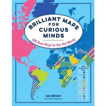
Brilliant Maps for Curious Minds
Which countries don't have rivers? Which ones have North Korean embassies? Who drives on the "wrong" side of the road? How many national economies are bigger than California's? And where can you still find lions in the wild? You'll learn answers to these questions and many more in Brilliant Maps for Curious Minds. This one-of-a-kind atlas is packed with eye-opening analysis (Which nations have had female leaders?), whimsical insight (Where can't you find a McDonald's?), and surprising connections that illuminate the contours of culture, history, and politics. Each of these 100 maps will change the way you see the world--and your place in it.Publisher's note: Brilliant Maps for Curious Minds was published in the UK under the title Brilliant Maps.
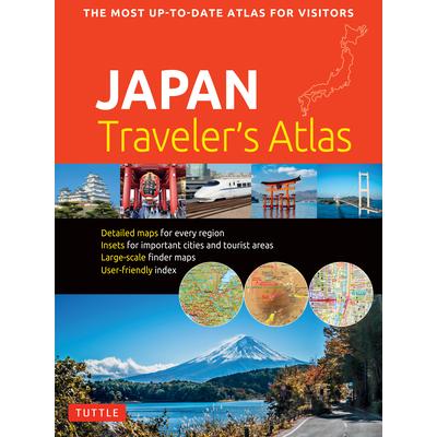
Japan Traveler`s Atlas
Finding your way around the various regions of Japan is a breeze with this handy Tuttle Japan Traveler's Atlas. Designed for the adventurous traveler and containing all the maps you'll need on your explorations, this atlas includes many views that are not available anywhere else. The atlas is conveniently divided into the major regions of Japan: TokyoMt. Fuji & Around TokyoCentral HonshuKyotoKansaiHiroshima & Western HonshuNorthern HonshuHokkaidoShikokuKyushuOkinawa & the Southwest Islands Each of the 148 maps in this atlas is presented in a logical, easy-to-follow manner, with emphasis on the most frequently-visited areas. All cities, towns, villages, places of interest including nature reserves are indexed for quick reference. Comprehensive: detailed insets are given for all the major cities, travel destinations and business hubs in Japan.Informative: Precise locations are indicated for all popular sights, hotels, restaurants, temples, shopping malls and other essential locations.Practical: The handy size, well-designed key maps and comprehensive index help you find any place you are looking for quickly.Reliable: No need to worry about cell service or battery--the maps in this atlas are thoroughly researched and regularly updated by the leading publisher of Asia Pacific maps.
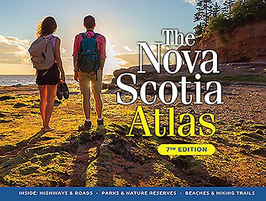
The Nova Scotia Atlas
This brand-new seventh edition of The Nova Scotia Atlas provides in-depth coverage not available anywhere else.On these detailed maps you will find the boundaries of the province's nature reserves and wilderness areas, all roads in the province and thousands of places you can easily locate. For any geographic feature which is mappable, this bestselling atlas is the undisputed resource to turn to. On these pages you'll find an incredible 2,000 gigabytes of data -- accessible with no cell signal or power required!Features include: - 4,544 lakes (832 now with depth indicated)- 3,002 rivers- 465 provincial and federal parks, protected areas and historic sites- 70 provincial nature reserves- 66 provincial wilderness areas- Campgrounds, picnic spots and hiking trails within parks- Beaches, mountains, hills, meadows and bogs- Numbered and colour-coded highways with crests and exit numbers- Every road longer than 200 metres- 997 marked communications towers and windmills- Reflects major highway realignments in Halifax, Antigonish, Barrington, Liverpool and Port JoliThis atlas is also the key to identifying any one of 1600 high-resolution, 1:10,000 incredibly detailed maps. Each map is available for free download from GeoNova.ca. The maps can be printed at home or ordered from a digital print shop for printouts up to 44" x 32".
Merriam-webster’s Student Atlas
Explore the world around you with this engaging collection of maps designed especially for middle schoolers. The latest edition of Merriam-Webster's Student Atlas has been updated to reflect recent global events and features abundant full-color physical, political, and thematic maps. Discover the world's landforms and bodies of water, the highest and lowest elevations, and learn more about ocean currents, and wind patterns. Thematic maps cover diverse topics such as continental drift, ocean floor, climate, natural resources, and population density. Features up-to-date statistics and global information. Packed with photographs and easy-to-use charts and graphs and featuring a glossary with brief definitions, this book is the perfect resource for kids interested in exploring the world around them both at home and in the classroom.
White Mountain Winter Recreation Map & Guide
This map and guide provides explorers with the only trail map of the White Mountain National Forest--a paradise for backcountry and cross-country skiers, snowboarders, snowshoers, hikers, and any other winter adventurer--specifically designed for winter use. Featuring more than 30 trails maintained for winter skiing and recreation in the Pinkham Notch, Twin Mountain, and Kancamagus areas, this map and guide covers what you need to know for a safe and enjoyable winter experience: trip descriptions, trailhead access and parking locations, seasonal road closures, safety and avalanche awareness tips, and detailed ski and hiking trails--including where human-powered routes overlap with snowmobile trails. New to this map is backcountry glade skiing, a growing trend that gained two U.S. Forest Service-approved ski zones in the White Mountain National Forest in 2018. Waterproof and tear-resistant for years of use on the slopes, this full-color, topographic map is the ultimate guide to backcountry winter recreation in the White Mountains.
Voyageurs National Park and Paddle Routes [map Pack Bundle]
- Waterproof - Tear-Resistant - Topographic MapsLocated at the border of Minnesota and Canada, Voyageurs National Park is defined by its interconnected waterways which require you to leave your car behind and explore by kayak, canoe, houseboat, or motorboat. In winter, snowmobiles, snowshoes, and skis will be your mode of travel in this extraordinary wilderness. The Voyageurs National Park map and the Voyageurs Paddle Routes maps have been combined in this Map Pack to provide an overview of the entire park as well as six carefully curated paddle routes that help visitors navigate the numerous lakes in the park.Voyageurs National Park and Paddle Routes: Map 264:: Voyageurs National ParkMap 410:: Voyageurs Paddle RoutesEvery Trails Illustrated map is printed on "Backcountry Tough" waterproof, tear-resistant paper. A full UTM grid is printed on the map to aid with GPS navigation.Map Scale = 1:50,000 & 1:70,000Sheet Size = 37.75" x 25.5"Folded Size = 4.25" x 9.25"
A World Atlas of Military History, 1861-1945
From the American Civil War to World War II, this comprehensive collection of maps includes detailed pictures of all the key battles and conflicts across the globe--from the Zulu War of 1879, the Russo-Japanese War of 1904-05, the Boer War of 1900, to nearly 100 maps on World War I and II. With a large index, concise commentary, and dozens of charts of statistics, this book can serve as a basic reference and a unique perspective on a turbulent era of military history.
Saco River Map & Guide
From Crawford Notch in the White Mountains to Saco Bay in the Atlantic Ocean, the Saco River flows through some of the most scenic land in the Northeast. This freshly revised map and guide--updated for the first time since 2002--charts the Saco River's 136-mile course across eastern New Hampshire and southern Maine. A longtime canoe and kayak destination, the river also has become a hot spot for tubing, swimming, whitewater paddling, fishing, and camping. This guide provides a mile-by-mile breakdown of recreation features along the way, with river access points, equipment outfitters, boat ramps, campgrounds, riverside hiking and biking trails, and ranger stations all identified on-map, as well as dams and areas of intermediate to advanced whitewater. In addition to recreation recommendations and safety and planning information, this map and guide also foregrounds river health, water quality, and wilderness ethics, helping all users better care for this popular natural resource and safeguard its continued use for future generations. Waterproof and tear-resistant, Saco River Map & Guide is a quintessential before-you-go planning tool and an invaluable companion once you're on the water. ALSO AVAILABLE 100-Mile Wilderness Map & Guide ISBN: 978-1-62842-100-2 Maine Mountain Guide: AMC's Comprehensive Guide to the Hiking Trails of Maine, Featuring Baxter State Park and Acadia National Park, edited by Carey Michael Kish ISBN: 978-1-62842-097-5 AMC's Outdoor Adventures: Acadia National Park: Your Guide to the Best Hiking, Biking, and Paddling by Jerry and Marcy Monkman ISBN: 978-1-62842-057-9 Quiet Water Maine: AMC's Canoe and Kayak Guide to 157 of the Best Ponds, Lakes, and Easy Rivers by Alex Wilson and John Hayes ISBN: 978-1-62842-066-1
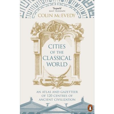
Cities of the Classical World
From Alexandria to York, this unique illustrated guide shows us the great centers of classical civilization afresh. The book's key feature is 120 specially-drawn maps tracing each city's thoroughfares and defenses, monuments and places of worship. Every map is to the same scale, allowing readers for the first time to appreciate visually the relative sizes of Babylon and Paris, London and Constantinople. There are also clear, incisive commentaries on each city's development, strategic importance, rulers and ordinary inhabitants. This compelling and elegant atlas opens a new window on to the ancient world, and will transform the way we see it.
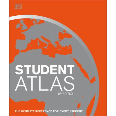
Student World Atlas
Packed with beautifully designed and detailed maps, this world atlas is the perfect companion for geography students. First published in 1988 and now in its 9th edition, Student World Atlas has been fully revised and updated. With 290 maps in total, it combines larger, traditional reference maps with smaller topic maps. These topics include industry, farming, climate, population, and the environment. Each theme will engage students, expanding their understanding of Earth and also making possible comparisons between different regions. For example, this student atlas not only displays an impressive map of the Caribbean, but highlights the hurricanes that continually threaten these islands and the people who live there. Then move to the New Zealand map and learn about its diverse population of Polynesians, European settlers, and many other immigrants that make up this multicultural nation. On every page, you will discover more and more fascinating facts about each country's landscape and its inhabitants. In addition to maps, this clear and accessible children's atlas also includes up-to-date statistics and flags for every country. It distills the huge mass of information available about our world down to the essential facts needed forthe effective and successful study of our ever-changing planet.
Michelin Sri Lanka Road & Tourist Map 803
Sri Lanka is the latest addition to Michelin's Road & Tourist Map series. The map includes an index of place names, city insets of Colombo and Kandy and includes National Parks and Tourist Sites. The Scale is 1:420,000 (1 cm = 4.2 km or 1 inch = 6.63 miles)
Lovin’ America (An American Girl Coloring Book)
Who is an American girl? This coloring book will teach your child that there is no basic definition of an American girl to conform to. All that matters is that your child remains herself and can stand on her own beliefs. This coloring book is an effective reminder that being unique is one's own signature. Coloring is a highly encouraged activity that will lead to self-confidence over time.
Michelin Naples City Map
NEW. The Michelin Naples City Map - part of Michelin's growing Laminated City Map series - is ideal for visitors wanting to see the sights and navigate around the city. Points of interest drawn from Michelin Green Guides are described and highlighted on the map for easy sight-seeing. Planned routes and stops can be marked, then wiped off the laminated surface* while the map's accordion-fold pattern allows for a fast look and even faster refold. Rely on Michelin's clear mapping and street index for an enjoyable visit. * Use only dry-erase markers. Scale: 1:14,000restaurants and hotels check out the MICHELIN Guide Italia (Italy). All these guides use the famed Michelin star rating system to guide you in choosing the best options for your time, budget, interest and taste.
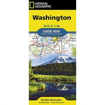
National Geographic Washington
- Waterproof - Tear-Resistant - Travel MapNational Geographic's Washington Guide Map is designed to meet the needs of travelers with detailed and accurate cartography and loads of helpful information about the state's many attractions. Cities and towns are clearly indicated and easy to find in the user-friendly index. A complete road network of highways, tollways, and other roads, along with distances noted in miles for major highways, will help you find the route that's right for you. National and state parks, public campsites, visitor information centers, airports, ski areas, ports of entry, and more are shown.Inset maps of Olympia, Yakima, Spokane, and Seattle provide greater detail of these urban centers. Olympic, Mount Rainier, and North Cascades national parks, and Mount Adams Scenic Drive are highlighted with maps and additional information to help visitors take advantage of the many sites and recreation activities available in these regions. A handy chart of park service sites and climate information are also included. Whether your travels in Washington bring you to its cities or its most remote wilderness areas, you'll find this map to be an invaluable tool for exploring all the state has to offer.Every State Guide Map is printed on durable synthetic paper, making them waterproof, tear-resistant and tough -- capable of withstanding the rigors of any kind of travel.Map Scale = 1:1,267,000Sheet Size = 24.75" x 17.75"Folded Size = 4" x 8.75"
The effect of ecotourism on the distribution of wild animals and their abundance in Abijatta Shala Lakes National Park
Master's Thesis from the year 2018 in the subject Tourism - Miscellaneous, Bahir Dar University (Bahir dar university), course: wild life conservation and ecotourism management, language: English, abstract: The purpose of this study was to investigate the effect of ecotourism on wild animals' distribution and abundance in Abijata Shala Lakes National Park. The study was conducted in Abijata Shala Lakes national park from September 2017 to February 2018. Three sites were selected: tourism destination site, tourism inaccessible site and local livelihood site. Wild animals distribution and abundance, were determined using line transect for mammals and point count for birds. Five selected mammals and six shore birds that frequently visited by tourist were selected. One-way ANOVA was used to compare the mean difference of wild animal's abundance between sampling site. The abundance and distribution of species in site were variable. The population mean was high in nature intact area for mammals: there were high in mean number of population of mammals.
Delorme Atlas & Gazetteer Arizona
With an incredible wealth of detail, DeLorme's Atlas & Gazetteer is the perfect companion for exploring the Arizona outdoors. Extensively indexed, full-color topographic maps provide information on everything from cities and towns to historic sites, scenic drives, trailheads, boat ramps and even prime fishing spots. With a total of 57 map pages, the Atlas & Gazetteer is your most comprehensive navigational guide to Arizona's backcountry. Full-color topographic maps provide information on everything from cities and towns to historic sites, scenic drives, recreation areas, trailheads, boat ramps and prime fishing spots Extensively indexed Handy latitude/longitude overlay grid for each map allows you to navigate with GPS Inset maps provided for major cities and the Grand Canyon as well as all state lands Product Details: Arizona State Dimensions: 15.5" x 11" AVAILABLE FOR ALL 50 STATES
RailPass RailMap Europe - Alpine Special 2018
Travelling around Europe by train is so much more than just an awesome holiday or interesting vacation experiences it is a step back into an impressive tapestry of prolific religious and historical bygone eras. The substantially updated 2018 edition of RailPass RailMap now includes brand new icons indicating UNESCO listed sites, significant religious buildings ie cathedral and abbeys, castles and attractive old world medieval towns to clearly identify the very best tourist rich destinations thus enabling the RailPass traveller to maximise their time, budget and designated travel days. Detailed RailPass RailMap (Austria and Switzerland) also now displays new geographical features including mountain elevation, ski resorts and identifies for the reader the best scenic views and cities that are best explored on foot.Also included in this Alpine Special are detailed RailPass RailMap and for whole of Switzerland and Austria plus French, German, Italian and Slovakian Alpine Routes and new for 2018 is focused attention on the most awesome routes and locations to visit particularly useful For Global Pass holders with limited days to explore where careful planning is absolutely crucial to get the most from a travel day. Learn more about the unbelievably awesome Swiss Glacier Express, Bernina Express and Golden Pass routes and the best way to experience the dramatic Austrian Alps plus tips and photographs so you know exactly what to expect.RailPass RailMap enables you to explore the whole European Railway Network with easy to navigate purposefully designed specifically for Interrail or Eurail global RailPass holders and covers 31 European countries in addition to Turkey and North Africa.Buyer Beware! Please note that RailPass RailMap 2018 has been specifically designed with the Global RailPass holder (interrailer) in mind. THIS IS NOT A COMPLETELY DEFINITIVE RAILWAY MAP. Instead RailPass RailMap is all about enabling easy and quick reference navigation around the entire European railway network in an easy to locate (i.e. top tourist destinations), easy to understand (easy to identify train types), easy to pack away format (i.e. can be folded in half) and full colour durable quality paper plus long lasting laminated gloss cover (i.e. large printed folding maps quickly suffer from tearing). The large A4 (letter) paperback format enables large spreads which have the look and feel of a folded map with many duplications so you can easily follow the network across the spreads.All the most popular tourist destination, cities and major towns on the network are highlights in large bold print. All the major network connections, scenic routes, intersections and junctions are easy to follow to enable you to quickly get to your chosen destinations.New for 2018 is major ferry crossings sailing info and RailPass discounts for UK, Ireland, Sweden, Denmark, Finland, Spain, Italy and Greece.Also included: - Easily identified High speed routes where compulsory reservations and supplements are required (bright orange lines) and where no additional cost is required (purple lines)- Main railway lines (seat reservation usually required in Eastern Europe)- Majority of local lines (in most cases no additional seat reservation requirement)- Green highlighted and easy to identify scenic routes so you can plan the most interesting and awesome routes- Major Swiss scenic routes are clearly identified with special highlights and legend so you know exactly how to make the very best of your time in this wonderful scenic rich country- Bus routes (pink lines) where the train network is in repair or is seasonal etc.Purchase includes complementary PDFs via website link. To learn more please visit RailMapEurope.com
Night Trains of Europe 2018 - RailPass RailMap
Night Trains of Europe 2018 Edition is substantially updated and revised with details of over 160 night trains which regularly traverse the continent.Explore the whole European railway network with the 74 page paperback version of illustrated RailPass RailMap Europe Designed specifically for Interrail or Eurail global railpass holders. Easy to navigate full colour print version covers 31 European countries in addition to Turkey and North AfricaPurchase includes complementary PDFs via website link. Updated 2018 edition includes detailed RailMaps of the most spectacular Alpine routes including French Alpine routes, northern Italy and western Austria. Brand new for 2018 are icons indicating UNESCO listed sites, significant religious buildings, castles and attractive Medieval towns.Buyer Beware! Please note that RailPass RailMap 2018 has been specifically designed with the Global RailPass holder (interrailer) in mind. THIS IS NOT A COMPLETELY DEFINITIVE RAILWAY MAP. Instead RailPass RailMap is all about enabling easy and quick reference navigation around the entire European railway network in an easy to locate (i.e. top tourist destinations), easy to understand (easy to identify train types), easy to pack away format (i.e. can be folded in half) and full colour durable quality paper plus long lasting laminated gloss cover (i.e. large printed folding maps quickly suffer from tearing). The large square paperback format enables large spreads which have the look and feel of a folded map with many duplications so you can easily follow the network across the spreads.All the most popular tourist destination, cities and major towns on the network are highlights in large bold print. All the major network connections, scenic routes, intersections and junctions are easy to follow to enable you to quickly get to your chosen destinations.New for 2018 is major ferry crossings sailing info and railpass discounts for UK, Ireland, Sweden, Denmark, Finland, Spain, Italy and Greece.Included: Detailed explanation of night train network with simplified infographic displaying relevant connections and major stops for each country with departing Night Train services including timetable info, schedule notescurrency and www.links to check departure times Index with Country flag and RailMap pages Detailed explanation of RailMap legend and what to look out for on RailMap Easily identified High speed routes where compulsory reservations and supplments are required (bright orange lines) and where no additional cost is requred (purple lines) Main railway lines (seat reservation usually required in Eastern Europe) Majority of local lines (in most cases no additional seat reservation requirement) Green highlighted and easy to identify scenic routes so you can plan the most interesting and awesome routes Swiss scenic routes are clearly identified with special highlights and legend so you know exactly how to make the very best of your time in this wonderful scenic rich country Bus routes (pink lines) where the train network is in repair or is seasonal etc. Ski resorts and popular summer hiking destinations Ports and popular ferry routes including discounts that railpass attracts and sailing info etc Train stations with shower facilities National parks and areas of outstanding beauty Cities and towns with nearby airports (with highlighted airport codes) Sandy beaches and stunning coastlines Mountain ranges and major inland lakes This is an indispensable railway travel guide designed by an experienced Interrailer with a passion for creating informative railway maps. RailPass RailMap is continually updated. To learn more please visit RailMapEurope.com
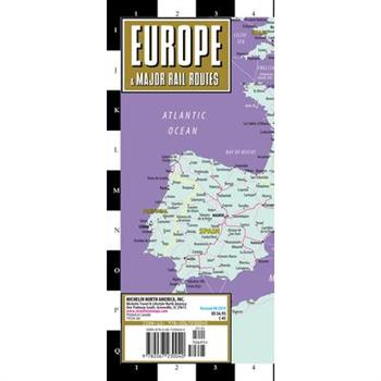
Streetwise Europe Rail Map
REVISED 2018Streetwise Europe Rail Map is a laminated railroad map of Europe in an accordion-fold pocket size format. Coverage includes: Main Europe Rail Network Map 1:11,500,000Dimensions: 4" x 8.5" folded, 8.5" x 19.25" unfolded If you can, travel through Europe via train. Experience the romance, scenic adventure, convenience and reliability of rail travel between major cities as well as to smaller towns. European Rail is also a more convenient way to travel from country to country. You'll always end up in the center of a major city, which is probably your destination anyway, not to mention being close to and seeing the passing countryside along the way. The STREETWISE(R) map of the European Rail system is a great companion for your trip to Europe or specific countries in Europe and Great Britain. First, it's a detailed map of Europe. Then, we overlay the rail system linking all connecting cities within Europe so you can plan and follow your travels along with the map. In addition, the travel map provides an index listing all the popular European routes between major cites with time tables and the city s grid locations on the map. Buy STREETWISE(R) Europe Rail Map, purchase a Eurail Pass and you re on your way to one of life s great adventures abroad. Our pocket size map of the Europe rail system is laminated for durability and accordion folding for effortless use. For a driving map of Europe, try the Michelin Europe Road Map No. 705.
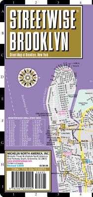
Streetwise Brooklyn Map
REVISED 2018 Streetwise Brooklyn Map is a laminated city center map of Brooklyn, New York. The accordion-fold pocket size travel map has integrated subway station locations. A complete index of streets, points of interest, education, culture, transportation and parks is clearly listed. Coverage includes: Main Brooklyn Map 1:38,000 Downtown Brooklyn Map 1:12,500Dimensions: 4" x 8.5" folded, 8.5" x 32" unfolded One of the five boroughs of New York, and one of the largest cities in America, Brooklyn used to be a hot destination for young multicultural hipsters looking to hit on new restaurants, galleries and housing. It still is for the most part, but sections of Brooklyn rival Manhattan in terms of skyrocketed real estate value and sophisticated desirability. You can experience the entire borough plus lower Manhattan with the STREETWISE(R) map of Brooklyn. The main map with detailed up to date subway overlay will help you navigate your way through all Brooklyn neighborhoods like Park Slope, Prospect Park, Brooklyn Heights, Williamsburg, Coney Island, Dumbo (Down Under the Manhattan Bridge Overpass), and even into parts of Queens. If you have business or shopping in downtown, find your way with the detailed indexed inset map of Downtown Brooklyn highlighting many sites. A complete index of streets, points of interest, education, culture, transportation and parks is clearly listed on the STREETWISE(R) Brooklyn Map. Our pocket size map of Brooklyn is laminated for durability and accordion folding for effortless use. restaurants and hotels, buy the red MICHELIN Guide New York City.
Colorado Trail [map Pack Bundle]
- Waterproof - Tear-Resistant - Topographic MapsIn a state known for its trails, The Colorado Trail is Colorado's premier long distance trail. Conceived in 1973 and completed in 1987, the trail runs 486 miles between Denver and Durango, traversing some of the most spectacular scenery in the state. This Map Pack combines the entire standard route into a single easy to purchase product. The Colorado Trail Map Pack includes: Map 1201:: Colorado Trail SouthMap 1202:: Colorado Trail NorthMore convenient and easier to use than folded maps, but just as compact and lightweight, National Geographic's Topographic Map Guide booklets are printed on 'Backcountry Tough' waterproof, tear-resistant paper with stainless steel staples. A full UTM grid is printed on the map to aid with GPS navigation.Map Scale = 1:75,000Folded Size = 4.25" x 9.38"
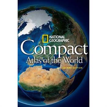
National Geographic Compact Atlas of the World
Beautiful, accurate, and up-to-the-minute, this completely updated mini atlas puts the entire world in the palm of your hand in an amazingly accessible format. National Geographic's maps and atlases are critically acclaimed and world-renowned for their accuracy, originality, authoritative content, and clean design. Now, the most convenient package of this trusted map content has been completely updated in Compact Atlas of the World, Second Edition. Sized at 4 x 6 inches with a resilient soft cover, this atlas is designed for easy reference and convenient storage in a pocket, backpack, or desk. All maps are newly researched and updated. Other enhancements include a new physical world map reflecting the latest cartographic techniques, plus world and continental coverage of population, climate, land cover, fresh water, and natural hazards such as earthquakes, volcanoes, and tsunamis. Superb overall readability, engaging design, and navigational ease allow the reader to quickly retrieve information. This atlas is a handy and affordable personal reference.
RailPass RailMap Europe 2017
** Please note updated and substantially revised Edition for 2018 is now available for purchase. **Discover and explore the whole European railway network with the 64 page paperback version of illustrated RailPass RailMap Europe Designed specifically for Interrail or Eurail global railpass holders. Easy to navigate full colour print version covers 31 European countries in addition to Turkey and North Africa Welcome to 2017 edition of RailPass RailMap Europe, Turkey and North Africa. Purchase includes PDFs via email request. Explore the entire European railway network with the bright full color icon, photo and info illustrated RailMap of Europe. Updated 2017 edition includes detailed maps of the most spectacular Alpine routes including central Switzerland, northern Italy and western Austria. Also included are city station maps for Basel, Belgium, Brussels, Budapest, Lisboa, London, Milano, Paris and Roma.Complementary PDF of RailPass RailMap 2017 is easily claimed by download from webstie.Buyer Beware! Please note that RailPass RailMap 2017 has been specifically designed with the Global RailPass holder (interrailer) in mind. THIS IS NOT A COMPLETELY DEFINITIVE RAILWAY MAP. Instead RailPass RailMap is all about enabling easy and quick reference navigation around the entire European railway network in an easy to locate (i.e. top tourist destinations), easy to understand (easy to identify train types), easy to pack away format (i.e. can be folded in half) and full colour durable quality paper plus long lasting laminated gloss cover (i.e. large printed folding maps quickly suffer from tearing). The large square paperback format enables large spreads which have the look and feel of a folded map with many duplications so you can easily follow the network across the spreads.All the most popular tourist destination, cities and major towns on the network are highlights in large bold print. All the major network connections, scenic routes, intersections and junctions are easy to follow to enable you to quickly get to your chosen destinations.New for 2017 is major ferry crossings sailing info and railpass discounts for UK, Ireland, Sweden, Denmark, Finland, Spain, Italy and Greece.Included: Index with Country flag and RailMap pages (see Index screenshot below) Detailed explanation of RailMap legend and what to look out for on RailMap Easily identified High Speed routes (bright orange lines) Main railway lines (seat reservation usually required) Majority of local lines (in most cases no additional seat reservation requirement) Green highlighted and easy to identify scenic routes so you can plan the most interesting and awesome routes Bus routes (pink lines) where the train network is in repair or is seasonal etc. Ski resorts and popular summer hiking destinations Ports and popular ferry routes including discounts that railpass attracts and sailing info etc Train stations with shower facilities National parks and areas of outstanding beauty Cities and towns with nearby airports (with highlighted airport codes) Sandy beaches and stunning coastlines Mountain ranges and major inland lakes Major Budget Airports (with accompanying airport codes) This is an indispensable railway travel guide designed by a experienced Interrailer with a passion for creating informative railway maps. RailPass RailMap is continually updated with a new edition published every year. To learn more please visit RailMapEurope.com
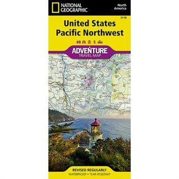
National Geographic United States Pacific Northwest
- Waterproof - Tear-Resistant - Travel MapThere are few nations as vast and spectacularly diverse as the United States of America. From the Atlantic to the Pacific, "America the Beautiful" offers boundless destinations and experiences for travelers seeking outdoor adventures, small town delights, or the excitement of urban culture.The United States Pacific Northwest Adventure Map will guide you through one of the most stunning regions in North America. The states of Washington, Oregon and Idaho contain Olympic, Mt. Rainier, Crater Lake, and North Cascades National Parks, Mt. Saint Helens and Mount Hood volcanoes, Columbia River Gorge, and dozens of magnificent National Monuments, Forests, and Wilderness Areas. The map includes the cities of Seattle, Portland, Boise, Spokane, and Eugene as well as Puget Sound and the spectacular Pacific coastline of Washington and Oregon. It covers western Montana and Wyoming, including Glacier and Yellowstone National Parks, along with Northern California, Nevada, and Utah. There is simply no better map for exploring the Pacific Northwest of the United States.National Geographic's US Adventure Maps provide the most authoritative and convenient travel maps available to plan and guide your USA Adventure. Each map delivers the perfect combination of detail and perspective, highlighting travel routes, topography, and points of interest for those venturing beyond the city centers. Whether you're on a classic American road trip or planning a grand tour to visit several cities or national parks, these maps offer the ultimate geographic resource as only National Geographic can provide.Every Adventure Map is printed on durable synthetic paper, making them waterproof, tear-resistant and tough -- capable of withstanding the rigors of international travel.Map Scale = 1:1,300,000Sheet Size = 25.5" x 37.75"Folded Size = 4.25" x 9.25"
Michelin Paris par Arrondissements
Discover Paris by foot, car or bike using the updated Michelin Paris by Arrondissements Pocket Atlas #62 (scale 1:10,000). In addition to Michelin's clear and accurate mapping, this detailed, indexed street atlas of the city will help you explore and navigate across Paris thanks to a full index and comprehensive legend pinpointing major sites, landmarks and tourist attractions, as well as practical information on public transportation, taxi stands, gas stations and shopping!
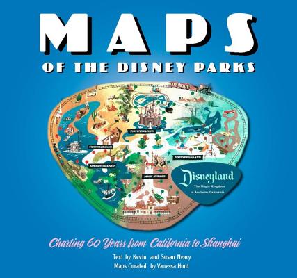
Maps of the Disney Parks
This deluxe Disney atlas is bursting with gorgeous park maps from around the work and across the six decades!It all started with a map. . . . Maps of the Disney Parks are more than just atlases used by guests to find their way to Big Thunder Mountain Railroad. They are snapshots of a place and time, relics treasured by collectors, and gorgeous pieces of artwork. In fact, it was a map (imagined by Walt Disney and drawn by Herbert Ryman) that was used to sell the idea of Disneyland to investors. Unfold this book of beautiful maps from when the very first Disney Park opened in 1955 right up to today. Discover details on how and why the domestic and international parks have changed over time, and enjoy sixty years worth of skillful creativity.Searching for that perfect gift for the Disney theme park fan in your life? Explore more archival-quality books from Disney Editions: Holiday Magic at the Disney ParksThe Disney Monorail: Imagineering a Highway in the SkyWalt Disney's Ultimate Inventor: The Genius of Ub IwerksOne Day at Disney: Meet the People Who Make the Magic Across the GlobeMarc Davis in His Own Words: Imagineering the Disney Theme ParksYesterday's Tomorrow: Disney's Magical Mid-CenturyEat Like Walt: The Wonderful World of Disney FoodThe Haunted Mansion: Imagineering a Disney ClassicPoster Art of the Disney Parks
The Best Poor Man’s Country
In many respects early Pennsylvania was the prototype of North American development. Its conservative defense of liberal individualism, its population of mixed national and religious origins, its dispersed farms, county seats, and farm-service villages, and its mixed crop and livestock agriculture served as models for much of the rural Middle West. To many western Europeans in the eighteenth century life in early Pennsylvania offered a veritable paradise and refuge from oppression. Some called it "the best poor man's country in the world." The Best Poor Man's Country was the winner of the Albert J. Beveridge Award of the American Historical Society.
Great City Maps
Journey back in time and take a walk through the historic streets of the world's greatest cities. Great City Maps is the companion title to DK's Great Maps and takes a focused look at over 70 gorgeously illustrated historical maps and plans of cities around the globe. Dive into the details of each beautiful map and learn about interesting features with visual tours of the maps' highlights - such as the Old London Bridge of London in 1572 and the orchards of Brooklyn in 1767 New York. Cities are centers of civilization and the way their maps portray them reflects their politics, religion, and culture. See how certain cities, and cartographic techniques, changed over time. More than just a bird's-eye view, this irresistible book tells the tales behind the cities from the hubs of ancient peoples to modern mega-cities, and profiles the iconic cartographers and artists who created each map. Perfect for history, geography, and cartography enthusiasts and a stunning gift for armchair explorers of all ages, Great City Maps is your window into the world's most fascinating cities.
Road Atlas: Scenic Drives Edition [united States, Canada, Mexico]
National Geographic's Road Atlas: Scenic Drives Edition, is the ideal companion for the next time you hit the road for an unforgettable road trip. Includes up-to-date road maps for all 50 U.S. States, plus Canada, Mexico, and Puerto Rico. Major cities and metropolitan areas are shown in detail with inset maps that include popular attractions, infrastructure and points-of-interest.Setting this atlas apart from all others is the inclusion of selection of 20 carefully researched scenic drives to help you plan the road trip of a lifetime. A map and guide section is also included for the 20 most popular National Parks. Take the guesswork out of traveling and trip planning with a comprehensive index, mileage charts, and cross-referenced pages.The Road Atlas: Scenic Drives Edition is printed in North America and it is a convenient letter-size format that fits comfortably into glove compartments or car side door pockets.Folded Size = 8" x 11"
Michelin Quebec Map
Brand-newMichelin Quebec Map 760 in its sturdy cardboard cover is invaluable to anyone driving in Quebec. It encompasses the road network in the most populated areas of the region and contains an English-language legend for reading the map symbols. Visitors to this French-speaking province of Canada can add a note of adventure to their stay with the many points of interest, parks and recreational sites indicated on the map. For effective trip planning before and during the journey, turn to Michelin maps.
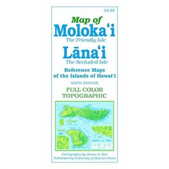
Map of Moloka’i and Lana’i
Features of the sixth edition of this full-color, topographic map of the Friendly Isle include detailed road networks, large-scale inset maps of towns, points of interest (historic, natural and cultural), hiking trails, parks, beaches, waterfalls, peaks and ridges (with altitudes), and more than 700 place names (index included). Most notably, Hawaiian words are spelled with all accent marks. 21 x 18 inches (unfolded), color
Brutalist Washington Map
"Brutalist Washington Map features 40 leading examples of Brutalist architecture in and around Washington, D.C., from the Hirshhorn Museum and the J. Edgar Hoover Building (FBI HQ), Dulles Airport and Georgetown's Lauinger Library to lesser known buildings like the the Woman's National Democratic Club Annex, National Presbyterian Church and Reston's Lake Anne Plaza. The reverse side of the map features an introduction to Brutalism and post-war construction in Washington, D.C. by Deane Madsen along with details for each building, and metro station, including the location, date and the architect or practice responsible. Perfect for a walking tour or framing, this map measures slightly larger than A2 open, folds to slightly larger than A5 and is protected by a wide band. All of our printed publications are litho-printed on quality FSC-certified recycled paper with non-toxic vegetable-based inks."
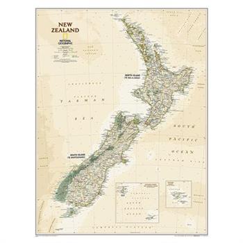
National Geographic: New Zealand Executive Wall Map - Laminated (23.5 X 30.25 Inches)
The reference map of New Zealand uses Expertly researched and designed, National Geographic's Executive style with an antique-style color palette and stunning shaded relief. The map shows this island nation in great detail, from the subtropical North Island (Te Ika-a-Maui) to the glacial carved valleys of Fiordland on the South Island (Te Waipounamu). The North Island is best known for large volcanic lakes and the cities of Auckland and Wellington. The South Island is famous for the Southern Alps that run along the spine of the island. The highest point in the country is Aoraki (Mount Cook) and is found in the Southern Alps.The first settlers of New Zealand were the Maori from Polynesia, the names on the map reflect this history with both English and Maori variants. The map also features a transportation network including highways, roads, passenger railroads, and major airports. All National Parks are also shown.The map is encapsulated in heavy-duty 1.6 mil laminate which makes the paper much more durable and resistant to the swelling and shrinking caused by changes in humidity. Laminated maps can be framed without the need for glass, so the frames can be much lighter and less expensive. Map Scale = 1:2,300,000Sheet Size = 23.5" x 30.25"
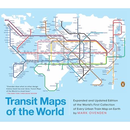
Transit Maps of the World
A completely updated and expanded edition of the cult bestseller, featuring subway, light rail, and streetcar maps from New York to Nizhny Novgorod. Transit Maps of the World is the first and only comprehensive collection of historical and current maps of every rapid-transit system on earth. In glorious, colorful graphics, Mark Ovenden traces the cartographic history of mass transit--including rare and historic maps, diagrams, and photographs, some available for the first time since their original publication. Now expanded with thirty-six more pages, 250 city maps revised from previous editions, and listings given from almost a thousand systems in total, this is the graphic designer's new bible, the transport enthusiast's dream collection, and a coffee-table essential for everyone who's ever traveled in a city.
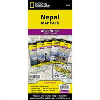
National Geographic Adventure Travel Maps Nepal Map Pack
- Waterproof - Tear-Resistant - Travel MapThe National Geographic Adventure Nepal Map Pack is the perfect companion for anyone who wants to travel to the "Roof of the World". The Map Pack includes five Adventure maps that cover all of Nepal with various levels of detail. The first map in the Map Pack is an overview map of Nepal which covers the entire country. Next, the series includes the trekking areas of Annapurna, Langtang, and Khumbu. Finally, a detailed map of the highest mountain on earth, Mount Everest. Each of the five maps cover these areas in detail with points of interest, intricate road networks, and an index of places to help you find even the smallest town. Each map includes a detailed city map of Kathmandu.The Nepal Map Pack includes: Map 3000:: Nepal Map 3001:: Everest Base Camp Map 3002:: Khumbu Map 3003:: Annapurna Map 3004:: LangtangEvery Adventure Map is printed on durable synthetic paper, making them waterproof, tear-resistant and tough -- capable of withstanding the rigors of international travel.Folded Size = 4.25" x 9.25"
Canada [map Pack Bundle]
- Waterproof - Tear-Resistant - Travel MapThe National Geographic Adventure Canada Map Pack is the perfect companion for anyone who wants to travel in Canada. The Map Pack includes three Adventure maps that cover almost all of inhabited Canada. From the rugged mountains of British Columbia through the plains of Saskatchewan all the way to untamed coast of Nova Scotia. Each of the three maps cover these areas in detail with points of interest, intricate road networks, and an index of places to help you find even the smallest town.The Canada Map Pack includes: Map 3113:: Canada West Map 3114:: Canada Central Map 3115:: Canada EastEvery Adventure Map is printed on durable synthetic paper, making them waterproof, tear-resistant and tough -- capable of withstanding the rigors of international travel.Map Scale = 1:2,100,000Sheet Size = 25.5" x 37.75"Folded Size = 4.25" x 9.25"
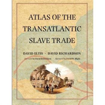
Atlas of the Transatlantic Slave Trade
A extraordinary work, decades in the making: the first atlas to illustrate the entire scope of the transatlantic slave trade Winner of the Association of American Publishers' 2010 R.R. Hawkins Award and PROSE Award "A monumental chronicle of this historical tragedy."--Dwight Garner, New York Times Between 1501 and 1867, the transatlantic slave trade claimed an estimated 12.5 million Africans and involved almost every country with an Atlantic coastline. In this extraordinary book, two leading historians have created the first comprehensive, up-to-date atlas on this 350-year history of kidnapping and coercion. It features nearly 200 maps, especially created for the volume, that explore every detail of the African slave traffic to the New World. The atlas is based on an online database (www.slavevoyages.org) with records on nearly 35,000 slaving voyages--roughly 80 percent of all such voyages ever made. Using maps, David Eltis and David Richardson show which nations participated in the slave trade, where the ships involved were outfitted, where the captives boarded ship, and where they were landed in the Americas, as well as the experience of the transatlantic voyage and the geographic dimensions of the eventual abolition of the traffic. Accompanying the maps are illustrations and contemporary literary selections, including poems, letters, and diary entries, intended to enhance readers' understanding of the human story underlying the trade from its inception to its end. This groundbreaking work provides the fullest possible picture of the extent and inhumanity of one of the largest forced migrations in history.
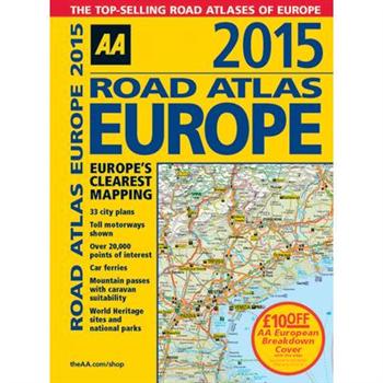
Road Atlas Europe 2015
Fully revised and updated for 2015, this specialist A4 road atlas designed for the British motorist in Europe, with multi-scale mapping of 46 countries. The atlas includes information on national speed limits, toll-free motorways, car ferries, mountain passes with caravan suitability, emergency telephone numbers, and road distances, together with national parks and many other places of interest. 14.2 miles to 1 inch, 1:900,000 (main scale), but please note some areas are at a smaller scale.
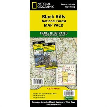
National Geographic Black Hills National Forest Map Pack Bundle
- Waterproof - Tear-Resistant - Topographic MapsThe Black Hills National Forest Map Pack Bundle is the perfect companion for anyone planning a trip to the Black Hills of South Dakota. The two maps in this Map Pack Bundle cover the Black Hills National Forest in great detail and include all of the information needed for a memorable trip for the first time or the frequent visitor. The maps include trails with mileage between intersections, numbered US Forest Service roads, motorized trails as well as hundreds of points of interest such as campgrounds, trail heads, and boat ramps.The Black Hills National Forest Map Pack includes: Map 238:: Black Hills South [Black Hills National Forest]Map 751:: Black Hills North [Black Hills National Forest]Every Trails Illustrated map is printed on "Backcountry Tough" waterproof, tear-resistant paper. A full UTM grid is printed on the map to aid with GPS navigation.Map Scale = 1:70,000Sheet Size = 37.75" x 25.5"Folded Size = 4.25" x 9.25"
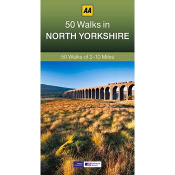
50 Walks in North Yorkshire
Walking is one of Britain's favourite leisure activities, and this guide to North Yorkshire features 50 mapped walks from two to ten miles, to suit all abilities.
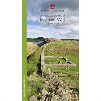
An Archaeological Map of Hadrian's Wall
Please note: This product is a map. It was more than just a wall: it was a whole military zone designed to control movement across the northern frontier of the Roman province of Britannia. Great earthwork barriers survive, along with the remains of forts and temporary camps; watch-towers and fortified gates; civilian settlements, temples, cemeteries, bath-houses, roads and bridges. Stretching across the spine of England from the North-East coast to the Irish Sea, the line of the frontier extends for over 100 miles through every type of landscape: from the streets of urban Tyneside, through arable fields; along the crags of the wild Whin Sill; to the sands of the Solway, and down the coast of Cumbria. Drawing upon the extensive expertise and unrivalled archives of English Heritage, and those of its partners, this map depicts the fruits of modern archaeological research: in field survey, geophysics, excavation, and the analysis of aerial photographs. Using Ordnance Survey 1:25,000 data - the ideal scale for walkers - this revised new map shows with great clarity all the elements of Hadrian's Wall, and distinguishes between those features that are visible and those that have been levelled through time. A brief text explains the remains on the ground, and how to use the map to find them - including the museums and the best places to visit. This World Heritage Site is now more accessible than ever before, so see the landscape through new eyes.
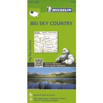
Michelin USA Big Sky Country Map 172
Michelin USA Big Sky Country Map 172 (scale: 1:1,267,000)--part of Michelin's brand-new US regional map series with bright green covers--zooms in close for comprehensive coverage of Idaho, Montana and Wyoming. It contains city maps for easy driving in Boise, Cheyenne and Helena, as well as an inset map for Yellowstone National Park. Michelin star-rated sights and a selection of not-to-be-missed annual events and festivals serve as inspiration for future road trips. Outdoor enthusiasts have their choice of national parks for scenery and activities: Glacier, Grand Teton, Wind Cave and Yellowstone. The QR code on the front cover offers even more travel information on destinations through Michelin's ViaMichelin website. The map includes a comprehensive index, a distance chart, and a multi-language legend in English and Spanish. Those traveling for business or pleasure, as well as locals traveling farther afield, will appreciate Michelin's high standard of clear and accurate mapping and the additional information on parks, events and points of interest to make the journey more enjoyable.
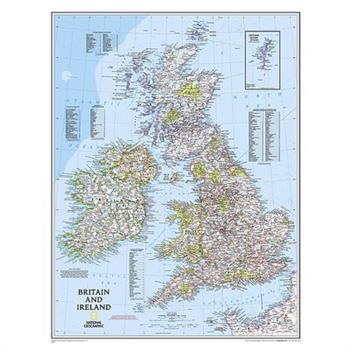
National Geographic: Britain and Ireland Classic Wall Map (23.5 X 30.25 Inches)
National Geographic's Classic political map of Britain and Ireland is both an attractive addition to any study or classroom and an informative tool for exploring these fascinating countries. The map features thousands of place names, major highways and roads, airports, ferry routes, bodies of water, and more. Handy indexes make it easy to identify the counties, districts, council areas, unitary authorities, and metropolitan districts of Ireland, Northern Ireland, Scotland, Wales, and England. An inset provides detail of the Shetland Islands. National parks are clearly indicated in green vignettes, and shaded relief reveals the interesting and varied topography of these island nations.English and Gaelic (Irish) share official status per the Republic of Ireland's constitution, so place names are rendered in both. In the Gaeltachtl, or predominantly Irish-speaking regions, only Irish place-names have official status and are used on signposts. These districts are found within the counties of Cork, Donegal, Galway, Kerry, Mayo, Meath, and Waterford. The map is packaged in a two inch diameter tube with a label showing a thumbnail of the map with dimensions and other pertinent information.Map Scale = 1:1,679,000Sheet Size = 23.5" x 30.25"
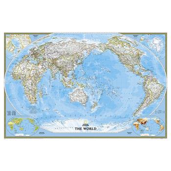
National Geographic: World Classic, Pacific Centered Wall Map (46 X 30.5 Inches)
Expertly researched and designed, National Geographic's World Wall Map is the authoritative map of the world by which other reference maps are measured.Product Features: Signature Classic style map with bright, easy to read color palette with blue oceans and colorful bordersUnique Pacific-centered view accentuates the Pacific Rim and focuses on Asia, Oceania, and the full breadth of the Pacific Ocean. Background shows mountain ranges and valleys in subtle shaded relief with mountain ranges labeled Major water bodies including rivers, lakes, glaciers, oceans, seas, gulfs, bays, straits, and bathymetryClearly defined international boundaries, cities, islands, airports, and physical featuresThousands of place names carefully and artfully placed to maintain legibility in heavily populated areasUp-to-date international boundaries and territorial control reflect de facto status on the groundMeticulously researched using multiple authoritative sources including the U.N., U.S. Board on Geographic Names, and policies of individual governments.Accurate place names use a combination of conventional English names, official national names, and standard transliterations for non-Latin alphabets. Drawn in Winkel Tripel projection with distortions minimized unlike other World maps (e.g. Greenland is shown the same size as Argentina, not South America)Corner inset maps feature vegetation, land use, population density, and north and south polar regionsThe map is packaged in a two inch diameter tube with a label showing a thumbnail of the map with dimensions and other pertinent information.Map Scale = 1:29,820,000Sheet Size = 46" x 30.5"




![Voyageurs National Park and Paddle Routes [map Pack Bundle] Voyageurs National Park and Paddle Routes [map Pack Bundle]](https://cdn.kingstone.com.tw/english/images/product/8110/9781566958110m.jpg?Q=532f1)







![Colorado Trail [map Pack Bundle] Colorado Trail [map Pack Bundle]](https://cdn.kingstone.com.tw/english/images/product/7403/9781566957403m.jpg?Q=48e8c)




![Road Atlas: Scenic Drives Edition [united States, Canada, Mexico] Road Atlas: Scenic Drives Edition [united States, Canada, Mexico]](https://cdn.kingstone.com.tw/english/images/product/7069/9781566957069m.jpg?Q=9268d)


![Canada [map Pack Bundle] Canada [map Pack Bundle]](https://cdn.kingstone.com.tw/english/images/product/6037/9781597756037m.jpg?Q=705a0)
