The Antrim Coast From A to Z
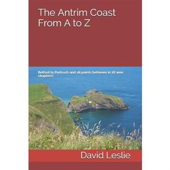
Between Belfast and Portrush can be found fantastic beaches, stunning cliffs, wild mountains and even wilder glens. The road that links Northern Ireland's greatest city with its premier seaside resort has been frequently heralded one of the world's best drives. Much of the Antrim Coast is designated an Area of Outstanding Natural Beauty and/or an Area of Special Scientific Interest - and a World Heritage Site, to boot! Like his other books in this series, David meanders through the valleys, forests, towns and villages of the Antrim Coast by taking in the sights, history, geology, and many of the people that make this such a special place.How did the Giant's Causeway get its name? Where was the worlds first Hydro-electric powered rail service? Which former pop star owns a nineteenth century tower in Cushendall? Why does Rathlin Island have a building named after Richard Branson? How many died before the Titanic hit the iceberg? Why would you want to climb to the top of a gas holder in Carrickfergus? Are there nine or ten Glens of Antrim? Why was an elephant allowed to roam the streets of Newtownabbey during World War II?These and many other questions are answered in The Antrim Coast From A to Z.The guide includes over 50 suggestions for further reading, many of which can be downloaded freely by following the hyperlinks at the end of each chapter.
Overtourism in the City of Dubrovnik. Characteristic Features, Impacts and Possible Solutions
Seminar paper from the year 2020 in the subject Tourism - Miscellaneous, grade: 1,3, University of Applied Sciences S羹dwestfalen; Meschede, language: English, abstract: This research project deals with the question to what extent the Croatian port city of Dubrovnik is affected by overtourism and how this can be interpreted and mitigated. Overtourism is a multifaceted phenomenon that is very much on the agenda of the tourism industry today. At the International Tourism Fair in Berlin in 2018, as well as in numerous newspaper articles, but also in general language use, the subject of overtourism is omnipresent. Due to the worldwide increase in travel behavior and the growing popularity of city tourism, urban areas are becoming increasingly congested. These include overcrowded streets and alleys, public places, accommodation facilities and numerous other facilities. This often has negative social, economic and ecological effects. More and more often, headlines of disgruntled inhabitants, socio-cultural conflicts, infrastructural problems, as well as other grievances can be found in the media. In many cases, these are due to even more rapidly increasing numbers of tourists.
Tourismus und Klimawandel. Anpassungs- und Verminderungsstrategien in der deutschen K羹sten- und Alpentourismusregion
Bachelorarbeit aus dem Jahr 2015 im Fachbereich Tourismus - Sonstiges, Note: 1,1, Hochschule Mittweida (FH) (Campus M21), Sprache: Deutsch, Abstract: In dieser Bachelorarbeit wird analysiert, welcher Zusammenhang und gegenseitiges Wechselspiel zwischen dem Klimawandel und dem Tourismus besteht. Ziel der Arbeit ist es, m繹gliche Adaptions- und Mitigationsstrategien aufzuzeigen, die die Tourismusbranche umsetzen kann, um sich den Folgen des Klimawandels anzupassen, bzw. diese zu vermindern. Der Fokus der Analyse liegt hier auf der deutschen K羹sten- und Alpentourismusregion. Abschlie?end werden die Strategien anhand von Best Practice Beispielen verdeutlicht. Der erste Gliederungspunkt des Hauptteils besch瓣ftigt sich vorerst mit dem Grundwissen, das zum Verst瓣ndnis f羹r die weitere Themabearbeitung notwendig ist. Zuerst wird das Themenfeld Tourismus genauer betrachtet. Einen Einstieg daf羹r geben eine Begriffserkl瓣rung und Definitionen, gefolgt von einem Einblick in die historische Entwicklung des Tourismus in Deutschland. Im Anschluss geht die Verfasserin auf die wirtschaftliche Bedeutung des Tourismus f羹r Deutschland ein, hierbei werden Zahlen und Daten des Jahres 2013 herangezogen. Abgerundet wird dieser Einblick in das Themenfeld Tourismus von der Auff羹hrung aktueller Trends, die die heutige Tourismusbranche pr瓣gen. Eine weitere S瓣ule des Verst瓣ndnisses ist der Begriff Klimawandel. Hier liegt der Fokus, neben Definitionen von Klima, Wetter und Witterung, auf der Begriffsabgrenzung zwischen den nat羹rlichen Klimaver瓣nderungen und den von Menschen gemachten Klimaver瓣nderungen. Auf die vorherrschende und zuk羹nftige klimatische Situation Deutschlands geht die Studentin anhand des Klimamodells REMO ein. Daraufhin wird die Analyse auf die beiden deutschen Tourismusregionen K羹ste und Alpen begrenzt und detailliert aufgezeigt, welche Auswirkungen und Folgen sich aufgrund des Klimawandels f羹r die beiden Regionen ergeben. Das n瓣chste Kapitel besch瓣ftigt sich mit dem Zusammensp
Washington Recreation Map
The Washington Recreation Map is a folded map version of the Recreation Guide pages within Benchmark's Washington Road & Recreation Atlas. The map side features public lands, extensive highway detail, point-to-point mileages, recreation attractions, campgrounds, parks & wildlife areas, boating & fishing access points, and hunting units (GMU). The reverse side features statewide categorized POI listings with helpful descriptions, current contact information, and map grid references.Map Scale = 1:650,000Sheet Size = 38" x 27"Folded Size = 4" x 9"
Chancen und Risiken der Digitalisierung f羹r den nachhaltigen Tourismus in Deutschland
Studienarbeit aus dem Jahr 2021 im Fachbereich Tourismus - Sonstiges, Note: 2,0, Hochschule Fresenius; Hamburg, Sprache: Deutsch, Abstract: Diese Arbeit befasst sich mit den Chancen und Risiken der Digitalisierung f羹r den nachhaltigen Tourismus in Deutschland. Dabei soll vor allem beantwortet werden, inwiefern Social Media die Entwicklung des nachhaltigen Tourismus beeinflusst. Um zu einer aussagekr瓣ftigen Beantwortung dieser Frage zu gelangen, wird im zweiten Kapitel der Arbeit der Begriff Nachhaltigkeit mit seinen drei Dimensionen der ?kologie, ?konomie und des Sozialen erl瓣utert. Im Anschluss wird der nachhaltige Tourismus in Deutschland dargestellt. Das vierte Kapitel veranschaulicht den Prozess der Digitalisierung. Auf Grundlage der vorherigen Kapitel, wird im f羹nften Kapitel konkretisiert, welche Chancen und Risiken die Digitalisierung bringt. Hierbei werden im Detail die Auswirkungen der Digitalisierung auf die Costumer Journey, und die Auswirkungen von Social Media auf den Tourismus geschildert. Anschlie?end werden die daraus folgenden Konsequenzen f羹r die Dimensionen der Nachhaltigkeit betrachtet. Zuletzt werden die Untersuchungen der Arbeit in Kapitel sechs zu einem Fazit zusammenfasst.
”Syltisierung”. Tourismusdestinationen zwischen Wirtschaftsraum und Lebensraum
Studienarbeit aus dem Jahr 2019 im Fachbereich Tourismus - Sonstiges, Note: 1.0, Hochschule Mittweida (FH), Veranstaltung: Destinationsmanagement, Sprache: Deutsch, Abstract: Ziel dieser Arbeit ist eine Einf羹hrung in den Begriff der "Syltisierung", der seit einigen Jahren sehr popul瓣r in den Medien vertreten ist, jedoch fachlich noch wenig Anerkennung erhalten hat, sodass die Fachquellen begrenzt waren und die Autorin viele Quellen aus den Medien herangezogen hat. Die Insel Sylt, als erfolgreichste deutsche Destinationsmarke, illustriert das Ph瓣nomen der Verdr瓣ngung Einheimischer durch den Tourismus so gut wie kein anderes deutsches Zielgebiet, sodass bei dieser Thematik der Name "Sylt" stets pr瓣sent ist. Da die Familie der Autorin drei Jahrzehnte lang in der Tourismusbranche der Insel t瓣tig war und die Entwicklung des Tourismus von der Anfangsphase des Fremdenverkehrs bis hin zum "Ausverkauf der Insel" miterleben konnte, besteht ein pers繹nlicher Bezug zu der Thematik. Im Zuge der Recherche stellte sich au?erdem heraus, dass eine Belegarbeit nicht ansatzweise ausreichen kann um dieses Thema in all seiner Komplexit瓣t und seinen Entwicklungen zu erfassen. Stattdessen entschied sich die Autorin daher, einen Fokus auf die Ursachen der "Syltisierung" und m繹gliche Ma?nahmen, um das Problem des mangelnden bezahlbaren Wohnraums f羹r Einwohner touristischer Destinationen zu l繹sen bzw. einzud瓣mmen. Momentan weitet sich die Entwicklung, mit Boom des Tourismus und der Destinationen weltweit, auf viele Regionen weiter aus, sodass es leider nicht m繹glich war alle Beispiele genau auszuf羹hren bzw. alle Konzepte aufzuzeigen. Die Ma?nahmen und Konzepte der n瓣chsten Jahre werden zeigen, inwieweit sich die Entwicklung eind瓣mmen l瓣sst und welche Mittel f羹r die Erhaltung des Lebensraums Einheimischer am effektivsten greifen.
Corporate Social Responsibility in the Hospitality Industry and its contribution to the welfare of local communities. The case of Hilton Hotels
Bachelor Thesis from the year 2020 in the subject Tourism - Hotel Management, grade: 1,7, University of Applied Sciences Deggendorf, language: English, abstract: This bachelor this thesis attempts to apply Freeman's (1984) Stakeholder Theory in order to recognize the primary stakeholder groups, in this case, local communities. It will try to answer the following questions: How is the Hilton's CSR strategic level structured? Which role do communities play in Hiltons' CSR strategy? What are the current Hilton's CSR initiatives and goals that contribute to the welfare of communities? Moreover, it helps to clarify the company's behaviour and relationship with its stakeholders, having in mind Freeman's major idea that the best responses to the strong influence of stakeholders in a company are to balance their conflicting and challenging demands through the constant evaluation of the company's sustainable best practices. In addition, this thesis aims to examine the implication of CSR in the hospitality industry and analyse the current CSR initiatives and best practices in the hospitality industry towards the welfare of communities. Thus, this research intends to evaluate in detail the CSR strategy of one renowned international hotel corporation in order to classify the important role that communities play in the strategy and to identify CSR initiatives and best practices towards the communities as stakeholders in the hospitality industry. This study takes as example the Hilton Worldwide Hotels. The literature part of this thesis is composed by four main chapters: the introduction and research questions, the development of the CSR idea, followed by its implication in the tourism and hospitality industry and the central problematic of CSR in international hotel companies towards local communities and finally, an introduction to the relation between the hospitality industry and the society and communities. After the introductory part, the second part introduces and desc
Destinationsmarketing der Insel Sylt. Was die Marke Sylt so erfolgreich macht
Studienarbeit aus dem Jahr 2018 im Fachbereich Tourismus - Sonstiges, Note: 1.2, Hochschule Mittweida (FH), Sprache: Deutsch, Abstract: Diese Arbeit besch瓣ftigt sich mit dem Destinationsmarketing der Insel Sylt und untersucht, welche Ma?nahmen die Marke Sylt so erfolgreich machen. Um zu verstehen, was ein erfolgreiches Destinationsmanagement und eine optimale touristische Vermarktung ausmachen, ist es zun瓣chst notwendig, einige wichtige Fachausdr羹cke deutlich zu machen. Des Weiteren geht es darum, zu verstehen, was die Bezeichnung "Marke" eigentlich impliziert und eine touristische Zielregion und eine Destinationsmarke eigentlich unterscheiden. In den theoretischen Grundlagen geht es somit um einer Auseinandersetzung mit der Definition und Fachliteratur, bevor anschlie?end das Fallbeispiel Sylt genauer untersucht wird, um nach der Theorie auch ein Gef羹hl f羹r die Praxis zu erhalten. Die Insel Sylt wurde gew瓣hlt, da kaum eine andere Insel in Deutschland bei so wenig Fl瓣che eine derart breite Aufmerksamkeit bekommt und so sehr polarisiert. Schon mehrfach wurde die Insel als DIE Destinationsmarke Deutschlands ausgezeichnet, obwohl man bis 2003 mit Imageproblemen zu k瓣mpfen hatte. Auch die Notwendigkeit und das Wirken von Destination Management Companies wird am Beispiel Sylt sch繹n deutlich, denn die Sylt Marketing GmbH leiste eine sehr ausgefeilte Arbeit, die Material liefert, um das Management genauer untersuchen zu k繹nnen. Sylt hat sich langsam von einem anf瓣nglichen vor allem durch Landwirtschaft gepr瓣gten Eiland zu Deutschlands beliebtestem Feriendomizil entwickelt und dabei stets auch geschafft seinen urspr羹nglichen Charakter beizubehalten.
National Geographic: The Dynamic Earth, Plate Tectonics Wall Map - Laminated (Poster Size: 36 X 24 Inches)
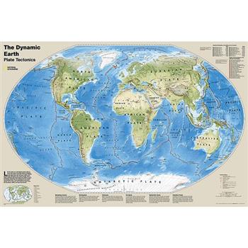
The Dynamic Earth map illustrates plate tectonics and features stunning bathymetry and naturally colored relief, as well as volcano and earthquake data through 2011.Like pieces of a giant jigsaw puzzle, tectonic plates fit together to form the earth's outer shell. The interaction of these plates causes earthquakes and volcanoes and shapes the earth's crust into mountains, valleys and deep-sea trenches. The Dynamic Earth map illustrates 17 major tectonic plates and highlights diffuse plate boundaries, convergent boundaries, spreading boundaries, fault zones, hot spots, notable earthquakes and volcanic eruptions of the 20th and 21st centuries, earthquakes with a magnitude of greater than 6.5 during the 20th and early 21st centuries, and notable volcanic eruptions during the past 10,000 years.The map is encapsulated in heavy-duty 1.6 mil laminate which makes the paper much more durable and resistant to the swelling and shrinking caused by changes in humidity. Laminated maps can be framed without the need for glass, so the frames can be much lighter and less expensive. Map Scale = 1:45,500,000Sheet Size = 36" x 24"
Film Production and Tourism Development in Nigeria. An Analysis of the Impact of Media on Tourism
Research Paper (postgraduate) from the year 2008 in the subject Tourism - Miscellaneous, grade: 4.5, University of Ibadan, language: English, abstract: This paper is about how the media in Nigeria can initiate a sense of departure to tourism sites through its movies/television programs. A major trend in tourism, this decade is the move away from the appreciation of the traditional elements of the practice-sight scenery, good weather and acquisition of luxury items -towards urban heritage -based, short -break, tourism emphasizing culture as products. The notion of departure or exit is in part initiated and constructed by a multiplicity of media, most importantly the film and television industries and packaged as advertisement. The entrepreneurs or developers of the media even in developing countries, perceive the countryside, specifically, not as a natural living environment of limited socio-economic value, but as a commodity that can be packaged and sold for a price to viewers. That is, the rural localities, locally and internationally have become popular contexts for a myriad of television serials or the setting of films and videos. The images the media foster are beamed into the homes of many people and succeed in constraining the audience to enjoy an experience of the great outdoors in the comfort and safety of the idyllic places. In other words, the viewers may be moved to go in search of the locations used anticipating the findings of what they saw on their screens and may be encountering the very role players in the presentations. Films and movies may and actually in certain circumstances serve to generate interests in locations used, especially when the setting involves attractive countryside and captivating cultural practices of the people. The films, therefore, have become of great interest to the public because they package specific cultures of the idyllic lifestyles and promote market values that can generate huge incomes.
New Concise World Atlas
With hundreds of dramatic, full-color, large-format maps produced by Europe's finest team of cartographers, the sixth edition of the New Concise World Atlas delivers a fully updated, diverse collection of geographical information in one well-organized, manageable volume. 144 pages of clear, detailed topographic and political world maps have been updated to show the latest transportation information (road, railways, and airports), administrative boundary changes, national parks, major tourist sites, and historical places of interest. The New Concise World Atlas also features beautifully rendered maps of the ocean seafloors and stunning new satellite imagery including Berlin, Cape Horn, Edinburgh, Gibraltar, Grand Canyon, Kampala, Kingston, La Paz, Memphis, Niagara Falls, Orlando, Osaka, Oslo, Perth, Philadelphia, Salar de Uyuni, Shanghai, Tehran, Tenerife, Tombouctou, Toronto, and Vienna. Recent changes to the world's geography are thoroughly captured in this edition; fully updated charts and world statistics provide data on climate, population, area, annual income, and physical dimensions. Finally, an index with over 64,000 items make searching for lesser-known locales quick and easy. Truly international in scope, created with meticulous care, and reflecting the very latest political developments and census information, Oxford's New Concise World Atlas, Sixth Edition achieves the highest standard among international map resources. This engaging and affordable resource is second to none in the superb quality of its maps, the breadth of its coverage, and its easy-to-use convenience.
National Geographic: Caribbean Classic Wall Map (Poster Size: 36 X 24 Inches)
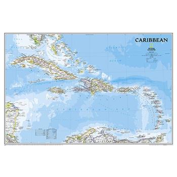
One of the most authoritative maps for the islands of the Caribbean Sea. It shows the entire region in great detail, with coverage extending from the tip of Florida to the northern extents of Colombia and Venezuela, east to Barbados, and west to the eastern edge of Honduras, Costa Rica, and Nicaragua. Detailed bathymetry reveals the remarkable seafloor variation of the Caribbean including the Puerto Rico Trench, the deepest point in the Atlantic Ocean at 8,605 meters (28,232 feet).Includes over 1,000 named places including country capitals, primary and secondary towns; political boundaries, important infrastructure, and all key landforms. Useful and informative notes about the region's history and unique geography are spread throughout the map, providing the reader further understanding of the Caribbean's unique attributes.The map is packaged in a two inch diameter tube with a label showing a thumbnail of the map with dimensions and other pertinent information.Map Scale = 1:3,286,000Sheet Size = 36" x 24"
The Lands Of The Eastern Caliphate
This book has been considered by academicians and scholars of great significance and value to literature. This forms a part of the knowledge base for future generations. So that the book is never forgotten we have represented this book in a print format as the same form as it was originally first published. Hence any marks or annotations seen are left intentionally to preserve its true nature.
Vom Hotel zur Marke. Markenmanagement in der familiengef羹hrten Hotellerie
Bachelorarbeit aus dem Jahr 2019 im Fachbereich Tourismus - Hotelmanagement, Note: 1, Management Center Innsbruck Internationale Fachhochschulgesellschaft mbH, Sprache: Deutsch, Abstract: Die Arbeit setzt sich zum Ziel, zu erforschen, inwieweit potenzielle Wettbewerbsvorteile der familiengef羹hrten Hotellerie in den Markenmanagement-Prozess integriert und Risikopotenziale minimiert werden k繹nnen, um ein Hotel als starke Marke zu etablieren. Zu diesem Zweck wurden Wettbewerbsvorteile und Risikopotenziale der familiengef羹hrten Hotellerie auf Basis bestehender Literatur abgeleitet. Als Grundlage wurde das identit瓣tsbasierte Markenmanagement gew瓣hlt und mit den Branchenbesonderheiten adaptiert. Eine Best-Practice-Study konnte zahlreiche Erkenntnisse der Arbeit belegen und aufzeigen, dass Markenmanagement auch in der familiengef羹hrten Hotellerie mit geringeren finanziellen und zeitlichen Mitteln m繹glich ist. Die Basis f羹r den Markenaufbau sollte in den Werten der Familie liegen, die in die Markenidentit瓣t integriert werden m羹ssen. Erfolgsfaktoren f羹r ein erfolgreiches Markenmanagement liegen dabei in der Balance zwischen der kontinuierlichen Umsetzung der Markenidentit瓣t und der Anpassungsf瓣higkeit an neue Trends. Zudem ist es entscheidend, alle Stakeholder in den Prozess zu integrieren und sicherzustellen, dass die Marke gelebt und das Nutzenversprechen zu jeder Zeit eingehalten wird. Auch die bewusste Kommunikation des famili瓣ren Charakters bringt entscheidende Wettbewerbsvorteile f羹r die Branche mit sich. Zudem wurde aufgezeigt, dass Differenzierung, Risikobereitschaft, Innovationen, emotionale Beziehungen, langfristige Planungshorizonte und Kreativit瓣t ausschlaggebend f羹r Erfolg im Markenmanagement sind.
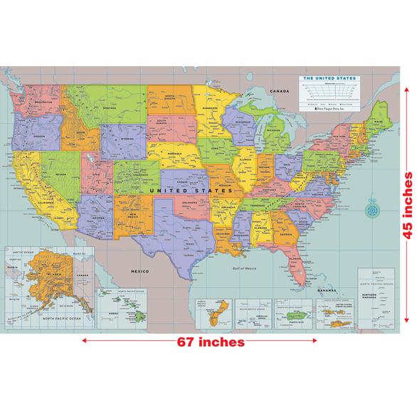
Laminated USA Wall Map (67’’ W X 45’’ H)
Laminated wall maps make beautiful and interactive d矇cor. Each map is color-coded in subtle, appealing palettes by continent or by state. Maps display essential geographical features, from rivers and mountains to cities and islands. Durable and reusable thanks to tough lamination. Suitable for framing or for hanging unframed. Write on and wipe off with a dry erase marker (not included). Ideal for home, office, and school. Cartography by David Lindroth - Maps measure 45" high x 67" wide (114.3 cm wide x 170.2 cm high). Box measures 46" long x 3" high x 3" deep (116.9 cm wide x 7.6 cm high x 7.6 cm deep).
Analyse und Perspektiven von Reisef羹hrern im Zeitalter des Internets anhand von Reiseblogs und Social-Media-Plattformen
Bachelorarbeit aus dem Jahr 2019 im Fachbereich Tourismus - Sonstiges, Note: 2,3, Jade Hochschule Wilhelmshaven/Oldenburg/Elsfleth (Wirtschaft und Tourismus), Veranstaltung: Bachelorarbeit, Sprache: Deutsch, Abstract: Ziel dieser Arbeit ist aufzuzeigen, inwieweit die Informations- und Reiseentscheidung durch das Internet beeinflusst wird. Dabei soll die Frage beantwortet werden, ob von einer Verdr瓣ngung der Reisef羹hrer in Buchform durch Reiseblogs und Social-Media-Plattformen gesprochen werden kann. Die Technologien des Internets bieten den Menschen verschiedene neue Informationsm繹glichkeiten, nicht nur im Beruf, sondern auch im privaten Bereich. In den letzten Jahren ist ein deutlicher Anstieg der Internetnutzer in Deutschland erkennbar. Im Jahr 2018 nutzten ca. 84% der deutschen Bev繹lkerung das Internet regelm瓣?ig. F羹r die Informationsbeschaffungsphase kommt den Online-Medien ebenfalls eine immer wichtiger werdende Bedeutung zu. Auch bei der Informationssuche 羹ber ein bestimmtes Reiseziel geht die Tendenz der Recherche immer mehr zu Webseiten von Reiseportalen oder Google hin. Bei der Reiseentscheidungsphase spielen zudem, durch unmittelbare Vergleichsm繹glichkeiten, die Qualit瓣t und der Preis eine immer entscheidendere Rolle. Reisef羹hrer in Buchform erschienen bereits seit Anfang des 19. Jahrhunderts und sind auch heute noch ein Offline-Medium, um Informationen 羹ber ein bestimmtes Reiseziel zu erlangen. Immer mehr Verlage bringen zum Buch passende Reisef羹hrer-Apps auf den Markt, welche alle Informationen praktisch auf einem Endger瓣t zusammenfasst. Neben diesen Informationen werden unter anderem auch Wettervoraussagen und integrierte Karten mit allen wichtigen Sehensw羹rdigkeiten in die Apps integriert. Durch die vermehrte Nutzung von Social-Media-Plattformen wie Facebook, Instagram & Co. wird eine Vernetzung unter Freunden und Bekannten geschaffen. Allerdings spielt diese im Bereich der Reiseinformationsbeschaffung und Reiseentscheidung nach der eigenen
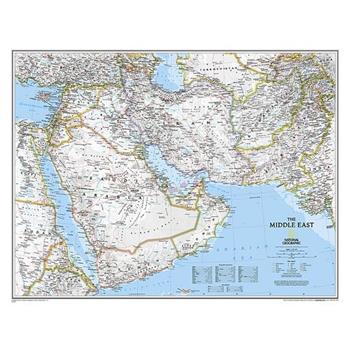
National Geographic: Middle East Classic Wall Map (30.25 X 23.5 Inches)
Expertly researched and designed, National Geographic's map of the Middle East covers a broad geographic area ranging from northern Africa through the Fertile Crescent to the western edge of China and India. Includes complete coverage of Afghanistan, Pakistan, Tajikistan, Iran, Iraq, Kuwait, Syria, Israel, Jordan, Lebanon, Saudi Arabia, Qatar, Bahrain, United Arab Emirates, Yemen, Oman, Cyprus, and Eritrea. Also includes parts of India, China, Kyrgyzstan, Uzbekistan, Turkmenistan, Azerbaijan, Armenia, Turkey, Egypt, Sudan, Ethiopia, and Djibouti.Features thousands of place names, accurate political boundaries, archeological sites, and major infrastructure networks such as roads, canals, ferry routes, airports, and railroads. The region's diverse terrain is detailed through accurate shaded relief, coastal bathymetry, and symbolism for water features and other land forms. Elevations of major peaks and depth soundings are expressed in meters. The signature Classic style map uses a bright, easy to read color palette featuring blue oceans and stunning shaded relief that has been featured on National Geographic wall maps for over 75 years.The map is packaged in a two inch diameter tube with a label showing a thumbnail of the map with dimensions and other pertinent information.Map Scale = 1:6,083,000Sheet Size = 30.25" x 23.5"
Nachhaltiges Management im Tourismus
Studienarbeit aus dem Jahr 2020 im Fachbereich Tourismus - Hotelmanagement, Note: 1,3, Internationale Berufsakademie der F+U Unternehmensgruppe Darmstadt, Sprache: Deutsch, Abstract: Im Fokus dieser Fallstudie steht das Prozess- und Qualit瓣tsmanagement des Destinationsmanagements in touristischen Unternehmen. Zun瓣chst werden die allgemeinen Begriffsdifferenzierungen eingef羹hrt. Anschlie?en wird im Verlauf der Arbeit die Analyse und Neubewertung des Qualit瓣tsmanagements des Praxisunternehmens durchgef羹hrt und Optimierungspotentiale herausgestellt. Anhand der vorausgegangenen Analyse wird eine neue Destinationsmarketingstrategie f羹r das Produktmanagement entwickelt. Als Praxisunternehmen dient dazu der Reiseveranstalter Knohl's Reisen aus Frankfurt.
Dubai und die Entwicklung zu einer Metropole. Eine kritische Betrachtung
Studienarbeit aus dem Jahr 2020 im Fachbereich Tourismus - Sonstiges, Sprache: Deutsch, Abstract: In der Hausarbeit soll die touristische Entwicklung Dubais kritisch beleuchtet werden. Daf羹r wurde Informationsmaterial zum Emirat Dubai und dessen Tourismus sowie allgemeine Fachliteratur herangezogen. Zudem wurde, aufgrund eines zweij瓣hrigen Auslandsaufenthalts in Dubai, auch viel Eigenrecherche betrieben. Die Arbeit gliedert sich in drei Hauptbereiche. Zu Beginn (Kapitel 2) wird Dubai allgemein sowie die Geschichte und Entwicklung des Emirates dargestellt. Im darauffolgenden Kapitel wird auf die Bedeutung und Entwicklung des Tourismus in Dubai vom jetzigen Standpunkt sowie zuk羹nftigen Erwartungen, bzw. Projekten eingegangen. Kapitel 4 befasst sich mit den Besonderheiten der Destination Dubai, bestehenden Sehensw羹rdigkeiten, geplanten Hotel- und Bauprojekten sowie die Zukunftserwartungen in den Tourismusbereich. Das Hauptkapitel stellt Kapitel 5 dar. Hier wird die zuk羹nftige touristische Entwicklung Dubais kritisch beleuchtet. Als Analyseinstrumente werden der Destinationslebenszyklus sowie 繹konomisch, 繹kologisch, gesellschaftliche Aspekte und deren Auswirkung auf den Tourismus in Dubai genutzt. Dubai entwickelte sich innerhalb k羹rzester Zeit vom armen Fischerdorf zum internationalen Handelsplatz, weiter zur hochmodernen Millionenmetropole mit einer atemberaubenden Skyline und modernster Infrastruktur. Arabische Kultur verflie?t mit westlicher Moderne. Weltrekorde, wie das h繹chste Geb瓣ude, die gr繹?te Einkaufsmall, das gr繹?te Riesenrad, die gr繹?te k羹nstlich erbaute Insel und viele weitere, reihen sich in Dubais Geschichte. Das rasante Wirtschaftswachstum beeindruckt Menschen aus aller Welt. Touristen sind fasziniert, Investoren werden angezogen. Das ungew繹hnlich schnelle Wachstum bringt jedoch auch zahlreiche negative Seiten hervor. Nicht alle Bereiche sind der rapiden Entwicklung gewachsen. Auch aus 繹kologischer Sicht ist die Wachstumsstrategie Dubais bedenkl
Tourist Tax for Destination Sustainability. Influencing Factors of Tourists’ Willingness to Pay
Bachelor Thesis from the year 2019 in the subject Tourism - Miscellaneous, grade: 1,3, University of Applied Sciences Bremerhaven, language: English, abstract: This paper aims to explore different types of tourist taxes and the motives for implementing them, as well as the impacts they induce on different stakeholders. Further, the topic of sustainability in tourism is elucidated. The research then deals with the willingness of German tourists to pay those taxes under different circumstances. As the literature review revealed a few qualitative studies on this topic, a quantitative approach was chosen, in order to test the results of these studies and the resulting hypotheses. It was expected, that tourists are likely to change their travel behavior due to the implementation of taxes, it was rather expected that they would not be willing to pay them. However, the study showed, that most participants are willing to pay a tourist tax, if the allocated funds are used to ensure the environmental sustainability of a destination. The factor which mostly influences the willingness to pay, is the respondents' attitude towards sustainability. Secondly, it was discovered that confidence in the implemented action seems to be of big importance. Participants who trust that allocated funds are used for the mentioned purposes, show a higher willingness to pay. Concludingly, local governments of tourist destination should increase their trustworthiness, by being more transparent, not only in collecting taxes, but also in finding appropriate purposes for spending the money on. Tourists are more likely to pay, if it is for the 'right' cause. As the overtourism problem increases around the world, many popular tourist destinations are resorting to measures, which are supposed to solve the problem totally, or to at least find ways to compensate the adverse effects created by tourism. One of these measures is the implementation of tourist taxes, which has become increasingly popular am
Picturing the Islamicate World
In Picturing the Islamicate World, Nadja Danilenko explores the message of the first preserved maps from the Islamicate world. Safeguarded in al-Iṣṭakhrī's Book of Routes and Realms (10th century C.E.), the world map and twenty regional maps complement the text to a reference book of the territories under Muslim rule. Rather than shaping the Islamicate world according to political or religious concerns, al-Iṣṭakhrī chose a timeless design intended to outlast upheavals. Considering the treatise was transmitted for almost a millennium, al-Iṣṭakhrī's strategy seems to have paid off. By investigating the Persian and Ottoman translations and all extant manuscripts, Nadja Danilenko unravels the manuscript tradition of al-Iṣṭakhrī's work, revealing who took an interest in it and why.
Topographic Symbols - FM 21-31 US Army Field Manual (1952 Civilian Reference Edition)
Master Your Map Skills with This Essential Manual on Topographic SymbolsPrepare yourself and brush up on your skills with this unabridged, high-quality Civilian Reference Edition reissue of the official Topographic Symbols FM 21-31 US Army War Department Field Manual, 1952 release. This unclassified civilian reference edition manual features over 200 icons, symbols, and abbreviations that adorn USGS quadrangle maps and military-style grid maps. This book represents the best knowledge about topographic map symbols for the solider teams who depend on accurate and detailed maps. Contents include essential knowledge about all types of symbols and icons that appear on topographic maps and USGS quadrangles for map reading and land navigation in the wilderness. Discussed inside these pages are symbols for relief, drainage, topography, vegetation, roads, buildings, hydrography, boundaries, public land, and other markers such as control points, elevations, and topographic indices. Gain essential skills for your outdoors activities by learning from the classic knowledge of the American soldier. Great for learning the ins-and-outs of mastering navigation of the outdoors while on foot or horseback. Not just for military personnel, this book is a great gift for outdoors enthusiasts, backpackers, campers, hikers, hunters, or scouts!A part of the Military Outdoors Skills Series: Volume 9This Doublebit Historic Edition reprint of Topographic Symbols FM 21-31 (1952) is professionally restored and presented from the original source with the highest degree of fidelity possible. Available in both paperback and hardcover, readers can enjoy this Civilian Reference Edition reissue for generations to come and learn from its timeless knowledge.About the Doublebit Military Outdoors Skills SeriesMilitary manuals contain essential knowledge about outdoors life, thriving while in the field, and self-sufficiency. Unfortunately, many great military books, field manuals, and technical guides over the years have become less available and harder to find. These have either been rescinded by the armed forces or are otherwise out of print due to their age. This does not mean that these texts are worthless or "out of date" - in fact, the opposite is true! It is true that the US Military frequently updates its manuals as its protocols have changed based on the times and combat situations that our armed services face. However, the knowledge about the outdoors over the entire history of military publication is timeless!By publishing the Military Outdoors Skills Series, it is our goal at Doublebit Press to do what we can to preserve and share historic military works, such as army field manuals (the FM series), technical manuals (the TM series), and other military books that hold timeless knowledge about outdoors life, navigation, and survival. Through remastered reprint editions of military handbooks and field manuals, we can preserve the time-tested skills and institutional knowledge that was learned through hard lessons and training by the U.S. Military and our expert soldiers.
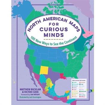
North American Maps for Curious Minds100 New Ways to See the Continent
No matter how well you think you know North America, the 100 infographic maps in this singular atlas uncover a trove of fresh wonders that make the continent seem like the center of the universe. Did you know that North America is where the first T. rex was found? Or that it's where you can visit the world's biggest geode as well as its oldest, tallest, and largest trees--not to mention the world's tallest and steepest roller coasters?! Brimming with fascinating insight (Who is the highest-paid public employee in each state?) and whimsical discovery (Where can you visit the world's largest island in a lake on an island in a lake on an island?), this book highlights the unexpected contours of geography, history, nature, politics, and culture, revealing new ways to see North America--and the hundreds of millions who call it home.
Prospects of Halal Tourism. Fundamentals of Tourism
Academic Paper from the year 2020 in the subject Tourism - Miscellaneous, University of Dhaka (Faculty of Business Studies), language: English, abstract: This study shares three different Islamic tourism concepts. The main objectives of the study are to determine the components of halal tourism and the opportunities and challenges of halal tourism. Furthermore, the study recommends some marketing practices of halal tourism as well as some controlling practices applicable for halal tourism. The concept of halal tourism is getting populated day by day because of increasing number of Muslim populations, the development of middle class and increasing amount of spendable income. This concept is also talking about sustainability. Halal is one of the most popular Arabic words in Islamic word which means lawful. Islamic Council of Victoria define halal as free from any component that Muslim are prohibited from consuming and processing, making, producing, manufacturing and/or storing by using utensils, equipment and/or machinery that have been cleansed according to Islamic law.
How Sustainable Development Affects the Aviation Industry. A Case Study of the Lufthansa Group
Bachelor Thesis from the year 2020 in the subject Tourism - Miscellaneous, grade: 1,5, Cologne Business School K繹ln, language: English, abstract: This bachelor thesis will firstly define the term sustainability and explain what it consists of according to the Triple Bottom Line Model by John Elkington by doing a systematic literature review. Furthermore, a closer look into the airline industry will be taken to analyse which challenges and possible opportunities carriers have to face during this significant transformation. While focusing on the research question 'to what extent is the Lufthansa Group adapting to the sustainable change?', the Lufthansa Group will serve as the case study of this thesis to gain a deeper understanding of not only the theoretical elaboration but also the practical implementation of the Paris Agreement of Climate Change. This analysis will firstly work out existing definitions of sustainability and sustainable development, which will be presented in the first chapter. Moreover, a small digression into sustainable tourism as a whole will be made, which serves as a transition to the main topic of this bachelor thesis: sustainability in the airline industry. The theoretical framework of this paper will be the Triple Bottom Line Model by John Elkington. This model defines sustainability depending on three main pillars, which form the components of the term. Moreover, based on different political statements and reports, such as the Paris Agreement of Climate Change, as well as on statistics that prove not only the existence of global warming but also its consequences, the importance of this elaboration will be once more underlined. In the end, balance and annual reports, which are placed at the disposal of the Lufthansa Group, will serve as the relevant data for analysing the application of the theory to the case study with the focus on the economic and social components.
The Concise Handbook of Country Flags
Are you looking for the ultimate A-Z guide of countries of the world?Now with more information than ever, heres what you will discover with The Concise Handbook of Country Flags: An A-Z guide of countries of the world and their flags BLED-TO-EDGE TABBED PAGES - Find your desired country super quickly with alphabetical indexed tabs!FUNCTIONAL - Unlike most fact books, we have kept the presentation simple and concise to allow you to locate facts quickly.AESTHETIC - designed in full color and with elegance and functionality for an overall great reader experience.MORE INFORMATION PER COUNTRY THAN EVER BEFORE - Each country has a huge 9 points of information! That includes capital, size, population, GDP, currency, highest point, official languages, major religion(s), formation/independence year and the name of the country within it's own language (e.g. Deutschland to Germany).COUNTRY LOCATION - Our numbering system allows you locate a country and its flag on a map in seconds!DATA RANKINGS - See how your country ranks against other countries for size, population, GDP and highest point.NOT JUST COUNTRY FLAGS AND FACTS - Discover earth facts, continent facts and how they rank against each other, a continent map, extra flags of territories, flags of the countries of the UK and organisation flags.MAKE A GREAT GIFT FOR YOURSELF OR FOR GEOGRAPHY FANS AND VEXILLOLIGISTS - B.C. Lester Books devotes their efforts into bringing cutting edge publications in Geography, so you know you will be getting a quality title, whoever this book is purchased for!CUSTOMERS LOVE OUR FLAG BOOKS - Designed as an overall improvement from our previous Flag Books, customers loved our Geography Publications and we think that you will too!Get yours now!
The Outer Banks Gazetteer
The rich history of North Carolina's Outer Banks is reflected in the names of its towns, geographic features, and waterways. A book over twenty years in the making, The Outer Banks Gazetteer is a comprehensive reference guide to the region's place names--over 3,000 entries in all. Along the way, Roger L. Payne has cataloged an incredible history of beaches, inlets, towns and communities, islands, rivers, and even sand dunes. There are also many entries for locations that no longer exist--inlets that have disappeared due to erosion or storms, abandoned towns, and Native American villages--which highlight important and nearly forgotten places in North Carolina's history. Going beyond simply recounting the facts behind the names, Payne offers information-packed and entertainingly written stories of North Carolina, its coastal geography, and its people.Perfect for anyone interested in the North Carolina coast, this invaluable reference guide uncovers the history of one of the most-visited areas in the Southeast.
Gesundheit im Tourismus. Die Graubereiche zwischen Gesundheits-, Medizin- und Wellnesstourismus
Bachelorarbeit aus dem Jahr 2018 im Fachbereich Tourismus - Sonstiges, Note: 1,7, Hochschule Heilbronn Technik Wirtschaft Informatik, Veranstaltung: Tourism Management, Sprache: Deutsch, Abstract: Zielsetzung dieser Arbeit ist, der fehlenden Transparenz in den Graubereichen von Gesundheits-, Medizin- und Wellnesstourismus entgegenzuwirken. ?berwiegend durch den Vergleich diverser, relevanter und qualitativer Informationsquellen sollen entscheidende Merkmale essentieller Begrifflichkeiten herausgearbeitet werden. Basierend darauf, werden argumentativ belegte Definitionen ausgew瓣hlt oder neu definiert, die nach Ansicht der Autorin den Wortinhalt am treffendsten wiedergeben. Unterst羹tzt wird dieser Prozess zudem durch ein Ausschlussverfahren und Abgrenzung zu anderen Benennungen mit differenten Kernelementen. Vor allem die Ausschlussverfahren basieren auf einem systematischen Ansatz, in dessen Rahmen vereinzelte Aussagen detailliert vorgestellt und kritisch untersucht werden. Die Abgrenzung oder Korrelation zwischen den einzelnen Bezeichnungen wird unter anderem mittels These-Antithese-Synthese hergeleitet. Resultat sollen stichhaltige Definitionen, Unterordnungen und Abgrenzungen sein, die konstruktive Orientierungshilfen f羹r das Angebot spezifischer Produkte darstellen. Dabei handelt es sich nicht nur um Produkte der Tourismusbranche in Zusammenhang mit dem Gesundheitswesen. Vielmehr werden durch abgeleitete Abgrenzungen 羹berdies Informationen f羹r einzelne, andere Felder dieser Branchen aufgearbeitet. Die Aufarbeitung der Begrifflichkeiten von der Basis her soll helfen, ein tieferes Verst瓣ndnis f羹r die individuellen Themenbereiche aufzubauen, weshalb es neben der Anbieterseite ebenso f羹r die Nachfrager-Seite informativ sein kann.
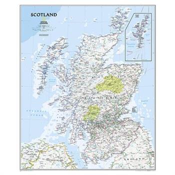
National Geographic: Scotland Classic Wall Map - Laminated (30 X 36 Inches)
National Geographic's wall map of Scotland is one of the largest and most detailed maps of the country. The signature Classic style design uses a bright, easy-to-read color palette featuring blue oceans and stunning shaded relief that has been featured on National Geographic wall maps for over 75 years. This map includes hundreds of named places including primary and secondary towns, counties, political boundaries, infrastructure, and selected historical sites. Scotland is shown in its entirety including the Highlands, Southern Uplands, Isle of Skye, Outer Hebrides, Inner Hebrides, Orkney Islands and the Shetland Islands (shown in an inset map). The nine political council areas of Scotland are also clearly identified.The map is encapsulated in heavy-duty 1.6 mil laminate which makes the paper much more durable and resistant to the swelling and shrinking caused by changes in humidity. Laminated maps can be framed without the need for glass, so the frames can be much lighter and less expensive. Map Scale = 1:650,000Sheet Size = 30" x 36"
A study into wine consumption patterns of Indians with special reference to the Pune region
Doctoral Thesis / Dissertation from the year 2014 in the subject Tourism - Hotel Management, grade: A, language: English, abstract: This research analyses the wine consumption patterns in Pune City (Pune Municipal Corporation limits) to determine the demographic of the wine consumers and their knowledge about wine. This research also seeks to understand the wine consumers' perceptions towards wine. The literature reviewed has shown the development of wine in India. The impact the wine industry has on the Indian economy has also been illustrated. Details of the major Indian wine manufacturers and the potential they have has been studied. Information on Indian grapes and wine has been collated. Articles and studies on the perceptions that wine consumers have showed that there are still some myths and misconceptions surrounding wine. The advantages and disadvantages faced by Indian wine manufacturers have been illustrated. Studies have shown the positive health benefits of moderate wine consumption The Indian market is a very young market. Indian wine manufacturers are still coming to terms with a small but growing consumer base. Numerous foreign studies have shown that the India has a good potential for wine marketing. Given the low levels of wine consumption, in comparison to Beer and Hard Liquor, this research identifies the wine consumers' perceptions and demographics. The research offers the wine manufacturers a target group on whom to focus their marketing strategies on. It also evaluates the perceptions of the wine consumer in respect to wine being an acceptable drink in a family environment and notions of wine perceived as a luxury drink. Wine marketers can use this as a basis of understanding the consumption patterns of wine consumers. India is the second largest populated country with a population of 1.2 billion people and a large middle class of over 250 million people. We could be consuming about 250 million liters of wine annually if each person dran
Terrorismus und Tourismus. Folgen und Ma?nahmen am Beispiel Nizza
Studienarbeit aus dem Jahr 2017 im Fachbereich Tourismus - Hotelmanagement, Note: 2,0, Hochschule Fresenius; Hamburg, Sprache: Deutsch, Abstract: Der Tourismus wird begleitet von Terror, politischen Krisen und Kriegen. Kein Thema ist derzeit aktueller. In den Medien werden die Menschen tagt瓣glich mit neuen terroristischen Attacken in Urlaubsgebieten konfrontiert. Der Tourismus wird damit auf eine harte Probe gestellt. Doch wie stark leidet der Tourismus, wie ver瓣ndert sich die Nachfrage der Touristen und was tut die Destination, um das Vertrauen der Menschen zur羹ckzugewinnen? Genau mit diesen Fragen besch瓣ftigen sich seit Jahren Forschungsinstitute f羹r Tourismus, die Welttourismus Organisation UNWTO aber auch die internationale Presse. Ziel der vorliegenden Arbeit ist es, die Folgen des Terrorismus auf den Tourismus und die Ma?nahmen zur Bew瓣ltigung der negativen Effekte darzustellen. Am Beispiel des Anschlages vom 14.07.2016 in Nizza, Frankreich. Dazu werden im ersten Kapital die Grundlagen des Tourismus, des Terrorismus und deren Verh瓣ltnis zueinander erl瓣utert. Anschlie?end werden im dritten Kapitel die historischen Hintergr羹nde Nizzas, die wirtschaftliche Situation vor dem Anschlag am 14.07.2016, der Anschlag selbst sowie Frankreich als Ziel des Terrorismus n瓣her beleuchtet. Das vierte Kapitel befasst sich mit der Leitfrage der Hausarbeit: Wie stark leidet der Tourismus in Nizza und weiteren Destinationen unter terroristischen Angriffen und inwiefern ver瓣ndert sich auch die Nachfrage der Touristen? Dabei werden die Auswirkungen auf das Destinationsimage, die Ver瓣nderung der Reiseentscheidung und touristischen Nachfrage sowie Frankreich und Nizza nach den Anschl瓣gen thematisiert. Anschlie?end werden im f羹nften Kapital Ma?nahmen auf die negativen Effekte erl瓣utert.
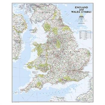
National Geographic: England and Wales Classic Wall Map - Laminated (30 X 36 Inches)
Expertly researched and designed, National Geographic's Classic style wall map of England and Wales (Cymru) provides exceptional detail of two of the three regions that make up the island of Great Britain. The map features a bright color palette with blue oceans and terrain detailed in stunning shaded relief that has been a hallmark of National Geographic wall maps for over 75 years. Administrative divisions are clearly defined and thousands of place names including cities, historical sites, bodies of water, national parks, and more are shown. The region's transportation infrastructure is detailed as well, with clearly indicated roads, motorways, airports, canals, ferry routes, and high-speed and passenger railroads. Coastal bathymetry is shown with depth curves and soundings. In addition to England and Wales (Cymru), coverage includes portions of Scotland, Northern Ireland, Ireland, and France. The map is encapsulated in heavy-duty 1.6 mil laminate which makes the paper much more durable and resistant to the swelling and shrinking caused by changes in humidity. Laminated maps can be framed without the need for glass, so the frames can be much lighter and less expensive. Map Scale = 1:868,000Sheet Size = 30" x 36"
The Complete Book of Country Flags, Facts and CapitalsTheComplete Book of Country Flags, Facts and CapitalsA colorful guide of all country flags, facts and capitals of the world including photos and c
Are you looking for a clear guide to all flags of countries of the world? Are you looking for country information, or the country's location on the map? Then look no further!Heres why The Complete Book of Country Flags, Facts & Capitals is the perfect handbook and reference guide for you!THE PERFECT BLEND OF PRACTICALITY AND AESTHETIC - Countries are organized by continent and country information is logically placed and easy to find. Between this data are colorful flags, beautiful maps and photos summarizing the continent, making for a lovely book for both kids and adults.WRITTEN FOR READERS OF ALL AGES - An informative yet a non-complicated read, with no unnecessary jargon, making the read enjoyable for children and adults alike.DETAILED INFORMATION INSIDE WITH IMPROVED READABILITY - A section of country and continent facts forming reliable data such as country's capital, area and population, coupled with summary paragraphs on continents and fun facts which give the book readability as well as just lists of information.FIND COUNTRY LOCATIONS IN SECONDS - Our numbering system allows you locate a country and its flag on a map in seconds!HANDY SIZE, DURABLE FINISH - 6x9 inch book witha. durable glossy cover makes this book ideal for suing at home or taking with you on holiday or to school!MAKES A GREAT GIFT FOR YOURSELF OR FOR GEOGRAPHY LOVERS - B.C. Lester Books devotes their efforts into bringing cutting edge publications in Geography, so you know you will be getting a quality title, whoever this book is purchased for!CUSTOMERS LOVE OUR FLAG BOOKS - Designed as an overall improvement from our previous Flag Books, customers loved our Geography Publications and we think that you will too!Get yours now!
Erfolgreiche Umsetzung von nachhaltigen Festivalkonzepten am Beispiel des Tollwood Festivals
Studienarbeit aus dem Jahr 2018 im Fachbereich Tourismus - Sonstiges, Note: 1,3, Hochschule Fresenius; Hamburg, Sprache: Deutsch, Abstract: Die vorliegende Arbeit befasst sich mit der Umsetzung der Nachhaltigkeit bei Festivals. Am Beispiel des Tollwood Kulturfestivals in M羹nchen werden die Aspekte der Umsetzung beispielhaft belegt. Ziel der Arbeit ist es folglich herauszuarbeiten, inwiefern die Nachhaltigkeit auf einem Festival umgesetzt werden kann und bereits wird. Daf羹r werden zun瓣chst im Theorieteil die notwendigen Begriffe Nachhaltigkeit und Festival definiert, um eine einheitliche Basis zu schaffen. Kapitel drei besch瓣ftigt sich mit der Zusammenwirkung der beiden Komponenten. Das vierte Kapitel befasst sich mit der Leitfrage der Hausarbeit: Welche M繹glichkeiten gibt es, ein Festival 繹kologischer und umweltvertr瓣glicher zu gestalten? Dabei werden die Themen Mobilit瓣t und Transport, Energiemanagement, Abfallmanagement, Wassermanagement und die Gastronomie thematisiert. Anschlie?end werden im f羹nften Kapitel die Umsetzung der Handlungsfelder am Beispiel des Tollwood Festivals erl瓣utert. Im sechsten Kapitel wird ein abschlie?endes Fazit gegeben. Gro?veranstaltungen wie Festivals sind mit einer hohen Natur- und Umweltbelastung verbunden. Menschenmassen kommen zusammen, tanzen, h繹ren Musik, essen und trinken, sie verbrauchen Ressourcen. H瓣ufig campen sie mitten in der Natur. Mengen an Abfall, weggeworfene Verpackungen, leere Dosen, Flyer und Werbeartikel bestimmen h瓣ufig das Bild eines Festivals. Das heutige Handeln bestimmt ausschlaggebend das Leben der n瓣chsten Generationen. Die Menschheit ist daf羹r verantwortlich, dass auch in Zukunft noch gute Lebensbedingungen vorgefunden werden k繹nnen. Nach diesem Gedanken sollte das Verhalten ausgerichtet werden - auch bei der Gestaltung von Festivals.
Venice and the Impact of Overtourism
Seminar paper from the year 2018 in the subject Tourism - Miscellaneous, grade: 1,0, Fresenius University of Applied Sciences Hamburg, language: English, abstract: It is Easter Sunday 2018 and there are 125,000 visitors in Venice, a number that the country of Bangladesh welcomes annually. The increasing in cheap airfare has triggered a boom in the tourism industry. 2017 saw 1,3 billion international travelers, a growth of 7% over 2016. There are more people travelling around the world than ever before. Moreover, the way of traveling has changed from a few-day trips, including overnight stays in hotels and exploring the city and getting to know the locals, to day- or hour-long trips. In the 17th century a trip to Venice was affordable by only the upper class of northern Euro-peans, who visited the city as a part of their Italian tour. Writers and artists were inspired by the magic of the lagoon city. The most romantic of cities, that is what visitors considered Venice and it has that reputation still to this day. Tourism is the main economy of Venice and it offers a lot of job opportunities. But on the other hand, it is one of the most touristic cities in the world with 30 million visitors annually, and that for a city with a population of 55,000. Tourists overflow the city, they are not concerned in supporting sustainability of the city and not conscious about the negative impact they leave behind. One could argue that tourism has become an issue rather than a resource for Venice. The natural environment of Venice and its residents are suffering from their popularity and the effects of overtourism. I would argue that all stakeholders in the tourism sector in Venice need to urgently act and start building a sustain-able future for the city. To withstand overtourism and to save the city and its inhabitants from extinction. This essay outlines positive and negative impact of overtourism in Venice concerning the economy, the social sector and its natural environment
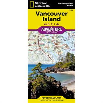
Vancouver Island
- Waterproof - Tear-Resistant - Travel MapNational Geographic's Vancouver Island Adventure Map provides global travelers with the perfect combination of detail and perspective in a highly functional travel tool. Cities and towns are clearly indicated and easy to find in the user-friendly index. A road network complete with distances and designations for roads, motorways, and expressways will help you find the route that's right for you. Secondary routes are also marked for those seeking to explore off the beaten path. Hundreds of points of interest and diverse and unique destinations are highlighted including national parks, nature reserves, World Heritage sites, archeological sites, ski areas, hot springs, beaches, museums, and more. The south side of the print map shows Victoria the capital of British Columbia, Pacific Rim National Park Reserve, and the costal town of Nanaimo. The northern half of the printed map covers the much more remote part of the island. There are many large protected areas in the north of the island including Strathcona, Cape Scott, Tahsish-Kwois Provincial Parks.Every Adventure Map is printed on durable synthetic paper, making them waterproof, tear-resistant and tough -- capable of withstanding the rigors of international travel.Map Scale = 1:275,000Sheet Size = 37.75" x 25.5"Folded Size = 4.25" x 9.25"
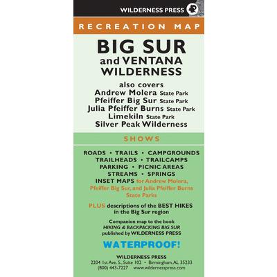
Big Sur and Ventana Wilderness Recreation Map
Find Your Way in Southern California's Beautiful Hiking Region Big Sur stretches more than 90 miles from Carmel, California, south to San Simeon. It is hemmed in by the Pacific Ocean to the west and the Santa Lucia Range to the east. Several hundred miles of trails crisscross the vast area. Discover the best of it with this four-color topographic map. The large, beautifully detailed map is 38.25" x 24.75", and it contains all the details you need to explore. On one side, the map features the northern half of Big Sur and the Ventana Wilderness--amidst the vast Los Padres National Forest. Inset maps of Andrew Molera State Park, Pfeiffer Big Sur State Park, and Julia Pfeiffer Burns State Park give you a closer look at these popular destinations. The other side showcases the southern half of the area, including Big Creek State Reserve, Limekiln State Park, and Silver Peak Wilderness. This third edition of the map shows every major road (along with minor and unpaved roads), and it includes trails, trailheads, campgrounds, parking, picnic areas, gas stations, ranger stations, waterways, peaks, and more. As an added bonus, the map calls out 11 of the top hikes in Big Sur, including four short hikes, three day hikes, and four backpacking trips. When you're finished, fold the map back to the convenient size of 4.13" x 8.75". It is lightweight, durable, waterproof, and it fits in your backpack or back pocket. So you can carry it with you on your Big Sur adventures! Use the map alone, or pair it with Hiking & Backpacking Bug Sur for even more great information.
Bon Voyage Travel Notebook
Bon Voyage Travel Notebook: A Journal For Those Who Love To Travel The WorldWhether you are ready to backpack across the country, jet off to Europe, head out on an African safari or set sail around the world, this is the perfect notebook to record all your travel memories. Large enough that you'll have plenty of room to write yet small enough to slide in your backpack or purse. Filled with 120 pages (60 sheets) of bright white lined paper Perfect for story writing, poetry, journaling, note taking and more Enjoy the therapeutic value of journaling while you travel A great travel book to record their thoughts, feelings and memories This fun notebook could even be great as a daily travel diary Or used for charting and planning your trips, personal goals and dream vacations. Other uses include: gratitude journal, fitness journal, food journal, idea journal, reading journal, project journal, poetry journal, prayer journal, and the list goes on Add this fun Bon Voyage Travel Notebook to your cart now or save it to your wish list for later. A great Bon Voyage travel gift for anyone about to take a trip. Be sure to check out the other fun journal and notebook designs by this author.
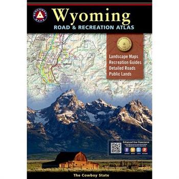
Wyoming Road and Recreation Atlas
Wyoming is the heart of the American West. Experience the wild spirit of Wyoming with Benchmark''s Wyoming Road & Recreation Atlas. No other map product can better portray Wyoming''s rugged, sky-scraping peaks, or the vast openness where the deer and the antelope really do play! Benchmark''s field-checked Landscape Maps clearly depict the terrain, and pinpoint the many backroads that crisscross the state. The Recreation Guide includes mule deer hunting units and details the many outstanding recreation destinations and opportunities within.Map Scale = 1:250,000 & 1:750,000Sheet Size = 11" x 15"
Kundenbindungsprogramme bei touristischen Leistungstr瓣gernMiles & More, Hilton Honors, Bah
Studienarbeit aus dem Jahr 2020 im Fachbereich Tourismus - Sonstiges, Note: 1,0, DIPLOMA Fachhochschule Nordhessen; Zentrale, Sprache: Deutsch, Abstract: In der vorliegenden Arbeit geht es um Chancen und Anforderungen von Kundenbindungsprogrammen bei den touristischen Leistungstr瓣gern "Deutsche Bahn", "Lufthansa" und "Hilton" im Vergleich. Kundenbindungsprogramme wurden in den letzten Jahrzehnten bei Kunden als auch bei Unternehmen beliebt und haben sich so als moderne Marketingstrategie etabliert. Gerade weil diese Programme oft stark vom Kostenfaktor sowie vom Nutzenfaktor untersch瓣tzt werden, sollte darauf geachtet werden, dass der Umfang nicht bewertet wird. Ein KBP kann sehr vielschichtig sein und kann wichtige Daten 羹ber Kunden liefern. Hierbei spielt es keine Rolle, ob es nur die Zufriedenheit des Kunden, das Befriedigen von Gewohnheiten, die Lieblingssitzplatzposition im Flugzeug oder die Pr瓣ferenzen eines Hotelzimmers sind.
Incorporating the Principles of Sustainable Tourism into the Strategic Marketing SystemAn
Bachelor Thesis from the year 2008 in the subject Tourism - Miscellaneous, grade: 1,0, Heilbronn University, language: English, abstract: Tourism is often considered a welcome source of economic development providing employment opportunities, producing means of earning foreign exchange, and stimulating the local economy. The tourism sector is more complex than economic activity alone, since the social, political, technical and ecological environments also have a strong influence on it and vice versa. "Conventional" mass tourism is associated with numerous negative effects, such as environmental destruction and loss of cultural heritage. For this reason, some of the terms that have surfaced over the last decade are "sustainable" tourism and "alternative" tourism. The increasing awareness of consumers about Corporate Social Responsibility and environmental issues has brought forward a new target group named the "morally conscious tourist". Destinations and especially international corporations alike advertise with these terms as a means to differentiate themselves, reaching out for this new, emerging customer segment. However, sustainability should not merely be a marketing ploy to reach new customers or to perform "greenwashing" in order to appear more environmentally friendly. In fact, it is a complex and difficult task to achieve the implementation of sustainable business practices and to develop sustainable tourism products. It is exactly this challenge the research paper will focus on by analyzing how to incorporate the principles of sustainability into the marketing system of tourism businesses or destinations. An exploratory as well as descriptive research design based on external and internal secondary data is used in order to obtain information that can answer the research question. The first aspect to be studied in this research paper is the development of tourism and the tourism industry with regards to the emergence of mass tourism, as well as the critic
Digitale Revolution im Tourismus. Chancen und Risiken f羹r die Hotellerie
Studienarbeit aus dem Jahr 2019 im Fachbereich Tourismus - Sonstiges, Note: 1,7, IU Internationale Hochschule, Sprache: Deutsch, Abstract: Das wesentliche Ziel der Arbeit ist es, herauszufinden, welche Chancen und Risiken die Digitalisierung f羹r touristische Dienstleister mit sich bringt. Mithilfe eines Experteninterviews sollen Erkenntnisse bez羹glich der oben aufgeworfenen Thematik gewonnen und die jeweiligen Chancen und Risiken genauer betrachtet werden. Ebenso soll aus den Experteninterviews abgeleitet werden, inwiefern sich die Hotellerie bereits mit der Thematik der Digitalisierung auseinandergesetzt hat und welche digitalen Umsetzungen 羹berhaupt m繹glich sind. Die digitale Revolution ruft eine Ver瓣nderung des Denkens und Handelns in der Hotellerie hervor. Neue Technologien werden bedeutender und aus diesem Grund m羹ssen sich touristische Dienstleister, insbesondere Hoteliers, ebenfalls mit dem Thema der Digitalisierung auseinandersetzen. Fraglich ist, ob die Hotellerie sich bewusst ist, welche Chancen, Risiken und M繹glichkeiten durch die Digitalisierung entstehen, und ob die Unternehmen noch zu gro?e Vorbehalte gegen羹ber der Digitalisierung haben.
Bleeding Kansas and the American Civil War
This book includes events that led up to the American Civil War. Kansas is where it all began. The book starts out with the U.S. Presidential Elections of 1852 and the passage of the Kansas-Nebraska Act in 1854, which allowed settlers, not Congress, to determine by popular vote, if they wanted to be admitted into the United States as a Free State or a Slave State. Streams of emigrants began to settle from Midwestern States, Northern States, and Southern States to make land claims in the Kansas Territory. It became a battleground. Politics, violent murders, rivalry governments, and election fraud in Kansas Territory, all played an important role leading up to the American Civil War. Abolitionist John Brown, his militants, and his sons, played a role in the violent murders in the Kansas Territory. Details of John Brown's raid into neighboring State of Missouri are also included, where he freed 11 slaves, murdered a slave owner, and stole several ox, wagons, supplies, and valuables. He was condemned by both Free-State and Pro-Slavery newspapers across the country, as well as the President of the United States and the Governor of Missouri, who both offered a combined reward of $3,250 for the capture of John Brown. He was a wanted man on the run. John Brown's unsuccessful raid on Harpers Ferry, Virginia, including Robert E. Lee and J.E.B. Stuart's involvement, and John Brown's subsequent hanging, are noted in the book. All major battles during the Civil War in Kansas are mentioned in the book, with troops strength details, casualty details, and colored battlefield maps showing the positions of the troops, including Maj Gen Sterling Price's retreat southwards with 500 supply trains, and Quantrill's Lawrence Massacre, where over 200 men and boys in town were killed, and where the town was pillaged and burned. This massacre became the bloodiest atrocity in the American Civil War. The book summarizes the places to stay and places to visit in Kansas by County, including battlefields, historical sites, museums, and cemeteries.
Urlaubs- und Freizeittourismus in Hessen. Hessen Mobility+ Card als zuk羹nftige Mobilit瓣tsl
Projektarbeit aus dem Jahr 2019 im Fachbereich Tourismus - Sonstiges, Note: 1.0, Frankfurt University of Applied Sciences, ehem. Fachhochschule Frankfurt am Main, Sprache: Deutsch, Abstract: Die Arbeit beschreibt die Projektausarbeitung der "Hessen Mobility+ Card", welche das Ziel verfolgt, den 繹ffentlichen Nahverkehr f羹r ausl瓣ndische G瓣ste attraktiver zu gestalten. Durch die Entwicklung der "Hessen Mobility+ Card" soll vor allem die L羹cke im Angebot des Rhein-Main-Verkehrsbunds hinsichtlich eines Mobilit瓣tsangebotes speziell f羹r Touristen aus dem Ausland, die nach Hessen reisen, geschlossen werden. Dabei ist es essentiell, dem Touristen ein verst瓣ndliches, sinnvolles und attraktives Angebot zu unterbreiten, welches er letztendlich auch wahrnimmt und eine echte, sowie g羹nstigere Alternative zu Mietwagen oder Gruppenreise im Reisebus erh瓣lt. Die Basis des Tickets stellt ein ?PNV Ticket f羹r alle 繹ffentlichen Verkehrsmittel in ganz Hessen und einige ?bergangsgebiete an den hessischen Grenzen dar. Damit wird sichergestellt, dass es keine Verwirrungen oder Unklarheiten 羹ber G羹ltigkeit und Einsetzbarkeit gibt, denn es wird potentiellen Kunden erm繹glicht, das ganze Bundesland per Bus und Bahn zu erkunden. Zus瓣tzlich bietet das Ticket in Kooperation mit diversen Partnern in Einzelhandel, Gastronomie und Lifestyle eine Rabatt-Funktion. Ein weiterer entscheidender Baustein des Mobilit瓣tsangebots und damit das "+" im Namen, ist der modulare Aufbau. Der Kunde kann sich verschiedene attraktive zus瓣tzliche Erweiterungen, die seinen Aufenthalt in Hessen qualitativ noch st瓣rker aufwerten, zum Basispaket hinzubuchen.
American Practical Navigator `Bowditch` 2019 Volume 2
Volume 2 of the latest edition of the Bowditch in paperback format. The American Practical Navigator, first published in 1802, was billed as the "epitome of navigation" by its original author, Nathaniel Bowditch. The text has evolved with the advances in navigation practices since that first issue and continues to serve as a valuable reference for marine navigation in the modern day. The publication describes in detail the principles and factors of navigation, including piloting, electronic navigation, celestial navigation, mathematics, safety, oceanography and meterology. It also contains various tables used in typical navigational calculations and solutions, including the formulas used to derive the tabular data. - NGA
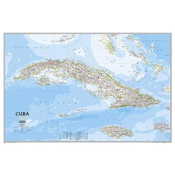
National Geographic: Cuba Classic Wall Map - Laminated (Poster Size: 36 X 24 Inches)
Expertly researched and designed, National Geographic's signature Classic style map of Cuba uses a bright and vibrant color palette featuring stunning shaded relief and ocean bathymetry. Pinpointed on the map are thousands of cities and towns, national parks, mountains, swamps, coral reefs and islands of the archipelago. In addition, major infrastructure networks are displayed, including highways, roads, railroads, oil fields and pipelines, airports, canals and ferry routes. Jamaica, the Cayman Islands, the Florida Keys, and most of the Bahamas and Haiti are shown, along with the Gulf of Mexico, Caribbean Sea, Atlantic Ocean and Straits of Florida. A user friendly index shows the English translation for many geographic terms. The map is encapsulated in heavy-duty 1.6 mil laminate which makes the paper much more durable and resistant to the swelling and shrinking caused by changes in humidity. Laminated maps can be framed without the need for glass, so the frames can be much lighter and less expensive. Map Scale = 1:1,500,000Sheet Size = 36" x 24"
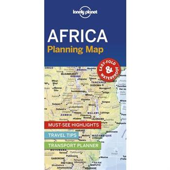
Lonely Planet Africa Planning Map
From Lonely Planet: The world's number one travel guide publisher*Durable and waterproof, with a handy slipcase and an easy-fold format, Lonely Planet's Africa Planning Map helps you explore with ease.Get more from your map and your trip with images and information about top attractions, itinerary suggestions and themed lists. With this easy-to-use, full-colour map in your back pocket, you can truly get to the heart of Africa - so begin your journey now!Easy-fold formatHandy slipcase Full colour and easy to use Beautiful imageryTailored itinerariesCan't-miss highlightsDetailed town indexThemed lists Covers Algeria, Angola, Benin, Botswana, Burkina Faso, Burundi, Cameroon, Cape Verde, Central African Republic, Chad, Comoros, Congo, Cote d'Ivoire, Democratic Republic of Congo, Djibouti, eSwatini (Swaziland), Egypt, Equatorial Guinea, Eritrea, Ethiopia, Gabon, The Gambia, Ghana, Guinea, Guinea-Bissau, Kenya, Lesotho, Liberia, Libya, Madagascar, Malawi, Mali, Mauritania, Mauritius, Morocco, Mozambique, Namibia, Niger, Nigeria, Rwanda, Senegal, Seychelles, Sierra Leone, Somalia, Somaliland, South Africa, South Sudan, Sudan, S瓊o Tom矇 and Pr穩ncipe, Tanzania, Togo, Tunisia, Uganda, Zambia, ZimbabweLooking for more extensive coverage? Check out Lonely Planet'sAfrica guidebook, our most comprehensive guidebook to the continent, covering the top sights and most authentic offbeat experiences.About Lonely Planet: Lonely Planet is a leading travel media company and the world's number one travel guidebook brand, providing both inspiring and trustworthy information for every kind of traveller since 1973. Over the past four decades, we've printed over 145 million guidebooks and grown a dedicated, passionate global community of travellers. You'll also find our content online, and in mobile apps, video, 14 languages, nine international magazines, armchair and lifestyle books, ebooks, and more.'Lonely Planet guides are, quite simply, like no other.' - New York Times'Lonely Planet. It's on everyone's bookshelves, it's in every traveller's hands. It's on mobile phones. It's on the Internet. It's everywhere, and it's telling entire generations of people how to travel the world.' - Fairfax Media (Australia)*Source: Nielsen BookScan: Australia, UK, USA, 5/2016-4/2017


