Victory in the West Atlas
A full and useful assembly of all 96 General, Situation & Sketch maps from the UNITED KINGDOM MILITARY SERIES: OFFICIAL CAMPAIGN HISTORY - VICTORY IN THE WEST: THE BATTLE OF NORMANDY & THE DEFEAT OF GERMANY.The maps are in chronological order, full size and faithful to the original cartography in all respects, allowing the reader to follow the liberation of German-occupied western Europe in 1944-45, from D-Day itself with its airborne assaults, the naval bombardment and seaborne landings on Gold, Juno, Sword, Utah and Omaha beaches. The hard fighting as the Allies secured their bridgehead and pushed inland, capturing Cherbourg and Caen, and enveloped the main German defending armies at the battle of the Falaise Gap. The failure of the British attempt to outflank the Germans with the airborne landings at Arnhem. The slow Allied advance into the Low Countries. Hitler's attempted audacious counterattack through the snowbound Ardennes which, after initial success, was thrown back in the 'Battle of the Bulge'. The final fighting and the crossing of the Rhine in March 1945.This is an important and official map collection with both General Maps, Situation Maps, Diagrams and Sketch Maps, and should be part of every serious military scholar's library.
The ”south Africa” Atlas Of The Rand
Discover the rich history and geography of South Africa's Witwatersrand Goldfields with this beautifully illustrated and meticulously researched atlas. With detailed maps and informative text, this volume is an essential resource for historians, geographers, and anyone interested in the fascinating story of the South African gold rush.This work has been selected by scholars as being culturally important, and is part of the knowledge base of civilization as we know it.This work is in the "public domain in the United States of America, and possibly other nations. Within the United States, you may freely copy and distribute this work, as no entity (individual or corporate) has a copyright on the body of the work.Scholars believe, and we concur, that this work is important enough to be preserved, reproduced, and made generally available to the public. We appreciate your support of the preservation process, and thank you for being an important part of keeping this knowledge alive and relevant.
Alden’s Handy Atlas of the World
Alden's Handy Atlas is a comprehensive guide to the geography and topography of the world, featuring detailed maps of all regions and countries. With over 200 full-color illustrations and informative essays on the history and culture of each region, this book is an essential reference guide for anyone interested in understanding the world we live in.This work has been selected by scholars as being culturally important, and is part of the knowledge base of civilization as we know it.This work is in the "public domain in the United States of America, and possibly other nations. Within the United States, you may freely copy and distribute this work, as no entity (individual or corporate) has a copyright on the body of the work.Scholars believe, and we concur, that this work is important enough to be preserved, reproduced, and made generally available to the public. We appreciate your support of the preservation process, and thank you for being an important part of keeping this knowledge alive and relevant.
Indexed Map of Indiana
Rand McNally's indexed map of Indiana is a comprehensive and detailed guide to the state's geography and transportation infrastructure. Featuring detailed information on railroads, express companies, post offices, and towns, this map is an essential resource for travelers and businesspeople alike. It also includes detailed geographical features such as islands, lakes, and rivers, making it a valuable tool for anyone interested in the state's natural beauty.This work has been selected by scholars as being culturally important, and is part of the knowledge base of civilization as we know it.This work is in the "public domain in the United States of America, and possibly other nations. Within the United States, you may freely copy and distribute this work, as no entity (individual or corporate) has a copyright on the body of the work.Scholars believe, and we concur, that this work is important enough to be preserved, reproduced, and made generally available to the public. We appreciate your support of the preservation process, and thank you for being an important part of keeping this knowledge alive and relevant.
Brookes’s General Gazetteer Improved
Join the explorers of the 18th century in this comprehensive guide to the geography and culture of the world. From the jungles of Africa to the frozen wastelands of Greenland, readers will learn about the people, places, and customs that make the world such a diverse and fascinating place.This work has been selected by scholars as being culturally important, and is part of the knowledge base of civilization as we know it.This work is in the "public domain in the United States of America, and possibly other nations. Within the United States, you may freely copy and distribute this work, as no entity (individual or corporate) has a copyright on the body of the work.Scholars believe, and we concur, that this work is important enough to be preserved, reproduced, and made generally available to the public. We appreciate your support of the preservation process, and thank you for being an important part of keeping this knowledge alive and relevant.
Cram’s Quick Reference Atlas and Gazetteer of the World
This comprehensive atlas and gazetteer includes detailed maps of every country in the world, as well as information on their geography, history, and culture. With its wealth of information and easy-to-use format, this book is an essential reference for students, travelers, and anyone interested in geography.This work has been selected by scholars as being culturally important, and is part of the knowledge base of civilization as we know it.This work is in the "public domain in the United States of America, and possibly other nations. Within the United States, you may freely copy and distribute this work, as no entity (individual or corporate) has a copyright on the body of the work.Scholars believe, and we concur, that this work is important enough to be preserved, reproduced, and made generally available to the public. We appreciate your support of the preservation process, and thank you for being an important part of keeping this knowledge alive and relevant.
Fortune's Magic Farm
First published in the early 19th century, this landmark work of geography offers readers a detailed and nuanced look at the world as it was known at the time. Featuring comprehensive descriptions of each country and continent, as well as detailed maps and analysis of the natural world, this is an essential resource for anyone interested in the history of cartography, geography, or exploration.This work has been selected by scholars as being culturally important, and is part of the knowledge base of civilization as we know it.This work is in the "public domain in the United States of America, and possibly other nations. Within the United States, you may freely copy and distribute this work, as no entity (individual or corporate) has a copyright on the body of the work.Scholars believe, and we concur, that this work is important enough to be preserved, reproduced, and made generally available to the public. We appreciate your support of the preservation process, and thank you for being an important part of keeping this knowledge alive and relevant.
Theology and Marxism in Eagleton and Zizek
Get the big picture with this comprehensive atlas of the world, featuring detailed maps of every country and region. Whether you're planning a trip or just curious about the world around you, this handy reference guide offers a wealth of geography and cultural insights.This work has been selected by scholars as being culturally important, and is part of the knowledge base of civilization as we know it.This work is in the "public domain in the United States of America, and possibly other nations. Within the United States, you may freely copy and distribute this work, as no entity (individual or corporate) has a copyright on the body of the work.Scholars believe, and we concur, that this work is important enough to be preserved, reproduced, and made generally available to the public. We appreciate your support of the preservation process, and thank you for being an important part of keeping this knowledge alive and relevant.
A Description of Early Maps, Originals and Facsimiles (1452-1611) Being a Part of the Permanent Wall Exhibition of the American Geographical Society, With a Partial List and Brief References to the Re
This comprehensive guide to early maps provides a wealth of information on the history and development of cartography from the fifteenth to the seventeenth centuries. Drawing on the resources of the American Geographical Society, the book features detailed descriptions and reproductions of a wide range of cartographic works, as well as informative commentary on their significance and context.This work has been selected by scholars as being culturally important, and is part of the knowledge base of civilization as we know it.This work is in the "public domain in the United States of America, and possibly other nations. Within the United States, you may freely copy and distribute this work, as no entity (individual or corporate) has a copyright on the body of the work.Scholars believe, and we concur, that this work is important enough to be preserved, reproduced, and made generally available to the public. We appreciate your support of the preservation process, and thank you for being an important part of keeping this knowledge alive and relevant.
New England Trail Map & Guide
Following portions of the Metacomet and Mattabesett trails, the New England Trail National Scenic Trail extends for 215 miles up the center of Connecticut and Massachusetts, from Long Island Sound to the New Hampshire border. This map and guide pairs two topographical trail maps―one for each state―with relevant information such as safety tips, Leave No Trace principles, natural history, and more. Fully revised and updated, this second edition features ten new suggested hikes, making for a total of thirty, including three hikes that are universally accessible. Inset maps for popular areas provide additional hiking opportunities just off the main trail. A collaboration between the trail's maintainers―the Appalachian Mountain Club and the Connecticut Forest & Park Association―in conjunction with the National Park Service, this map and guide is an indispensable resource for anyone seeking to day hike or thru-hike this stunningly beautiful National Scenic Trail.
Area Book and Book Of Reference to the Plan Of the Parish Of
This comprehensive book contains important information about the Parish of Great Britain, providing an insight into its geography, location, demography, and other valuable information. It is an essential reference book for anyone seeking to understand the architecture, social, or economic history of Great Britain.This work has been selected by scholars as being culturally important, and is part of the knowledge base of civilization as we know it.This work is in the "public domain in the United States of America, and possibly other nations. Within the United States, you may freely copy and distribute this work, as no entity (individual or corporate) has a copyright on the body of the work.Scholars believe, and we concur, that this work is important enough to be preserved, reproduced, and made generally available to the public. We appreciate your support of the preservation process, and thank you for being an important part of keeping this knowledge alive and relevant.
Alden’s Handy Atlas of the World
Alden's Handy Atlas is a comprehensive guide to the geography and topography of the world, featuring detailed maps of all regions and countries. With over 200 full-color illustrations and informative essays on the history and culture of each region, this book is an essential reference guide for anyone interested in understanding the world we live in.This work has been selected by scholars as being culturally important, and is part of the knowledge base of civilization as we know it.This work is in the "public domain in the United States of America, and possibly other nations. Within the United States, you may freely copy and distribute this work, as no entity (individual or corporate) has a copyright on the body of the work.Scholars believe, and we concur, that this work is important enough to be preserved, reproduced, and made generally available to the public. We appreciate your support of the preservation process, and thank you for being an important part of keeping this knowledge alive and relevant.
Lonely Planet Singapore City Map 2
Durable and waterproof, with a handy slipcase and an easy-fold format, Lonely Planet's Singapore City Map is your passport to travelling with ease. Get more from your map and your trip with images and information about top city attractions, walking tour routes, transport maps, itinerary suggestions, an extensive street and site index, and practical travel tips and directory. With this easy-to-use, full-colour navigation tool, you can get to the heart of Singapore, so begin your journey now!Durable and waterproofEasy-fold format and convenient sizeHandy slipcaseFull colour and easy to useExtensive street and site indexImages and information about top city attractionsHandy transport mapsWalking tour routesPractical travel tips and directoryItinerary suggestionsCovers Chinatown, EW17, Kampong Glam, Little India, Marina South, Sentosa Cove and Tanjong Pagar.Looking for more extensive coverage? Check out Lonely Planet's Singapore, our most comprehensive guidebook to the city, covering the top sights and most authentic offbeat experiences. Or check out Lonely Planet'sPocketSingapore, a handy-sized guide focused on the can't-miss experiences for a quick trip.About Lonely Planet: Lonely Planet is a leading travel media company, providing both inspiring and trustworthy information for every kind of traveller since 1973. Over the past four decades, we've printed over 145 million guidebooks and phrasebooks for 120 languages, and grown a dedicated, passionate global community of travellers. You'll also find our content online, and in mobile apps, videos, 14 languages, armchair and lifestyle books, ebooks, and more, enabling you to explore every day.'Lonely Planet guides are, quite simply, like no other.' New York Times'Lonely Planet. It's on everyone's bookshelves; it's in every traveller's hands. It's on mobile phones. It's on the Internet. It's everywhere, and it's telling entire generations of people how to travel the world.' Fairfax Media (Australia)
Lonely Planet Tokyo City Map 2
Durable and waterproof, with a handy slipcase and an easy-fold format, Lonely Planet's Tokyo City Map is your conveniently sized passport to travelling with ease. Get more from your map and your trip with images and information about top city attractions, walking tour routes, transport maps, itinerary suggestions, an extensive street and site index, and practical travel tips and directory. With this easy-to-use, full-colour navigation tool, you can get to the heart of Tokyo, so begin your journey now!Durable and waterproofEasy-fold format and convenient sizeHandy slipcaseFull colour and easy to useExtensive street and site indexImages and information about top city attractionsHandy transport mapsWalking tour routesPractical travel tips and directoryItinerary suggestionsCovers Chiyoda-Ku, Fujimi, Ginza, Hongo, Imado, Jinnan, Kotobuki, Muromachi, Nezu, Sendagaya, Shibuya-Ku, Ueno and more!Looking for more extensive coverage? Check out Lonely Planet's Tokyo, our most comprehensive guidebook to the city, covering the top sights and most authentic offbeat experiences. Or check out Lonely Planet'sPocketTokyo, a handy-sized guide focused on the can't-miss experiences for a quick trip.About Lonely Planet: Lonely Planet is a leading travel media company, providing both inspiring and trustworthy information for every kind of traveller since 1973. Over the past four decades, we've printed over 145 million guidebooks and phrasebooks for 120 languages, and grown a dedicated, passionate global community of travellers. You'll also find our content online, and in mobile apps, videos, 14 languages, armchair and lifestyle books, ebooks, and more, enabling you to explore every day.'Lonely Planet guides are, quite simply, like no other.' New York Times'Lonely Planet. It's on everyone's bookshelves; it's in every traveller's hands. It's on mobile phones. It's on the Internet. It's everywhere, and it's telling entire generations of people how to travel the world.' Fairfax Media (Australia)
2024 Collins Handy Road Atlas Britain and Ireland
This easy-to-use, handy A5 sized road atlas with popular lie-flat spiral binding features extremely clear route planning maps of Britain and Ireland and fits neatly into your glove box or bag. The atlas has been fully updated. The maps of Britain are at 9.9 miles to 1 inch (1:625,000) and the whole of Ireland is covered at 15.8 miles to 1 inch (1:1,000,000). There are also a selection of more detailed urban area maps at 4.5 miles to 1 inch (1:285,000) to aid route planning in these busy areas. Main features Road maps that focus on the main roads, motorways and settlements.More detailed maps of London, Manchester, Merseyside and West Midlands.Park & Ride locations (for bus and rail).Handy distance calculator chart highlighting distances between the major towns.
2024 Collins Road Map of Scotland
Full-color map of Scotland at 8.7 miles to 1 inch, with clear road network and administrative areas shown in color. The map covers the whole of Scotland and part of Northern England conveniently on one side, and is ideal for reference or route planning.The map shows the road network in detail for easy route planning. It is ideal for business users also, with its political coloring of local council areas.Main features: Fully updatedAdministrative areas shown in colorClear, detailed road network and road distancesTown and city names, rivers, railway lines and canals are clearly shown7 city/town center street plans showing places of interestIndex to place namesMileage chartCar ferry routesKey in English, French and German
100-Mile Wilderness Map & Guide
Fully-revised and updated, this waterproof, tearproof map offers a comprehensive view of the 100-Mile Wilderness/Moosehead Lake region and Baxter State Park, with detailed insets spotlighting some of the most popular hiking, skiing, biking, and multiuse trails and trail systems in the area, including Gulf Hagas, Katahdin Woods and Waters National Monument, Katahdin itself, AMC's Maine Woods land, and AMC's local lodges and cabins. You'll find recommended hikes for all ability levels, as well as information on safety, camping, backcountry shelters, and resources for more information on the Maine Woods Initiative. Based on highly accurate trails data developed, GPS-rendered, and field-tested by AMC, the map also includes trail-segment mileage and identifies peaks, wilderness areas, and points of interest. It also serves as a companion to Maine Mountain Guide, Twelfth Edition, by Carey Kish. If you have only one map of Maine's 100-Mile Wilderness, make this it.
Map of Ireland Handy
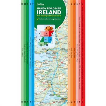
Explore new places with this authoritative map of Ireland.Easy-to-use route-planning map covering the whole of Ireland opens almost like a book. It has the convenience of an atlas with all the benefits of a fold-out map, and features clear, full-color road maps at 10 miles to 1 inch plus city center plans of Belfast and Dublin.The map is laminated on both sides making it very hard wearing and it comes in a plastic wallet.Features include: - Clear detailed mapping with attractive layer colors showing height - Places of tourist interest and Tourist Information Centres shown - Distance chart on the back of the map in both miles and kilometers - Distances are shown on the roads to aid journey planning
Insight Guides Flexi Map Berlin
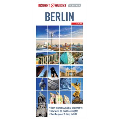
Insight Flexi Map Berlin: This easy to use, full-colour, water-proof map is all you need to navigate Berlin. It also includes handy destination detail on the Unter Den Linden area, and tips on top attractions and getting around. - Combines clear, up-to-date cartography with destination detail, stylish design and stunning photography - The main map is at a scale of 1:20 000, with prominent public buildings, hotels and other places of interest highlighted in the extensive index, including the Brandenburg Gate and the Reichstag. - Secondary maps cover the Under Den Linden area in greater detail, a detailed plan of the Messe Berlin and a map of the wider Berlin area, with a separate U-Bahn and S-Bahn network map located on the back cover for easy reference - But it's also much more than a map! - includes tips on top attractions, galleries, museums, heritage sites, travelling further afield, and getting around - Laminated finish is tough, waterproof and can be written on with a non-permanent marker pen - just write and wipe as required Company info: About Insight Guides: Insight Guides is a pioneer of full-colour guide books, with almost 50 years' experience of publishing high-quality, visual travel guides with user-friendly, modern design. We produce around 400 full-colour print guide books and maps, as well as phrasebooks, picture-packed eBooks and apps to meet different travellers' needs. Insight Guides' unique combination of beautiful travel photography and focus on history and culture create a unique visual reference and planning tool to inspire your next adventure.
London A-Z Pocket Atlas
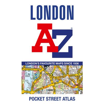
A pocket-sized paperback street atlas of Central London in full colour, covering an area extending from the centre of London to: Brent Cross, Golders Green, Highgate, Finsbury Park, Stoke Newington, Leytonstone, Wanstead, West Ham, Thames Flood Barrier
Seville Popout Map
Let PopOut Seville guide you around this wonderful city.Explore the splendour of Seville with the help of this genuinely pocket-sized, pop-up map. Small in size yet big on detail, this compact, dependable, Seville city map will ensure you don't miss a thing.Includes a PopOut map - a detailed map of the city centerAdditional maps - Parque de Maria Luisa, Greater Seville and Seville province are also includedAdvice on the top things to see while you're thereHandy, self-folding, tourist map is small enough to fit in your pocket yet offers extensive coverage of the city in an easy-to-use formatThorough street index is also featured and cross-referenced to the map so you can easily find your destinationHotels, restaurants, stores and attractions are all included on the mapIdeal to pop in a pocket or bag for quick reference while exploring this beautiful city. Fold size: 95mm x 130mm (3.75" x 5.25")Sheet size: 215mm x 225mm (8.5" x 9.75")Approx scale: 1:11 000 (Scale to be used as a guideline only)
Rand McNally Easy to Read Folded Map: New York State Map
Rand McNally 2023 Road Atlas with Protective Vinyl Cover
Michelin Italy Road Atlas
Michelin's European atlases have an exciting new look inside and out. The new cover design highlights the focus on road travel adventures and discovery, while inside, the new, simplified page numbers make it easy to locate the next page of the journey. Small locator maps on each page clearly situate the map page within the context of the larger area for better navigation. Extremely practical town and city map pages include a map of the town center and the surrounding area. Of course, all the atlases feature Michelin's accurate mapping, updated every two years by dedicated Michelin teams, where you'll find Michelin picks for scenic drives
Lonely Planet Florence City Map 2
Durable and waterproof, with a handy slipcase and an easy-fold format, Lonely Planet's Florence City Map is your conveniently sized passport to travelling with ease. Get more from your map and your trip with images and information about top city attractions, walking tour routes, transport maps, itinerary suggestions, an extensive street and site index, and practical travel tips and directory. With this easy-to-use, full-colour navigation tool in your back pocket, you can truly get to the heart of Florence, so begin your journey now! Durable and waterproof Easy-fold format and convenient size Handy slipcase Full colour and easy to use Extensive street and site index Images and information about top city attractions Handy transport maps Walking tour routes Practical travel tips and directory Itinerary suggestions Covers Piazza della Signoria, Santa Maria Novella, San Lorenzo, San Marco, Fiesole, Santa Croce, Boboli, San Miniato al Monte Looking for more extensive coverage? Check out Lonely Planet's Florence and Tuscany, our most comprehensive guidebook to the city, covering the top sights and most authentic offbeat experiences. Or check out Lonely Planet'sPocketFlorence and Tuscany, a handy-sized guide focused on the can't-miss experiences for a quick trip. About Lonely Planet: Lonely Planet is a leading travel media company, providing both inspiring and trustworthy information for every kind of traveller since 1973. Over the past four decades, we've printed over 145 million guidebooks and phrasebooks for 120 languages, and grown a dedicated, passionate global community of travellers. You'll also find our content online, and in mobile apps, videos, 14 languages, armchair and lifestyle books, ebooks, and more, enabling you to explore every day. 'Lonely Planet guides are, quite simply, like no other.' New York Times 'Lonely Planet. It's on everyone's bookshelves; it's in every traveller's hands. It's on mobile phones. It's on the Internet. It's everywhere, and it's telling entire generations of people how to travel the world.' Fairfax Media (Australia)
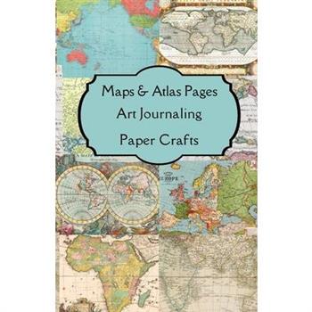
Maps & Atlas Pages Art Journaling Paper Crafts
Maps & Atlas Pages Art Journaling Craft Paper features beautifully curated double sided themed images and journaling pages for your art journals, junk journals, scrapbooks, altered books, smash books, journals, planners, notebooks, book marks, keepsakes, heirlooms, decoupage, cards, collages, and mixed media projects. This art book contains enough themed art journaling pages to make either one 80-page (4 sides x 20 pages) signature, two 40-page (4 sides x 10 pages) signatures, or the 20-pages can be shared among your own designed themed art journal. This art book measures 8.5 x 5.5 inches. The 20 themed journaling pages are meant to be folded to make 5.5 inches tall x 4.25 inches wide pages. These art journaling pages have beautifully themed curated pages with the primary image on one side and either lined or minimalistic complimentary pages on the other side for journaling your thoughts, dreams, ideas, goals, poems, stories, and inspiration. This paper art book is part of a series. Popular themes explored in this series are floral, nature, vintage, Victorian era, Edwardian era, Georgian era, Suffragettes, steampunk, gothic, shabby chic, grunge, art nouveau, art deco, contemporary, retro, boho, craftivism, seasonal, holidays, historical, travel. This paper art book series has been specially designed to be environmentally friendly as sustainable arts & crafts by being specifically themed to use the least amount of paper. Every part of this book can be used in paper crafting. Featured images are backed with complimentary backgrounds for journaling. The cover can be used in your paper crafts or as a folder to hold your ephemera. Purposely created in the print on demand format so that books will only be printed as ordered eliminating the need to stockpile paper. Each book is printed locally to the purchaser to prevent global shipping using the least amount of fuel and carbon footprint. The low waste approach to designing this art book series has always been to repurpose, reclaim, reuse, recycle, upcycle, and be as eco friendly as possible. Joyful activities such as journaling and paper arts can feel like active meditation creating calm, making room for contemplation. Journal for yourself or make them as gifts for your friends and family.


