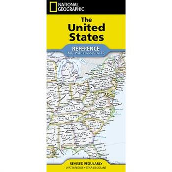
National Geographic United States Map (Folded with Flags and Facts)
- Waterproof - Tear-Resistant - Reference MapExpertly researched and designed, National Geographic's United States Flags & Facts Map is the authoritative map of the United States by which other reference maps are measured. The map side includeds a political map showing countries, cities and other landmarks and a physical map shows the landforms such as mountain ranges and rivers.Clearly defined boundaries, major cities, and physical featuresHundreds of place names carefully placed to maintain legibility in heavily populated areasIncludes the United States and adjacent regions within Canada and MexicoDetailed physical map of the United States with mountain ranges, plains, lakes, and riversFlags and facts with detailed information about cultural and physcial attributes of each statePrinted in the U.S.A. on extremely durable, waterproof, and tear-resistant materialThis Reference Map is printed on durable synthetic paper, making it waterproof, tear-resistant and tough -- capable of withstanding the rigors of any kind of use in the home or classroom.Sheet Size = 37.75" x 25.5"Folded Size = 4.25" x 9.25"
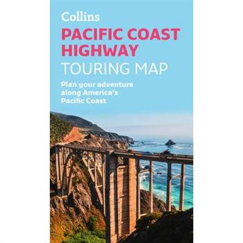
Pacific Coast Highway Touring Map
Full color, informative map of the popular Pacific Coast Highway, named one of the best road trips in the world by The Times, and DK. With detailed mapping, key tourist information and a suggested itinerary, this is a perfect guide for anyone traveling along the west coast. This map includes: Clear comprehensive mapping Tourist routes, attractions and places of interest clearly marked Images of top sights along the route accompanied by textual descriptions Suggested itineraries Detailed index of places of interest and place names Essential for those planning an adventure along America's Pacific Coast Highway.
Dolomite High Route Map [Alta Via 1] Map
- Waterproof - Tear-Resistant - Topographic MapThe Alta Via n. 1 (High Route One) of the Dolomites is considered to be the most beautiful classic route in the entire Dolomite territory. It connects Lake Braies with Belluno, winds along a route of approximately 125 kilometers (78 miles), with 7,300 meters (23,950 feet) of altitude difference in 12 stages. The route cuts from north to south and is normally followed starting from Braies. The Alta Via n. 1 crosses five different mountain groups: the Braies Dolomites, the Fanes Group (Fanis), the Ampezzo Dolomites, the Northern Dolomites of Zoldo, and the Southern Dolomites of Zoldo.The Dolomite Topographic Map Guide booklet makes a perfect traveling companion when traversing these routes. A detailed description of each trail section is included that tells travelers about the many landmarks encountered along the way.Every Great Treks map is printed on "Backcountry Tough" waterproof, tear-resistant paper. A full Lat/Long grid is printed on the map to aid with GPS navigation. Every map purchase helps support the National Geographic Society, an impact driven, nonprofit organization with global reach that uses the power of science, exploration, education, and storytelling to illuminate and protect the wonder of our world.Folded Size = 4.25" x 9.38"
Singapore Travel Map Fourteenth Edition
The Singapore Travel Map from Periplus is designed as a convenient, easy-to-use tool for travelers. This map, created using durable coated paper, is made to open and fold multiple times, whether it's the entire map that you want to view or one panel at a time. Following highways and byways, this map will show you how to maneuver your way to banks, gardens, hotels, golf courses, museums, monuments, restaurants, churches and temples, movie theaters, shopping centers and more! This 14th edition includes maps and plans that are scaled to: Area Maps: Singapore Island 1:55,000Sentosa Island 1:25,000City Plans: Singapore City 1:20,000 Central District 1:12,500Periplus Travel Maps cover most of the major cities and travel destinations in the Asia-Pacific region. The series includes an amazing variety of fascinating destinations, from the multifaceted subcontinent of India to the bustling city-state of Singapore and the 'western style' metropolis of Sydney to the Asian charms of Bali. All titles are continuously updated, ensuring they keep up with the considerable changes in this fast-developing part of the world. This extensive geographical reach and attention to detail mean that Periplus Travel Maps are the natural first choice for anyone traveling in the region.
Michelin Map Africa Morocco 742
MICHELIN National Map Morocco will give you an overall picture of your journey thanks to its clear and accurate mapping scale 1/1,000,000. Our National Map Series will help you easily plan your safe and enjoyable journey thanks to a comprehensive key, a complete name index as well a clever time & distance chart. Michelin's driving information will help you navigate safely in all circumstances.
Essential World Atlas
Discover the world with this atlas, which includes maps, flags, and country profiles in a handy, compact package.This is a new edition that includes updated maps and statistics, as well as short profiles of each of the world's 196 nations. In this atlas, you will find: A series of 12 global thematic maps on subjects diverse as ocean currents and languages.60 full-colour regional maps featuring political and state borders.A fully cross-referenced index-Gazetteer featuring 20,000 places.Data profiles of each country, including flags and key statistical indicators. You can also read additional information about the main population and administrative centres, main lines of communication, ports, and airports.This is the perfect reference tool to help digest all the information in today's world through the essential facts about our ever-changing planet.
Amalfi Coast Touring Map
Full color, informative map of Italy's popular Amalfi Coast. With detailed mapping, key tourist information and a suggested itinerary, this is a perfect guide for anyone traveling along the picturesque Amalfi Coast. This map includes: Clear comprehensive mapping Tourist routes, attractions and places of interest clearly marked Images of top sights along the route accompanied by textual descriptions Suggested itineraries Detailed index of places of interest and place names Essential for those planning an adventure along Italy's Amalfi Coast.
Lonely Planet India Planning Map
Durable and waterproof, with a handy slipcase and an easy-fold format, Lonely Planet's India Planning Map is your essential navigation tool. This full-colour map features accompanying images and information about top attractions, itinerary suggestions, a transport guide, themed lists and practical travel tips. Durable and waterproofEasy-fold format and convenient sizeHandy slipcaseFull colour and easy to useBefore-you-go infoBeautiful imageryTailored itinerariesCan't-miss regional highlightsDetailed town indexTransport plannerThemed listsCovers Rajasthan, Jaipur, Jaisalmer, Ranthambhore National Park, Udaipur, Delhi, Agra, Varanasi, Lucknow, Himachal Pradesh, Ladakh, Shimla, Leh, McLeod Ganj, Manali, Kolkata, Sundarbans, Darjeeling, Assam, Mumbai, Goa, Ajanta & Ellora Caves, Kerala, Hampi, Mysuru, ChennaiLooking for more extensive coverage? Check out Lonely Planet'sIndia, our most comprehensive guidebook to India, covering the top sights and most authentic offbeat experiences.About Lonely Planet: Lonely Planet is a leading travel media company, providing both inspiring and trustworthy information for every kind of traveller since 1973. Over the past four decades, we've printed over 145 million guidebooks and phrasebooks for 120 languages, and grown a dedicated, passionate global community of travellers. You'll also find our content online, and in mobile apps, videos, 14 languages, armchair and lifestyle books, ebooks, and more, enabling you to explore every day.'Lonely Planet guides are, quite simply, like no other.' New York Times'Lonely Planet. It's on everyone's bookshelves; it's in every traveller's hands. It's on mobile phones. It's on the Internet. It's everywhere, and it's telling entire generations of people how to travel the world.' Fairfax Media (Australia)
Lonely Planet Stockholm City Map
Experience your dream trip with Lonely Planet's Stockholm City Map, the ultimate travel tool to help you plan and navigate your way around amazing local sights, landmarks and attractions.Bop your way around ABBA: The Museum, get inspired by the feats of some of the world's greatest thinkers at Nobelmuseet, defy heights and speed on the rides at Gr繹na Lund Tivoli, and decide where you want to go next and what you want to see in each of the city's exciting neighbourhoods.Inside Lonely Planet's Stockholm City Map: Full colour map in a durable easy-fold formatWaterproof and packaged in a handy slipcaseAlphanumeric grid to find points of interest easilyPublic transport explained to help you get aroundTop picks of must-see highlights including the Stadshuset, the Nobelmuseet and the Kungliga SlottetEssential travel tips and nuts and bolts information on money, food and drink, local transport, cycling or walking around Djurg疇rdenBeautiful photography and bonus zoomed-in map ofGamla StanCovers: Djurg疇rden, Kungsholmen, Ladug疇rdsg瓣rdet, ?stermalm, Skeppsholmen, S繹dermalm, SoFo Get ready for your next adventure with Lonely Planet's Stockholm City Map, the ultimate navigation tool to help you explore Stockholm's well-known attractions and best-kept secrets.
Lonely Planet New Orleans City Map
Experience your dream trip with Lonely Planet's New Orleans City Map, the ultimate travel tool to help you plan and navigate your way around amazing local sights, landmarks and attractions.Cycle the historic 2.6 mile Lafitte Greenway, breathe in the fresh air in shady Audubon Park, explore three centuries of Louisiana history at the Cabildo, and decide where you want to go next and what you want to see in each of the city's exciting neighbourhoods.Inside Lonely Planet's New Orleans City Map: Full colour map in a durable easy-fold formatWaterproof and packaged in a handy slipcaseAlphanumeric grid to find points of interest easilyPublic transport explained to help you get aroundTop picks of must-see highlights including Frenchmen Street, National WWII Museum, and St Louis CathedralEssential travel tips and nuts and bolts information on money, food & drink, festivals and eventsBeautiful photography and bonus zoomed-in map of Mid-City, Esplanade Ridge & Bayou St JohnCovers: French Quarter; Garden District; Gretna; Irish Channel; Lower Garden District; Mid-City; Riverbend; St Roch; The Trem矇; Uptown; Warehouse District Get ready for your next adventure with Lonely Planet's New Orleans City Map, the ultimate navigation tool to help you explore New Orleans' well-known attractions and best-kept secrets.
Rand McNally Easy to Fold: New York State Laminated Map
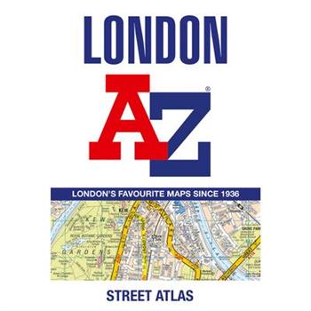
London A-Z Street Atlas
Navigate your way around London with this detailed, easy-to-use and up-to-date A-Z Street Atlas.First published in 1936, this iconic atlas is a trusted means of finding your way around the capital city.The main mapping extends beyond Central London from Heathrow Airport to Chingford at a scale of 2.88 inches to 1 mile (4.55 cm to 1 km), featuring postcode districts, one-way streets, the Congestion Charging Zone and Low Emission Zone.The large-scale street map of Central London - at a scale of 5.75 inches to 1 mile - cover Regent's Park and Shoreditch, Chelsea and Vauxhall, Hyde Park and Bermondsey.A comprehensive index lists streets, selected flats, walkways and places of interest, place, area and junction names. Additional healthcare (hospitals, walk-in centres and hospices) and transport connections (National Rail, London Tramlink, Docklands Light Railway, London Underground and Overground stations, and River Bus pier) are indexed as well.Also included are: - Overview map of the Congestion Charging Zone, Ultra Low Emission and Low Emission Zones- West End Theatre map- London Connections rail services map
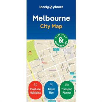
Lonely Planet Melbourne City Map
Durable and waterproof, with a handy slipcase and an easy-fold format, Lonely Planet's Melbourne City Map is your conveniently sized passport to travelling with ease. Get more from your map and your trip with images and information about top city attractions, walking tour routes, transport maps, itinerary suggestions, an extensive street and site index, and practical travel tips and directory. With this easy-to-use, full-colour navigation tool in your back pocket, you can truly get to the heart of Melbourne, so begin your journey now!Durable and waterproofEasy-fold format and convenient sizeHandy slipcaseFull colour and easy to useExtensive street and site indexImages and information about top city attractionsHandy transport mapsWalking tour routesPractical travel tips and directoryItinerary suggestionsCovers City Centre, Docklands, Southbank, Williamstown, South Melbourne, Port Melbourne, Albert Park, South Yarra, Prahran, Windsor, East Melbourne, Richmond, Fitzroy, Collingwood, Carlton, North Melbourne, St KildaLooking for more extensive coverage? Check out Lonely Planet's Melbourne and Victoria, our most comprehensive guidebook to the city, covering the top sights and most authentic offbeat experiences. Or check out Lonely Planet'sPocketMelbourne, a handy-sized guide focused on the can't-miss experiences for a quick trip.About Lonely Planet: Lonely Planet is a leading travel media company, providing both inspiring and trustworthy information for every kind of traveller since 1973. Over the past four decades, we've printed over 145 million guidebooks and phrasebooks for 120 languages, and grown a dedicated, passionate global community of travellers. You'll also find our content online, and in mobile apps, videos, 14 languages, armchair and lifestyle books, ebooks, and more, enabling you to explore every day.'Lonely Planet guides are, quite simply, like no other.' New York Times'Lonely Planet. It's on everyone's bookshelves; it's in every traveller's hands. It's on mobile phones. It's on the Internet. It's everywhere, and it's telling entire generations of people how to travel the world.' Fairfax Media (Australia)
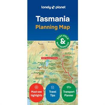
Lonely Planet Tasmania Planning Map
Durable and waterproof, with a handy slipcase and an easy-fold format, Lonely Planet's Tasmania Planning Map is your essential navigation tool. This full-colour map features accompanying images and information about top attractions, itinerary suggestions, a transport guide, themed lists and practical travel tips. Durable and waterproofEasy-fold format and convenient sizeHandy slipcaseFull colour and easy to useBefore-you-go infoBeautiful imageryTailored itinerariesCan't-miss regional highlightsDetailed town indexTransport plannerThemed listsCovers Tasmania, King Island, Flinders IslandLooking for more extensive coverage? Check out Lonely Planet'sTasmania, our most comprehensive guidebook to Tasmania, covering the top sights and most authentic offbeat experiences. Or check out Lonely Planet'sExperience Tasmania, a concise visual guide highlighting the top experiences of Tasmania.About Lonely Planet: Lonely Planet is a leading travel media company, providing both inspiring and trustworthy information for every kind of traveller since 1973. Over the past four decades, we've printed over 145 million guidebooks and phrasebooks for 120 languages, and grown a dedicated, passionate global community of travellers. You'll also find our content online, and in mobile apps, videos, 14 languages, armchair and lifestyle books, ebooks, and more, enabling you to explore every day.'Lonely Planet guides are, quite simply, like no other.' New York Times'Lonely Planet. It's on everyone's bookshelves; it's in every traveller's hands. It's on mobile phones. It's on the Internet. It's everywhere, and it's telling entire generations of people how to travel the world.' Fairfax Media (Australia)
Lonely Planet Porto City Map
Durable and waterproof, with a handy slipcase and an easy-fold format, Lonely Planet's Porto City Map is your conveniently sized passport to travelling with ease. With this easy-to-use, full-colour navigation tool in your back pocket, you can truly get to the heart of Porto, so begin your journey now!Durable and waterproofEasy-fold format and convenient sizeHandy slipcaseFull colour and easy to useExtensive street and site indexImages and information about top city attractionsHandy transport mapsWalking tour routesPractical travel tips and directoryItinerary suggestionsCovers Afurada, Boavista, Cedofeita, Fonta穩nhas, Foz do Douro, Massarelos, Miragaia, Ribeira, Serralves, Vila Nova de GaiaLooking for more extensive coverage? Check out Lonely Planet's Experience Portugal, our most comprehensive guidebook to the country, covering the top sights and most authentic offbeat experiences. Or check out Lonely Planet'sPocket Porto, a handy-sized guide focused on the can't-miss experiences for a quick trip.About Lonely Planet: Lonely Planet, a Red Ventures Company, is the world's number one travel guidebook brand. Providing both inspiring and trustworthy information for every kind of traveller since 1973, Lonely Planet reaches hundreds of millions of travellers each year online and in print and helps them unlock amazing experiences. Visit us at lonelyplanet.com and join our community of followers on Facebook (facebook.com/lonelyplanet), Twitter (@lonelyplanet), Instagram (instagram.com/lonelyplanet), and TikTok (@lonelyplanet).'Lonely Planet. It's on everyone's bookshelves; it's in every traveller's hands. It's on mobile phones. It's on the Internet. It's everywhere, and it's telling entire generations of people how to travel the world.' Fairfax Media (Australia)
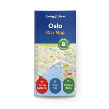
Lonely Planet Oslo City Map
Durable and waterproof, with a handy slipcase and an easy-fold format, Lonely Planet's Oslo City Map is your conveniently sized passport to travelling with ease. Get more from your map and your trip with images and information about top city attractions, walking tour routes, transport maps, itinerary suggestions, an extensive street and site index, and practical travel tips and directory. With this easy-to-use, full-colour navigation tool in your back pocket, you can truly get to the heart of Munich, so begin your journey now! Durable and waterproofEasy-fold format and convenient sizeHandy slipcaseFull colour and easy to useExtensive street and site indexImages and information about top city attractionsHandy transport mapsWalking tour routesPractical travel tips and directoryItinerary suggestionsCovers Aker Brygge, Barcode, Bislett, Bjorvika, Bygd繪y, Damstredet, Frogner, Gimle, Gr繪nland, Gr羹nerlokka, Opera HouseLooking for more extensive coverage? Check out Lonely Planet's Norway, our most comprehensive guidebook to the country, covering the top sights and most authentic offbeat experiences. Or check out Lonely Planet'sPocketOslo, a handy-sized guide focused on the can't-miss experiences for a quick trip.About Lonely Planet: Lonely Planet is a leading travel media company, providing both inspiring and trustworthy information for every kind of traveller since 1973. Over the past four decades, we've printed over 145 million guidebooks and phrasebooks for 120 languages, and grown a dedicated, passionate global community of travellers. You'll also find our content online, and in mobile apps, videos, 14 languages, armchair and lifestyle books, ebooks, and more, enabling you to explore every day.'Lonely Planet guides are, quite simply, like no other.' New York Times'Lonely Planet. It's on everyone's bookshelves; it's in every traveller's hands. It's on mobile phones. It's on the Internet. It's everywhere, and it's telling entire generations of people how to travel the world.' Fairfax Media (Australia)
Streetwise Manhattan Map - Laminated City Center Street Map of Manhattan, New York
Streetwise Manhattan Map is a laminated city center travel map of Manhattan, New York. The accordion-fold pocket size travel map shows integrated subway lines, stations and bus map.
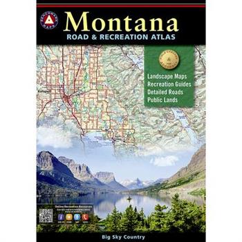
Montana Road & Recreation Atlas
Benchmark field-checkers drove thousands of miles to make sure the Montana Road & Recreation Atlas is the most accurate, comprehensive, and reliable map product ever published for Big Sky Country.Map Scale = 1:250,000 & 1:800,000Sheet Size = 11" x 15"
Rand McNally Easy to Read Folded Map: Arizona State Map
The Atlas of the Civil War
From the first shots fired at Fort Sumter in 1861 to the final clashes on the Road to Appomattox in 1864, The Atlas of the Civil War reconstructs the battles of America's bloodiest war with unparalleled clarity and precision. Edited by Pulitzer Prize recipient James M. McPherson and written by America's leading military historians, this peerless reference charts the major campaigns and skirmishes of the Civil War. Each battle is meticulously plotted on one of 200 specially commissioned full-color maps. Timelines provide detailed, play-by-play maneuvers, and the accompanying text highlights the strategic aims and tactical considerations of the men in charge. Each of the battle, communications, and locator maps are cross-referenced to provide a comprehensive overview of the fighting as it swept across the country. With more than two hundred photographs and countless personal accounts that vividly describe the experiences of soldiers in the fields, The Atlas of the Civil War brings to life the human drama that pitted state against state and brother against brother.


![Dolomite High Route Map [Alta Via 1] Map Dolomite High Route Map [Alta Via 1] Map](https://cdn.kingstone.com.tw/english/images/product/9254/9781566959254m.jpg?Q=d50d3)


