Collins World Atlas: Essential Edition
A new fully updated reference atlas in the exciting Collins world atlas range. Great value and contains all the world maps you need in a budget atlas, for family, study and business use.Explore our planet;- Clear maps giving balanced worldwide coverage- Key statistics and flags for every country of the world- World time zones maps- Discover more than 36,000 placesMapping updates include;- Country name changes - Czechia (formerly Czech Republic), Eswatini (formerly Swaziland) and North Macedonia (formerly Macedonia)- Extensive place name changes in New Zealand, Myanmar and Ukraine- Changes to capital cities in Burundi, Chad, Eswatini, Kazakhstan and Kiribati- Railways in France, Kazakhstan and Turkmenistan. Motorways in UK and Ireland- New rail and road bridge across Kerch Strait- Everest height updated to 8,849m / 29,032ft
Narrative and Critical History of America
This work has been selected by scholars as being culturally important, and is part of the knowledge base of civilization as we know it.This work is in the "public domain in the United States of America, and possibly other nations. Within the United States, you may freely copy and distribute this work, as no entity (individual or corporate) has a copyright on the body of the work.Scholars believe, and we concur, that this work is important enough to be preserved, reproduced, and made generally available to the public. We appreciate your support of the preservation process, and thank you for being an important part of keeping this knowledge alive and relevant.
AMC Maine Mountains Trail Maps 3-6
As an upgrade to the paper maps that come with AMC's Maine Mountain Guide, 12th edition, this collection of trail maps features of a diverse range of hiking destinations, providing coverage of the Mahoosuc Range, Bigelow Range, Evans Notch, and both Eastern and Western Mount Desert Island in Acadia National Park. Composed of lightweight, waterproof, tear-resistant Tyvek, these maps are a must-have for Maine hikers and the perfect companion to AMC's Maine Mountains Trail Maps 1-2.
Wild Maps for Curious Minds
Which nations have launched animals into space? Where are the world's cat people? How many humans live in high-risk zones for natural disasters? How far do you have to travel to hug all fifteen of the world's oldest trees? Where in the world do snakes live--or better yet, where can you avoid them?! Find the thought-provoking answers to these questions and many more in Wild Maps for Curious Minds. This infographic atlas of nature's most impressive wonders and eye-popping oddities is bursting with discovery (Where's the most remote place on Earth?), whimsical insight (Which animals have launched into space?), and startling revelations (How much forest have we destroyed?) that will change the way you see the natural world--and that celebrate our planet and the plants and animals with whom we share it.
Narrative and Critical History of America
This work has been selected by scholars as being culturally important, and is part of the knowledge base of civilization as we know it.This work is in the "public domain in the United States of America, and possibly other nations. Within the United States, you may freely copy and distribute this work, as no entity (individual or corporate) has a copyright on the body of the work.Scholars believe, and we concur, that this work is important enough to be preserved, reproduced, and made generally available to the public. We appreciate your support of the preservation process, and thank you for being an important part of keeping this knowledge alive and relevant.
The importance of tourism in climatic-extreme destinations
Seminar paper from the year 2022 in the subject Tourism - Miscellaneous, grade: 1,3, language: English, abstract: This paper is about the importance of tourism in climatic-extreme destinations. Using the Coachella Valley and Mount Everest region as case studies. The main aim of this research is to highlight the economic impacts on the local community to prove that both destinations are highly dependent on tourism. In the last chapter, the devastating economic impacts of the covid pandemic - as a contrary situation - on each destination are observed to substantiate the importance of seasonal tourists. Resulting, more concrete statements on tourism dependency will be made, as worldwide travel restrictions and lockdowns led to a slump in the tourism industry, directly affecting the local economy. It is a well-known fact that the tourism sector can contribute to the economic growth of a region. This is why the tourism industry plays a crucial role in destination development - both directly and indirectly. As a result, tourism generates a variety of social benefits for a region like the creation of new jobs, infrastructural improvements and allows small-sized enterprises to grow. Consequently, tourism is even more important for seasonal and climatically challenging destinations to guarantee the survivability of the local community during the low season with hardly any tourists. Therefore, it is highly relevant to illustrate this positive influence in more detail. Throughout the entire paper, case studies of two different and climatically distinct destinations will be used: The Coachella Valley as a desert in California and in contrast the Mount Everest region with unpredictable temperatures combined with a lack of oxygen. There is no doubt that Mount Everest attracts significantly more spendy adventurers every single year. In addition, the Coachella Valley in California is primarily drawn by over 250,000 visitors in April from all over the globe to attend the f
The fundamentals and strategies of nature based tourism and ecotourism
Essay from the year 2022 in the subject Tourism - Miscellaneous, grade: 2,0, language: English, abstract: This essay is about the fundamentals and strategies of nature based tourism and ecotourism. Ecotourism, which is a type of alternative tourism, is separated into two categories: "hard" and "soft" ecotourism. Hard ecotourism is characterized by a scientific interest in the environment, biodiversity as well as wildlife. Hard ecotourism is the most opulent type of ecotourism, frequently involving a lack of hotel accommodations or other amenities. Sleeping at an environmentally friendly campground is one illustration of hard ecotourism. General or "soft" ecotourism, which is similarly based on a fascination with nature, adopts a less intense approach. Hiking is prevalent, although it is regarded a recreational activity rather than a conduit for environmental research, as it would be in hard ecotourism. Ecotourism is not designed to have negative environmental implications, but given the lack of clarity about what constitutes sustainable practices, this could happen inadvertently. As a result, it is critical to explain those negative consequences, as well as the necessity of management strategies as a tool for reducing or even eliminating those consequences. Nature-based tourism is a broad word for tourist practices that require people interacting with the earth in ways that are distinct from humankind's usual activities. Regardless of the fact that pristine countryside is desirable, tourists often want modern conveniences and tailored items. There seems to be a conflict between desired and ideal levels of growth and development because it is incompatible with the fundamental vision of eco - as well as nature-based tourism.
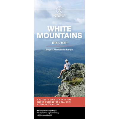
AMC White Mountains Trail Map 1: Presidential Range
Waterproof and lightweight, this Presidential Range map includes detailed maps of the full Presidential Range, with an inset of Mount Washington. Printed in full-color on waterproof Tyvek, this fully updated map includes comprehensive trail coverage of the popular hiking region, as well as safety and planning tips and emergency information. GPS-rendered, this map is tear-resistant, has an easy-to-read scale, and includes trail segment mileage.
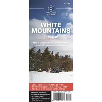
AMC White Mountains Trail Map 3-4: Crawford Notch-Sandwich Range and Moosilauke-Kinsman Ridge
In full-color, printed on waterproof Tyvek, this fully updated map of the Crawford Notch-Sandwich Range and the Moosilauke and Kinsman regions of the White Mountain National Forest includes comprehensive trail coverage of Crawford Notch State Park, the Sandwich Range, and Echo Lake State Park, plus trails along the Kancamagus Highway from Conway toward Lincoln. On the reverse is a detailed map of Mount Moosilauke and North and South Kinsman, plus surrounding areas. GPS-rendered, this map is tear-resistant, has an easy-to-read scale, and includes trail segment mileage.
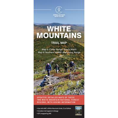
AMC White Mountains Trail Map 5-6: Carter Range-Evans Notch and North Country-Mahoosuc
With complete coverage of the trails in the Carter Range and Evans Notch area, including the Caribou-Speckled Mountain Wilderness, Echo Lake State Park, and Green Hills Preserve on one side, and detailed coverage of the Mahoosucs and the North Country on the reverse, this waterproof Tyvek map is a must-have for hikers in the White Mountain National Forest. Fully updated, the map includes comprehensive trail coverage at an easy-to-read scale, and includes trail segment mileage.
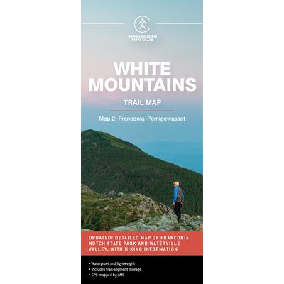
AMC White Mountains Trail Map 2: Franconia-Pemigewasset
Waterproof and lightweight, this Franconia-Pemigewasset map includes detailed maps of Franconia Notch State Park and Waterville Valley, as well as hiking information. Printed in full-color on waterproof Tyvek, this fully updated map includes comprehensive trail coverage of the stunning Pemigewasset Wilderness Area along with the popular Kancamagus Highway, plus safety and planning tips and emergency information. GPS-rendered, this map is tear-resistant, has an easy-to-read scale, and includes trail segment mileage.
Green Tourism in Iceland. Is Iceland the right Destination for this sustainable Concept?
Seminar paper from the year 2020 in the subject Tourism - Hotel Management, grade: 1,7, Fresenius University of Applied Sciences Munich, language: English, abstract: This term paper examines what sustainability means, what Green Tourism is and how it should be implemented. It also looks at how and whether Iceland has already implemented it. Furthermore, this paper deals with two theses. The first thesis deals with whether Iceland is one of the pioneering countries in the development and unification of sustainability and tourism. The second thesis is that Iceland is the perfect destination to practice Green Tourism. First of all, this paper presents some basic information about Iceland. Then the concept of sustainability is introduced. Afterwords, the concept of Green Tourism is introduced. Also, the demand for this kind of tourism is presented and the demanders are briefly defined. Afterwards an overview is given of what Iceland already offers in terms of sustainability and Green Tourism. Finally, a summary is given and the theses and the re-search question are answered.
School Atlas (With Online Content on Dropbox)
This book offers remedies through the use of herbs commonly available in the market. This book discusses the properties of popular herbs, (their availability, alternative names, chemical composition, uses & benefits and caution) such as, Ashwagandha, Aloe vera, Asparagus (Shatawar), Neem, Basil, Bhringraj, Cardamom, Papaya, Brahmi, Quinine, Cinnamon, Amla, Ginger, Pudina, Poppy, Safed Musli, Shankapushpi, Baheda, Haritaki besides many more; and offers treatment for ailments, which every family faces at some point of time. Natural medicines often provide a safe, effective, and economical alternative to pharmaceuticals, and research validates this finding. Many modern drugs are actually derived from plants such as morphine from the opium poppy, digitalis from foxglove, and reserpine from rauwolfia. Herbs are less likely than pharmaceuticals to cause side effects which, when they do occur, are generally far milder. Herbs work physiologically to restore balance rather than simply targeting a symptom. As a result, herbs often tend to take effect more gradually than pharmaceuticals.
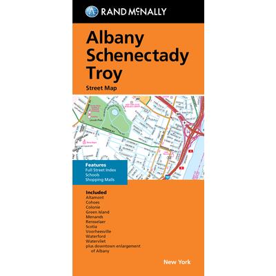
Rand McNally Folded Map: Albany Schenectady Troy Street Map
Let’s Get Hiking
Are you planning a big hike?How about a long distance walk, like one of the Caminos in Spain?Whether you are walking around your neighborhood or walking the full 500 miles of the Camino Frances in Spain, being prepared with the right equipment and the right knowledge is vital to your success and enjoyment while on your journey.. Do you have the right backpack(s) for the type of hike you are doing?Do you have the right boots?How are you going to handle your money? How are you going to prevent other people from handling your money for you?Do you speak the language? How will you communicate with the locals, especially if you are lost? Doing a big hike or a long walk needs proper preparation.Let's Get Walking was written to provide you with the information you need before you get out there and wish you had the right information. Preparation is more than buying a nice backpack or a snazzy pair of boots. This book is the best investment you will ever make when it comes to getting ready for your big walk or hlke, and it links you to some great stores to help you.
Grand Teton Day Hikes & National Park Map [Map Pack Bundle]
- Waterproof - Tear-Resistant - Topographic MapsThe Tetons evoke a sense of inspiration and aspiration in all who visit. Established in 1929, Grand Teton National Park now encompasses and protects 310,000 acres (485 square miles) for everyone to enjoy. This two title Map Pack Bundle helps explorers of all levels see everything this astounding park has to offer. The map pack includes an overview map that shows the entire park as well as a Day Hikes map guide. With this combination of maps visitors can feel comfortable planning a trip to a park with options for everyone, from multi-day backpack trips to short hikes on the shores of Jackson Lake.The Grand Teton National Park Day Hikes Topographic Map Guide includes seventeen diverse hikes for all hiking enthusiasts, from the easy, 1.1 mile long Schwabacher Landing to the strenuous, 12.9 mile long Granite Canyon with almost a mile of elevation loss. Each hike has a detailed map, a trail profile visualizing the changes in elevation, and a short summary of the interesting features encountered along the trip. The Grand Teton Day Hikes and National Park Map Pack includes: Map 202:: Grand Teton National ParkMap 1706:: Grand Teton National Park Day HikesEvery Trails Illustrated map is printed on 'Backcountry Tough' waterproof, tear-resistant paper. National Geographic's Topographic Map Guide booklets are printed on 'Backcountry Tough' waterproof, tear-resistant paper with stainless steel staples. A full UTM grid is printed on the map to aid with GPS navigation.Map Scale = 1:50,000Sheet Size = 25.5" x 37.75"Folded Size = 4.25" x 9.25"
Road Map Britain: Northern England
Britain's clearest mapping from the experts at the AA, in a handy foldable map. Practical, slimline format with durable, plastic encapsulated covers. Clear mapping at an easy-to-read scale. National Trust, English Heritage, Scottish and Welsh Heritage sites all shown. Caravan & Camping sites pinpointed on the mapping. City and town plans. Easy-to-read place index name
Texas Road & Recreation Atlas
Texas's vast openness is the source of everything that makes it unique. No other publication can display this expansive landscape and its recreation potential with more precision than Benchmark's Texas Road & Recreation Atlas. The field-checked Landscape Maps reveal back roads landforms with amazing realism and detail, clearly showing how the state's vast network of roads and local recreation landmarks fit into the countryside. A complete Recreation Guide provides regional maps and lists a variety of outdoor activities. Arranged by category, it is the ideal planning tool for adventures, from a simple day-trip to an extended exploration.Benchmark field-checkers drove over 25,000 miles to make sure the Texas Road & Recreation Atlas is the most accurate, comprehensive, and reliable map product ever published for The Lone Star State.Map Scale = 1:253,440 & 1:1,267,200Sheet Size = 11" x 15"
Online Reputation of Baku City (Azerbaijan) as a Tourism Destination
Master's Thesis from the year 2016 in the subject Tourism - Miscellaneous, language: English, abstract: The focus of the thesis is to investigate the current online reputation of the tourism destination Baku (Azerbaijan), and to underline the importance of examination of the online reputation for this tourism destination. In particular, existing communication gaps between official and unofficial online communication will be closely investigated. Finally, throughout the research, scientific literature devoted to the reputation concept will be analysed and based on the findings the existing lacks in this field will also be addressed. In the last decade the study of online reputation was the focus for many scholars. The advent of the Web 2.0 allowed Internet users to produce online contents, and as consequence increased the needs to better understand how to manage the online reputation of an object, person, a company, and a tourism destination as well. Indeed, in the current dynamics of a business environment, the monitoring of online reputation became an essential part of management for organisations, and also DMOs (Destination Management Organizations) are also involved in such a phenomenon.
Exploring the determinants of satisfactory shark tourism experiences from the participants’ perspective in Gansbaai, South Africa
Gansbaai, a small coastal town in South Africa, is considered "the shark cage diving capital of the world", despite there being over 40 shark tourism destinations worldwide. However, Gansbaai has one outstanding feature which few other destinations have: great white sharks. Because of this, Gansbaai attracts visitors from all over the world who travel to the area with the expectation to witness this particular species, making it an international hotspot for shark tourists. However, in recent years, a decline in the great white shark population has been widely reported in the media. The decline of the shark population is not only a problem for South Africa, but globally. Today, 172 shark species are already on the IUCN Red List of Threatened Species. Yet, South Africa is one of the few places on earth where humans have the opportunity to interact with this species at close range. The outcry is great, as the impact on the South African shark industry has been profound. It seems that this has also had an impact on the satisfaction of the participants, as an ad-hoc analysis of online ratings shows. This is critical for the industry, as potential participants nowadays take their cue from the experiences of previous people.The main reason for this is the confusing plethora of tourism services available today. Therefore, the online review platform TripAdvisor has become a reliable source for travel decisions. Accordingly, analyses of online reviews have become particularly popular in the tourism and hospitality industry as it allows service providers to gain insight into what influences consumer satisfaction. This shows the importance for tour operators in Gansbaai's shark industry to understand what influences visitor satisfaction in order to adjust their concepts sustainably. Therefore, the aim of the study is to identify the factors which influence visitor satisfaction in the shark tourism industry in Gansbaai based on TripAdvisor reviews.
Utah Road & Recreation Atlas
Utah is well established as a recreation playground, from world-class skiing in the north to 5 amazing national parks in the south. This Utah atlas is designed to help locals and visitors make the most of the wealth of attractions that Utah has to offer. You'll find hundreds of recreation sites, fishing spots, and hunting areas as well as a myriad of parks, natural wonders, and historic sites dotted across the state. Our Landscape Maps show all drive-able Utah roads, classed by surface and purpose, and hundreds of campgrounds and recreation access points. Large-scale metro maps of the Wasatch Front are also included.Map Scale = 1:250,000 & 1:730,000Sheet Size = 11" x 15"
Determinants of satisfactory shark tourism experiences from the participants’ perspective in Gansbaai, South Africa
Bachelor Thesis from the year 2021 in the subject Tourism - Miscellaneous, grade: 1,3, University of Applied Sciences Heide, language: English, abstract: The aim of the study is to identify the factors which influence visitor satisfaction in the shark tourism industry in Gansbaai based on TripAdvisor reviews. In this regard, the methodology used in this study is a qualitative content analysis, which is conducted inductively. At the end of the study, the reader will thus be able to understand not only what determines a satisfactory shark experience, but also what limits it. Gansbaai, a small coastal town in South Africa, is considered "the shark cage diving capital of the world", despite there being over 40 shark tourism destinations worldwide. However, Gansbaai has one outstanding feature which few other destinations have: great white sharks. Because of this, Gansbaai attracts visitors from all over the world who travel to the area with the expectation to witness this particular species, making it an international hotspot for shark tourists. However, in recent years, a decline in the great white shark population has been widely reported in the media. The decline of the shark population is not only a problem for South Africa, but globally. Today, 172 shark species are already on the IUCN Red List of Threatened Species. Yet, South Africa is one of the few places on earth where humans have the opportunity to interact with this species at close range. The outcry is great, as the impact on the South African shark industry has been profound. It seems that this has also had an impact on the satisfaction of the participants, as an ad-hoc analysis of online ratings shows. This is critical for the industry, as potential participants nowadays take their cue from the experiences of previous people. The main reason for this is the confusing plethora of tourism services available today. Therefore, the online review platform TripAdvisor has become a reliable source for travel dec
Factors Influencing Customer’s Purchase Intention in Niche-Tourism E-Marketplace
Academic Paper from the year 2018 in the subject Tourism - Miscellaneous, language: English, abstract: The main objective of this study is to investigate what factors influencing customer's purchase intention in niche-tourism e-marketplace.To achieve the aims of this study, the answers for the following questions are sought: What factors influencing customer's purchase intention in niche-tourism e-marketplace? Which factor is the most important? For the last decade, Vietnam has been recognized as one of the fastest growing tourism destinations in Asia. Vietnamese tourism industry has witnessed a tremendous growth and became one of the major sectors within the Vietnamese economy in recent years. In fact, it has contributed approximately 9.2 % to the GDP of the country in 2019 thanks to over 18 million foreign tourists and 85 million domestic holidaymakers according to Vietnam Tourism Annual Report 2019. This figure has proved that this "non-smoke" industry has been and will be a promising land for investment.
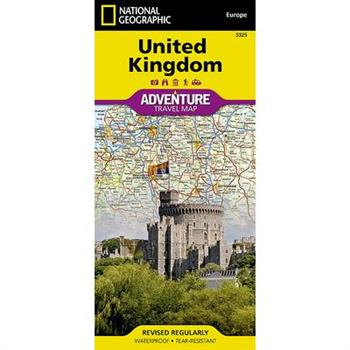
United Kingdom
- Waterproof - Tear-Resistant - Travel MapNational Geographic's United Kingdom Adventure Map is designed to meet the needs of adventure travelers with its detailed, accurate information and user-friendly design. Cities and towns are easy to find with the map's helpful index. Motorways, highways, and other roads are clearly designated and include distance in kilometers so travelers can easily plan their best route. With specialty content to include hundreds of diverse and unique recreational, ecological, cultural, and historical destinations, this map is a perfect companion to a guidebook.The south side of this map covers the southern portion of the UK, from the tip of France and across the Isle of Man to Northern Ireland. The north side shows Belfast, and across the Channel to Edinburgh, the Outer Hebrides, the Orkney Islands, and the Shetland Islands.The United Kingdom is comprised of the island of Great Britain which includes England, Wales, and Scotland; surrounding islands including the Outer Hebrides, Orkney Islands, and Shetland Islands; and Northern Ireland. No part of the UK is more than 75 miles from the sea, but the geography is diverse. England consists of mostly lowland terrain with mountainous regions found in the north and in Wales. Scotland is divided into two distinct regions by the Highland Boundary Fault which separates the Highlands to the north and west and the lowlands in the south and east. The largest body of water in the UK is Northern Ireland's Lough Neagh. Though it is the largest body of water by surface area, Scotland's Loch Ness is larger by volume due to its great depth.Every Adventure Map is printed on durable synthetic paper, making them waterproof, tear-resistant and tough -- capable of withstanding the rigors of international travel.Map Scale = 1:825,000Sheet Size = 37.75" x 25.5"Folded Size = 4.25" x 9.25"
Ultimate Bible Atlas
The Ultimate Bible Atlas is the perfect tool for those who are beginning to study the Bible. Featured are more than 300 maps, charts, photos, and biblical reconstructions illuminating the geographical context of key biblical places and topics. This resource packs an amazing amount of information about the physical context of biblical events, including: Abraham's journeys The miraculous deliverance of Israel from Egypt under Moses's leadership Joshua's conquest of Canaan David's uniting Israel as one nation The division of the Kingdom after the death of Solomon The Babylonian Exile Jesus's birth and childhood Jesus's ministry in Judea, Galilee, and Perea A day-by-day account of Passion Week in Jerusalem The expansion of the early church Paul's missionary journey The optimal size of the Ultimate Bible Atlas makes it easy-to-carry and easy-to-use in personal study or group activities. This valuable resource will enhance your understanding of the places, objects, and events in the Bible for years to come.
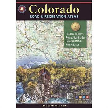
Colorado Road & Recreation Atlas
Benchmark's Colorado Road & Recreation Atlas captures the story of Colorado... it's fast-moving history, tremendous mountains, deep canyons, and range of climates. This atlas is a product of many minds, all committed to the same purpose -- providing a complete a picture as possible of the Centennial State. The Landscape Maps reveal landforms with amazing realism and detail clearly showing how the state's vast network of roads and local recreation landmarks fit into the countryside. A complete 30-page Recreation Guide lists a myriad of outdoor activities, arranged by category, and is the ideal planning tool for any kind of outdoor adventure.Map Scale = 1:200,000 & 1:500,000Sheet Size = 11" x 15"
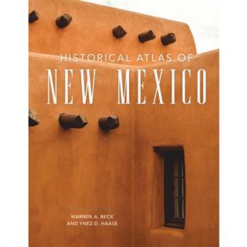
Historical Atlas of New Mexico
"Combines a good geography of the state with much interesting information along practically any line one might wish to follow." Navajo Times "It is a supreme treat to look at a volume so well organized. . . . [T]his is a must-have book." American West "School teachers will hail this book with delight, and students at any level will wonder how anyone ever got along without it." Santa Fe New Mexican New Mexico's long and dramatic history was in many ways predestined by its location, vast size, and abundant mineral resources. Treasure-hunting Spanish explorers tramped across its plains and scaled its mountains in search of the Seven Cities of C穩bola in the sixteenth century. In clashing with descendants of the prehistoric Indian population, the Spanish began three centuries of struggles that lasted through the nineteenth century when the steamroller of United States expansion arrived. The history of New Mexico is the story of the blending of the three cultures-Hispanic, Indian, and Anglo. In this volume, a historian and a cartographer collaborate to depict specific aspects of the state's geography and events of its history, with the narrative illustrated through maps. Topics include geographical data (from topography to weather), sites of prehistoric civilizations, Spanish and United States expeditions, first towns, historic trails, the Civil War, stagecoach lines, railroads, county boundaries, principal cities and roads, state and national parks and monuments, and state judicial districts. Warren A. Beck was Professor of History at California State University, Fullerton. Ynez D. Haase is a professional geographer and cartographer in Santa Barbara. Beck and Haase are coauthors of Historical Atlas of California and Historical Atlas of the American West, also published by the University of Oklahoma Press.
New Mexico Road & Recreation Atlas
The very first Benchmark atlas title, first released in 1995, has once again been field-checked and updated with current public land owndership and recreation points of interest. The Recreation Guide lists dozens of POI with contact info for every corner of The Land of Enchantment.Map Scale = 1:285,000 & 1:1,000,000Sheet Size = 11" x 15"
Benchmark: Oregon Recreation Map
The Oregon Recreation Map is a folded map version of the Recreation Guide pages within Benchmark's Oregon Road & Recreation Atlas. One side provides a full state map that features Public Lands, extensive highway detail, point-to-point mileages, recreation attractions, campgrounds, parks and wildlife areas, fishing access points, and hunting units (GMU). The reverse side features categorized recreation POI listings with helpful descriptions, current contact information, and map grid references.Map Scale = 1:800,000Sheet Size = 34" x 27"Folded Size = 4" x 9"
Human-Wildlife Conflict in Lake Nakuru National Park. Impacts to the Surrounding Communities
Bachelor Thesis from the year 2018 in the subject Tourism - Miscellaneous, grade: 89.7, Kenyatta University, language: English, abstract: The purpose of this research was to study on the impacts of human wildlife conflict in the surrounding communities of Lake nakuru national park. To fulfill the intention of this research, the objectives were: to investigate the impacts of human wildlife in Lake Nakuru national park and the surrounding communities, to determine the relationship between wildlife and the surrounding communities in LNNP and the available conflict reporting procedures by KWS. Furthermore, the aim was to examine the influence between human population increase adjacent to the park and human wildlife conflict in LNNP, to establish how the current response and mitigation measures by KWS influences human wildlife conflict in LNNP, to establish how the current response and mitigation measures by KWS influences human wildlife conflict in LNNP. To achieve the above objectives, the study adopted the empirical evidence for the analyses and presentation of data. In quantitative techniques, the analyses were supported by the use of statistical package for social science, proportions, percentages and averages to arrive at a general picture for the generation of conclusion. Qualitative data from questionnaires and active observation of some wildlife for instance baboon's and monkey behavior, and other evidences were analyzed thematically employed into the computation of statistical tables, bar graphs as well as charts. Human-Wildlife Conflict has become a serious problem in different parts of the world with adverse impacts on lives of the local people. This has been attributed to a number of factors including the fact that human population increases but the resources available are fixed. Close to the protected areas for instance, the problem is very serious with the local communities' interaction with wildlife creating negative impacts to both sides. Destruction o
Management Aspects of an Ecotourism Attraction. A Review on Idanre Hills
Seminar paper from the year 2021 in the subject Tourism - Miscellaneous, grade: A2, Obafemi Awolowo University, language: English, abstract: The present study is aimed at evaluating the current state of the management of Idanre Hills with the view to contribute knowledge to the sustainable development of the attraction. The natural landscape of the hills is replete with an abundance of biodiversity and a cultural heritage that has survived for centuries. Today, the Idanre landscape is a preferred destination explored for its benefits (notably environmental, economic and socio-cultural). Being in the tentative list of world heritage site, the stakeholders in accordance with the UNESCO regulation have been tasked with adopting effective management and protection strategies to ensure the development of a sustainable heritage site for the present and future generations amongst other benefits. From analysis of literature, in its current state; some factors were found to constitute barriers to the attainment of high performance in the management of Idanre hills including conflict of interests between members of the Idanre community and the state authority on the subject of management; inadequate financial resources, climate change, lack of political will, poor infrastructure, limited education in tourism destination management amongst others. Various solutions have been proffered concerning effective management and sustainable development of tourism attraction from scholarly works. Meanwhile, it is believed that the recommendations for the assessment of management performance should ultimately be in line with the criteria as specified by the UNESCO for the reason that Idanre hills is in the tentative list of world heritage sites. The outcome of adhering to these management criteria is that consequently, the conditions of integrity of the attraction are sustained or enhanced over a longer period.
World Flags
Color your way through the 190+ world flags with World Flags: The Coloring Book!We take you on a journey across the world one flag at a time, starting in Canada, travelling continent to continent until we reach Australia & Oceania.For a practical and fun coloring book, choose ours: We have included color guides for all flags so that you don't have to search the internet the flags to see the colors. We have included all flags and not just the more well known ones. We have fitted outlines of varying sizes, some flags, for example Indonesia (half red half white) may be smaller than more detailed flags, for example, the United States of America.Durable Soft-touch Matte finish cover, so you can color away at home or on your travels!Large A4 size.High Quality Flag Outline Graphics for a superior coloring experience!Quality 90GSM paper, ideal for coloring pencils and crayons, but not recommended for highlighters or paints.Grab your coloring book now by adding to basket!!
Nachhaltigkeit als Herausforderung der Kreuzfahrtbranche
Masterarbeit aus dem Jahr 2020 im Fachbereich Tourismus - Sonstiges, Note: 1,0, Heinrich-Heine-Universit瓣t D羹sseldorf, Sprache: Deutsch, Abstract: Die vorliegende Arbeit untersucht und beleuchtet die unterschiedlichen Aspekte der Nachhaltigkeit in der Kreuzfahrtbranche. Die Untersuchung fokussiert dabei nicht nur die Reedereien und die Situation an Bord, sondern gew瓣hrt einen breiten Gesamt羹berblick, bei dem auch die verschiedenen Stakeholderinteressen sowie Ph瓣nomene und Entwicklungen an Land betrachtet werden. Einen gro?en Wert wird dabei auf die drei Dimensionen (S瓣ulen) der Nachhaltigkeit gelegt - n瓣mlich die ?kologie, die Gesellschaft und die ?konomie. Darauf aufbauend folgt schlie?lich eine Betrachtung der Ergebnisse im Lichte der Covid-19-Pandemie.
Energiemanagement in der Hotellerie. Wie kann man das Klima sch羹tzen und Kosten senken?
Bachelorarbeit aus dem Jahr 2018 im Fachbereich Tourismus - Hotelmanagement, Note: 1,3, HAWK Hochschule f羹r angewandte Wissenschaft und Kunst - Fachhochschule Hildesheim, Holzminden, G繹ttingen, Sprache: Deutsch, Abstract: Die vorliegende Arbeit richtet sich an speziell an Energiefragen interessierte Hoteliers, aber vor allem auch an diejenigen, die Interesse daran haben, im Hotelgewerbe durch einen verantwortungsvollen Umgang mit k羹nstlichen und nat羹rlichen Ressourcen ihre Energiekosten zu senken oder Installationen zur Energieeinsparung umzusetzen, um sich somit aktiv f羹r eine allgemeine Reduktion des Energieverbrauches zu engagieren. Das Thema Energiemanagement ist seit Jahren ein wesentlicher Bestandteil f羹r die Wirtschaft. Klimaerw瓣rmung und Folgen des Klimawandels sowie der Anstieg von CO2-Emissionen sind eines der gr繹?ten globalen Probleme des 21. Jahrhunderts. Deshalb ist es wichtig geworden, sich intensiver mit diesem Thema auseinanderzusetzen. Mit den zur Implementierung vorgestellten Ma?nahmen des Energiemanagements soll aufgezeigt werden, dass in der Hotellerie wirtschaftliche Energieeinsparpotenziale bestehen sowie diese fr羹hzeitig erkannt und mit gezielten Ma?nahmen und teils geringem Aufwand erreicht werden k繹nnen. Dar羹ber hinaus l瓣sst sich der fortschreitende Klimawandel durch ein erfolgreiches Energiemanagement positiv beeinflussen. Neben der Betriebskostensenkung und dem aktiven Umweltschutz soll sich der Gast, aber auch jeder einzelne Mitarbeiter durch h繹chste Komfortanspr羹che wohlf羹hlen. Beste Voraussetzungen bieten daf羹r Geb瓣ude, welche durch entsprechende Sanierungen bzw. Erweiterungen energieeffizient umgestaltet werden k繹nnen. Auf praxisnahe Weise sollen die Ergebnisse dieser Arbeit dabei helfen, den Hotelbetreiber im verantwortungsvollen Umgang mit Energie zu unterst羹tzen und betriebliche Einsparungsma?nahmen zu realisieren.
Idaho Recreation Map
The Idaho Recreation Map is a folded map version of the Recreation Guide pages within our Idaho Road & Recreation Atlas. One side provides a full state map that features Public Lands, extensive highway detail, point-to-point mileages, recreation attractions, campgrounds, parks and wildlife areas, fishing access points, hunting units (GMU), and inset area maps for Lake Coeur d'Alene, Greater Boise, Island Park, and Ketchum - Sun Valley. The reverse side includes a map of hunting zones & units and features categorized recreation listings with helpful descriptions, current contact information, and map grid references.Map Scale = 1:833,333Sheet Size = 38" x 27"Folded Size = 4" x 9"









![Grand Teton Day Hikes & National Park Map [Map Pack Bundle] Grand Teton Day Hikes & National Park Map [Map Pack Bundle]](https://cdn.kingstone.com.tw/english/images/product/9032/9781566959032m.jpg?Q=2e621)
