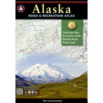
Alaska Road & Recreation Atlas
Alaska truly is the Last Frontier. No other publication can display this rugged scenery and recreation potential with more precision than Benchmark's Alaska Road & Recreation Atlas. The Landscape Maps reveal landforms with amazing realism and detail, clearly showing how the state's vast network of roads, waterways, and recreation landmarks fit into the landscape. A complete Recreation Guide lists a myriad of outdoor activities. Arranged by category and boasting unequalled insight and detail, it is the ideal planning tool from a simple scouting trip to an extended exploration. Benchmark field-checkers drove several thousand miles to make sure the Alaska Road & Recreation Atlas is the most accurate, comprehensive, and reliable map product ever published for the 49th State.Map Scale = 1:316,800 & 1:1,267,200Sheet Size = 11" x 15"
Michelin Quebec Map
Brand-newMichelin Quebec Map 760 in its sturdy cardboard cover is invaluable to anyone driving in Quebec. It encompasses the road network in the most populated areas of the region and contains an English-language legend for reading the map symbols. Visitors to this French-speaking province of Canada can add a note of adventure to their stay with the many points of interest, parks and recreational sites indicated on the map. For effective trip planning before and during the journey, turn to Michelin maps.
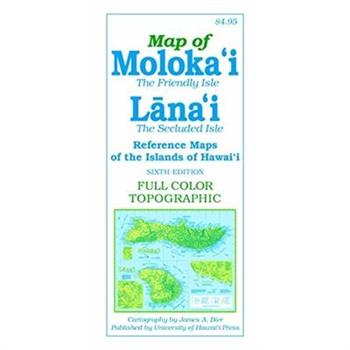
Map of Moloka’i and Lana’i
Features of the sixth edition of this full-color, topographic map of the Friendly Isle include detailed road networks, large-scale inset maps of towns, points of interest (historic, natural and cultural), hiking trails, parks, beaches, waterfalls, peaks and ridges (with altitudes), and more than 700 place names (index included). Most notably, Hawaiian words are spelled with all accent marks. 21 x 18 inches (unfolded), color
Brutalist Washington Map
"Brutalist Washington Map features 40 leading examples of Brutalist architecture in and around Washington, D.C., from the Hirshhorn Museum and the J. Edgar Hoover Building (FBI HQ), Dulles Airport and Georgetown's Lauinger Library to lesser known buildings like the the Woman's National Democratic Club Annex, National Presbyterian Church and Reston's Lake Anne Plaza. The reverse side of the map features an introduction to Brutalism and post-war construction in Washington, D.C. by Deane Madsen along with details for each building, and metro station, including the location, date and the architect or practice responsible. Perfect for a walking tour or framing, this map measures slightly larger than A2 open, folds to slightly larger than A5 and is protected by a wide band. All of our printed publications are litho-printed on quality FSC-certified recycled paper with non-toxic vegetable-based inks."
National Geographic: New Zealand Executive Wall Map - Laminated (23.5 X 30.25 Inches)
The reference map of New Zealand uses Expertly researched and designed, National Geographic's Executive style with an antique-style color palette and stunning shaded relief. The map shows this island nation in great detail, from the subtropical North Island (Te Ika-a-Maui) to the glacial carved valleys of Fiordland on the South Island (Te Waipounamu). The North Island is best known for large volcanic lakes and the cities of Auckland and Wellington. The South Island is famous for the Southern Alps that run along the spine of the island. The highest point in the country is Aoraki (Mount Cook) and is found in the Southern Alps.The first settlers of New Zealand were the Maori from Polynesia, the names on the map reflect this history with both English and Maori variants. The map also features a transportation network including highways, roads, passenger railroads, and major airports. All National Parks are also shown.The map is encapsulated in heavy-duty 1.6 mil laminate which makes the paper much more durable and resistant to the swelling and shrinking caused by changes in humidity. Laminated maps can be framed without the need for glass, so the frames can be much lighter and less expensive. Map Scale = 1:2,300,000Sheet Size = 23.5" x 30.25"
Transit Maps of the World
A completely updated and expanded edition of the cult bestseller, featuring subway, light rail, and streetcar maps from New York to Nizhny Novgorod. Transit Maps of the World is the first and only comprehensive collection of historical and current maps of every rapid-transit system on earth. In glorious, colorful graphics, Mark Ovenden traces the cartographic history of mass transit--including rare and historic maps, diagrams, and photographs, some available for the first time since their original publication. Now expanded with thirty-six more pages, 250 city maps revised from previous editions, and listings given from almost a thousand systems in total, this is the graphic designer's new bible, the transport enthusiast's dream collection, and a coffee-table essential for everyone who's ever traveled in a city.
New Concise World Atlas
With hundreds of dramatic, full-color, large-format maps produced by Europe's finest team of cartographers, the fifth edition of the New Concise World Atlas solidifies Oxford's position as the only publisher of regularly updated atlases at every desirable size and price. Containing over 100 pages of the most up-to-date topographic and political maps, the New Concise World Atlas also features a new front section of satellite imagery to replace the old "Earth in Space" section, as well as new detailed maps of the ocean seafloors. In addition to this new front section, there are 16 extra pages of world maps for this new edition covering areas such as Kazakhstan, Central Asia, Egypt, Morocco, Algeria, Tunisia, Peru, and Brazil. Recent changes to the world's geography are thoroughly captured in this edition; fully updated tables and world statistics provide data on climate, population, area, and physical dimensions. Finally, an index with over 58,000 items make searching for lesser-known locales quick and easy. Truly international in scope, created with meticulous care, and reflecting the very latest political developments and census information, Oxford's New Concise World Atlas, Fifth Edition achieves the highest standard among international map resources. This engaging and affordable resource is second to none in the superb quality of its maps, the breadth of its coverage, and its easy-to-use convenience.
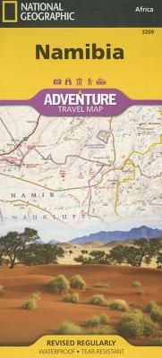
National Geographic Namibia Map
- Waterproof - Tear-Resistant - Travel MapNational Geographic's Namibia Adventure Map is designed to meet the needs of adventure travelers with its detailed and accurate information. This map includes the locations of cities and towns with a user-friendly index, a clearly marked road network complete with distances and designations for roads/highways, plus secondary routes for those seeking to explore off the beaten path. The Namibia map also includes hundreds of marked private guest lodges, camps and, state-owned rest camps. Adventure Maps differ from a traditional road map because of the specialty content they include. Each map contains hundreds of diverse and unique recreational, ecological, cultural, and historic destinations -- outside of the major tourist hubs. National Geographic Adventure Maps are the perfect companion to a guidebook.Namibia is located on the south east shore of Africa. The climate is dry, even on the Atlantic coast where the dunes of the Namib Desert provide a spectacular sight. The eastern border of Namibia with Botswana, is defined by the Kalahari Desert. Despite the dry environment the protected areas of Namibia include almost 15 percent of the land area with virtually the entire Namib Desert coastal strip under protection. These protected areas are home to cheetahs, lions, zebras, giraffes, and even elephants.The northern part of the map includes the famous Skeleton Coast National Park. The the capital city of Windhoek falls in the generous overlap area of the printed map. The south side of the map includes Namib-Naukluft National Park as well as the Tsau//Khaeb (Sperrgebiet) National Park and, the long border with South Africa.Every Adventure Map is printed on durable synthetic paper, making them waterproof, tear-resistant and tough -- capable of withstanding the rigors of international travel.Map Scale = 1:1,200,000Sheet Size = 25.5" x 37.75"Folded Size = 4.25" x 9.25"
National Geographic Blue Ridge Parkway, North Carolina, Virginia
- Waterproof - Tear-Resistant - Travel MapThe Blue Ridge Parkway is a winding route that traverses some of America's most picturesque scenery. The Parkway is America's most visited National Park unit and when combined with Skyline Drive through Shenandoah National Park, also covered in detail on this map, a travel experience of over almost 600 miles is created. The Blue Ridge Parkway starts in the south at the foot of the Great Smoky Mountains and runs along the Blue Ridge through several National Forests from North Carolina and into Virginia. National Geographic's Blue Ridge Parkway Destination Map strikes the perfect balance between map and guidebook and is ideal for a wide range of travelers. Destination Maps combine finely detailed maps with fascinating and practical travel information. The front side features a large-scale map of the Blue Ridge Parkway in North Carolina and Virginia and Skyline Drive in Virginia, richly layered with travel information and beautiful photographs showcasing some of many ways travelers can experience the road known as "America's Favorite Drive". In addition to the easy-to-read map on the front, the reverse side includes regional descriptions, arts and culture finds, and visitor resources. Explore detailed insets of the Great Smoky and Shenandoah National Parks. Some of the extra features include: Charts detailing visitor centers and nearby state parksColorful photographs featuring the region's enchanting landscapeHistory, leaf viewing, wildflowers, wildlife, and places to visitDescriptive content highlighting outdoor recreation opportunities, water recreation, camping, hiking, and the Appalachian TrailEvery Destination Map is printed on durable synthetic paper, making them waterproof, tear-resistant and tough -- capable of withstanding the rigors of any kind of travel.Map Scale = 1:800,000Sheet Size = 25.5" x 37.75"Folded Size = 4.25" x 9.25"
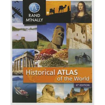
Rand Mcnally Historical Atlas of the World
The Historical Atlas of the World presents important periods and turning points in 5,000 years of world history in over 100 pages of thematic maps. Atlas features: 2015 copyright "€" updated to include recent world events like the Arab Spring & changes in U.S. relations with Cuba Presents major periods of world history through more than 100 bold, colorful maps Thematic maps include literacy, languages, religions, and more Includes a section on benefits of using the atlas 112 pages, paperback, 8" x 10"
Are We There Yet?
Part of Rand McNally's Backseat Books series, Are We There Yet? will keep kids entertained for hours. Find travel games, car bingo, decoding puzzles, dot-to-dots, mazes, word scrambles and more in this bright, colorful activity book. Rand McNally brings a fun and educational way to play with your kids, whether at home or on the road. Decoding puzzles, dot-to-dot mazes, car bingo, crossword puzzles, word scrambles and much, much more! Includes answer key in the back of the book PRODUCT DETAILS 64 pages; 8.5" x 11"
National Geographic Adventure Travel Maps Nepal Map Pack
- Waterproof - Tear-Resistant - Travel MapThe National Geographic Adventure Nepal Map Pack is the perfect companion for anyone who wants to travel to the "Roof of the World". The Map Pack includes five Adventure maps that cover all of Nepal with various levels of detail. The first map in the Map Pack is an overview map of Nepal which covers the entire country. Next, the series includes the trekking areas of Annapurna, Langtang, and Khumbu. Finally, a detailed map of the highest mountain on earth, Mount Everest. Each of the five maps cover these areas in detail with points of interest, intricate road networks, and an index of places to help you find even the smallest town. Each map includes a detailed city map of Kathmandu.The Nepal Map Pack includes: Map 3000:: Nepal Map 3001:: Everest Base Camp Map 3002:: Khumbu Map 3003:: Annapurna Map 3004:: LangtangEvery Adventure Map is printed on durable synthetic paper, making them waterproof, tear-resistant and tough -- capable of withstanding the rigors of international travel.Folded Size = 4.25" x 9.25"
National Geographic Adventure Map Vietnam
- Waterproof - Tear-Resistant - Travel MapNational Geographic's Map Pack of Vietnam has you covered, from the green rice fields in the north to the fascinating bustle of the Mekong Delta in the south. The entire country is shown in detail on these two Adventure Maps, Vietnam North and Vietnam South. Each map covers these areas in detail with points of interest, intricate road networks, and an index of places to help you find even the smallest town.The Vietnam Map Pack includes: Map 3015:: Vietnam North Map 3016:: Vietnam SouthEvery Adventure Map is printed on durable synthetic paper, making them waterproof, tear-resistant and tough -- capable of withstanding the rigors of international travel.Map Scale = 1:650,000Sheet Size = 25.5" x 37.75"Folded Size = 4.25" x 9.25"
Carta Map The Old City of Jerusalem
On reverse: map of Jerusalem center and index to street names.,
Atlas of the Transatlantic Slave Trade
A extraordinary work, decades in the making: the first atlas to illustrate the entire scope of the transatlantic slave trade Winner of the Association of American Publishers' 2010 R.R. Hawkins Award and PROSE Award "A monumental chronicle of this historical tragedy."--Dwight Garner, New York Times Between 1501 and 1867, the transatlantic slave trade claimed an estimated 12.5 million Africans and involved almost every country with an Atlantic coastline. In this extraordinary book, two leading historians have created the first comprehensive, up-to-date atlas on this 350-year history of kidnapping and coercion. It features nearly 200 maps, especially created for the volume, that explore every detail of the African slave traffic to the New World. The atlas is based on an online database (www.slavevoyages.org) with records on nearly 35,000 slaving voyages--roughly 80 percent of all such voyages ever made. Using maps, David Eltis and David Richardson show which nations participated in the slave trade, where the ships involved were outfitted, where the captives boarded ship, and where they were landed in the Americas, as well as the experience of the transatlantic voyage and the geographic dimensions of the eventual abolition of the traffic. Accompanying the maps are illustrations and contemporary literary selections, including poems, letters, and diary entries, intended to enhance readers' understanding of the human story underlying the trade from its inception to its end. This groundbreaking work provides the fullest possible picture of the extent and inhumanity of one of the largest forced migrations in history.
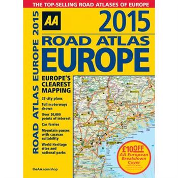
Road Atlas Europe 2015
Fully revised and updated for 2015, this specialist A4 road atlas designed for the British motorist in Europe, with multi-scale mapping of 46 countries. The atlas includes information on national speed limits, toll-free motorways, car ferries, mountain passes with caravan suitability, emergency telephone numbers, and road distances, together with national parks and many other places of interest. 14.2 miles to 1 inch, 1:900,000 (main scale), but please note some areas are at a smaller scale.
National Geographic Black Hills National Forest Map Pack Bundle
- Waterproof - Tear-Resistant - Topographic MapsThe Black Hills National Forest Map Pack Bundle is the perfect companion for anyone planning a trip to the Black Hills of South Dakota. The two maps in this Map Pack Bundle cover the Black Hills National Forest in great detail and include all of the information needed for a memorable trip for the first time or the frequent visitor. The maps include trails with mileage between intersections, numbered US Forest Service roads, motorized trails as well as hundreds of points of interest such as campgrounds, trail heads, and boat ramps.The Black Hills National Forest Map Pack includes: Map 238:: Black Hills South [Black Hills National Forest]Map 751:: Black Hills North [Black Hills National Forest]Every Trails Illustrated map is printed on "Backcountry Tough" waterproof, tear-resistant paper. A full UTM grid is printed on the map to aid with GPS navigation.Map Scale = 1:70,000Sheet Size = 37.75" x 25.5"Folded Size = 4.25" x 9.25"
Wilderness Recreation Map Big Sur and Ventana Wilderness
Find your way around Big Sur with this four-color topographic map showing every major road, trailhead, and trail in Pfeiffer Big Sur State Park, Julia Pfeiffer Burns State Park, Ventana Wilderness, Silver Peak Wilderness, Andrew Molera State Park, Lime Kiln State Park, and northern Los Padres National Forest. Notes campgrounds and trail camps, and includes detailed insets of Pfeiffer Big Sur and Julia Pfeiffer Burns state parks. This new second edition was carefully updated and heavily revised with help from the Ventana Wilderness Alliance.
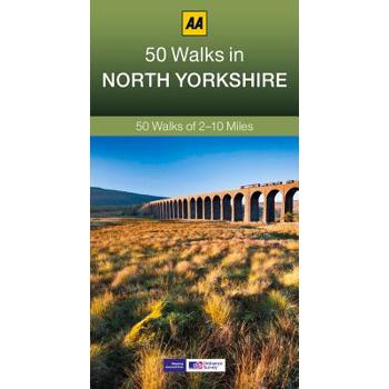
50 Walks in North Yorkshire
Walking is one of Britain's favourite leisure activities, and this guide to North Yorkshire features 50 mapped walks from two to ten miles, to suit all abilities.
50 Walks in Berkshire & Buckinghamshire
Walking is one of Britain's favourite leisure activities, and this guide to Berkshire and Buckinghamshire features 50 mapped walks from two to ten miles, to suit all abilities.
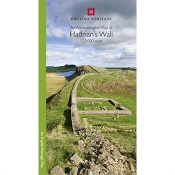
An Archaeological Map of Hadrian's Wall
Please note: This product is a map. It was more than just a wall: it was a whole military zone designed to control movement across the northern frontier of the Roman province of Britannia. Great earthwork barriers survive, along with the remains of forts and temporary camps; watch-towers and fortified gates; civilian settlements, temples, cemeteries, bath-houses, roads and bridges. Stretching across the spine of England from the North-East coast to the Irish Sea, the line of the frontier extends for over 100 miles through every type of landscape: from the streets of urban Tyneside, through arable fields; along the crags of the wild Whin Sill; to the sands of the Solway, and down the coast of Cumbria. Drawing upon the extensive expertise and unrivalled archives of English Heritage, and those of its partners, this map depicts the fruits of modern archaeological research: in field survey, geophysics, excavation, and the analysis of aerial photographs. Using Ordnance Survey 1:25,000 data - the ideal scale for walkers - this revised new map shows with great clarity all the elements of Hadrian's Wall, and distinguishes between those features that are visible and those that have been levelled through time. A brief text explains the remains on the ground, and how to use the map to find them - including the museums and the best places to visit. This World Heritage Site is now more accessible than ever before, so see the landscape through new eyes.
Michelin USA Big Sky Country Map 172
Michelin USA Big Sky Country Map 172 (scale: 1:1,267,000)--part of Michelin's brand-new US regional map series with bright green covers--zooms in close for comprehensive coverage of Idaho, Montana and Wyoming. It contains city maps for easy driving in Boise, Cheyenne and Helena, as well as an inset map for Yellowstone National Park. Michelin star-rated sights and a selection of not-to-be-missed annual events and festivals serve as inspiration for future road trips. Outdoor enthusiasts have their choice of national parks for scenery and activities: Glacier, Grand Teton, Wind Cave and Yellowstone. The QR code on the front cover offers even more travel information on destinations through Michelin's ViaMichelin website. The map includes a comprehensive index, a distance chart, and a multi-language legend in English and Spanish. Those traveling for business or pleasure, as well as locals traveling farther afield, will appreciate Michelin's high standard of clear and accurate mapping and the additional information on parks, events and points of interest to make the journey more enjoyable.
National Geographic: Pacific Crest Trail Wall Map in Gift Box Wall Map (18 X 48 Inches)
Expertly researched and designed, National Geographic's map of the Pacific Crest Trail is ideal for fans and hikers of this magnificent National Scenic Trail. It makes a great planning tool or as reference to track progress on the 2,600 plus mile length. This beautiful map shows the entire length of the trail from Mexico to Canada through California, Oregon, and Washington. A unique elevation profile highlights the trail's peaks and valleys, and an informative mileage chart shows the distance between key locations. Also highlighted on this map are passes, peaks, national forests, national parks, state parks, and Indian reservations. Additional points of interest include lodges and campgrounds near the trail.The map is packaged in a full color box designed for gift giving. The box includes a large image of a section of the map inside and details including size and scale.Map Scale = 1:1,700,000Sheet Size = 18" x 48"


