National Geographic: Britain and Ireland Classic Wall Map (23.5 X 30.25 Inches)
National Geographic's Classic political map of Britain and Ireland is both an attractive addition to any study or classroom and an informative tool for exploring these fascinating countries. The map features thousands of place names, major highways and roads, airports, ferry routes, bodies of water, and more. Handy indexes make it easy to identify the counties, districts, council areas, unitary authorities, and metropolitan districts of Ireland, Northern Ireland, Scotland, Wales, and England. An inset provides detail of the Shetland Islands. National parks are clearly indicated in green vignettes, and shaded relief reveals the interesting and varied topography of these island nations.English and Gaelic (Irish) share official status per the Republic of Ireland's constitution, so place names are rendered in both. In the Gaeltachtl, or predominantly Irish-speaking regions, only Irish place-names have official status and are used on signposts. These districts are found within the counties of Cork, Donegal, Galway, Kerry, Mayo, Meath, and Waterford. The map is packaged in a two inch diameter tube with a label showing a thumbnail of the map with dimensions and other pertinent information.Map Scale = 1:1,679,000Sheet Size = 23.5" x 30.25"
National Geographic: World Classic, Pacific Centered Wall Map (46 X 30.5 Inches)
Expertly researched and designed, National Geographic's World Wall Map is the authoritative map of the world by which other reference maps are measured.Product Features: Signature Classic style map with bright, easy to read color palette with blue oceans and colorful bordersUnique Pacific-centered view accentuates the Pacific Rim and focuses on Asia, Oceania, and the full breadth of the Pacific Ocean. Background shows mountain ranges and valleys in subtle shaded relief with mountain ranges labeled Major water bodies including rivers, lakes, glaciers, oceans, seas, gulfs, bays, straits, and bathymetryClearly defined international boundaries, cities, islands, airports, and physical featuresThousands of place names carefully and artfully placed to maintain legibility in heavily populated areasUp-to-date international boundaries and territorial control reflect de facto status on the groundMeticulously researched using multiple authoritative sources including the U.N., U.S. Board on Geographic Names, and policies of individual governments.Accurate place names use a combination of conventional English names, official national names, and standard transliterations for non-Latin alphabets. Drawn in Winkel Tripel projection with distortions minimized unlike other World maps (e.g. Greenland is shown the same size as Argentina, not South America)Corner inset maps feature vegetation, land use, population density, and north and south polar regionsThe map is packaged in a two inch diameter tube with a label showing a thumbnail of the map with dimensions and other pertinent information.Map Scale = 1:29,820,000Sheet Size = 46" x 30.5"
National Geographic: United States Executive Wall Map (43.5 X 30.5 Inches)
Expertly researched and designed, National Geographic's United States wall map is the standard by which other reference maps of the U.S. are measured.Product Features: Antique-style "executive" color palette All 50 states with insets for Hawaiian Islands and Alaska plus inset showing relative size of AlaskaClearly defined state and country boundaries, cities, islands, national parks, and physical featuresThousands of place names carefully and artfully placed to maintain legibility in heavily populated areasBackground shows mountain ranges and valleys in subtle shaded relief with mountain ranges labeled Major water bodies including rivers, lakes, gulfs, bays, straits, and ocean bathymetryTransportation routes including interstate highways, major state routes, airports, waterways, canals, and ferriesThe map is packaged in a two inch diameter tube with a label showing a thumbnail of the map with dimensions and other pertinent information.Map Scale = 1:4,557,000Sheet Size = 43.5" x 30.5"
National Geographic: Scandinavia Classic Wall Map (23.5 X 30.25 Inches)
National Geographic's wall map of Scandinavia is one of the largest and most detailed maps of the region. The signature Classic style design uses a bright, easy-to-read color palette. This map features thousands of place names, accurate political boundaries, national parks, and major infrastructure networks such as roads, superhighways, airports, canals, ferry routes, and high-speed and passenger railroads. The region's diverse terrain is detailed through accurate shaded relief, coastal bathymetry, and symbolism for water features and other land forms. Elevations of major peaks and depth soundings are expressed in meters. Inset maps provide detail of Iceland, the Faroe Islands, and Jan Mayen. In addition to Norway, Sweden, and Finland, coverage includes Denmark, Lithuania, Latvia, Estonia, and Kaliningrad Oblast. The map is packaged in a two inch diameter tube with a label showing a thumbnail of the map with dimensions and other pertinent information.Map Scale = 1:2,763,000Sheet Size = 23.5" x 30.25"
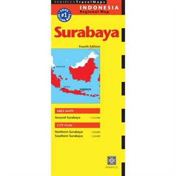
Surabaya Travel Map
The Surabaya Travel Map from Periplus is designed as a convenient, easy-to-use tool for travelers. Created using durable coated paper, this map is made to open and fold multiple times, whether it's the entire map that you want to view or one panel at a time. Following highways and byways, this map will show you how to maneuver your way to banks, gardens, hotels, golf courses, museums, monuments, restaurants, churches and temples, movie theaters, shopping centers and more! This 4th edition includes maps and plans that are scaled to: Area Map: Around Surabaya 1:125,000City Plans: Northern Surabaya 1:20,000 Southern Surabaya 1:20,000Periplus Travel Maps cover most of the major cities and travel destinations in the Asia-Pacific region. The series includes an amazing variety of fascinating destinations, from the multifaceted subcontinent of India to the bustling city-state of Singapore and the 'western style' metropolis of Sydney to the Asian charms of Bali. All titles are continuously updated, ensuring they keep up with the considerable changes in this fast-developing part of the world. This extensive geographical reach and attention to detail mean that Periplus Travel Maps are the natural first choice for anyone traveling in the region.
How Maps Change Things
This full-colour book is about politics and faith and the values we hold. It's about human relations, social justice, peace, budgets, and environmental concerns. It's about that "Aha!" moment when we realize that maps are loaded not just with data, but with meaning, with the map maker's perceptions and prejudices about what's important and what's not. Ultimately, this book is about becoming aware of how we shape and use maps and how they in turn shape us, so that we can begin to reflect on and choose the kind of world we want. The book includes an experiential Study Guide perfect for use by adult and youth study groups of all kinds. Author Ward Kaiser brings to this book broad experience as a publisher, business and ecumenical executive, pastor, teacher, and community organizer. He introduced the Peters Projection world map to North America, publishing its first English-language version in 1983. His handbook to that map, A New View of the World, is widely used by high school and college teachers, mission educators, and social activists. He and his wife, Lorraine, divide their time between central Florida and the Niagara Peninsula of Ontario, Canada.
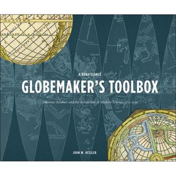
Renaissance Globemaker's Toolbox + the Naming of America
A special boxed set of these companion volumes about the most important maps and notes in the history of cartography
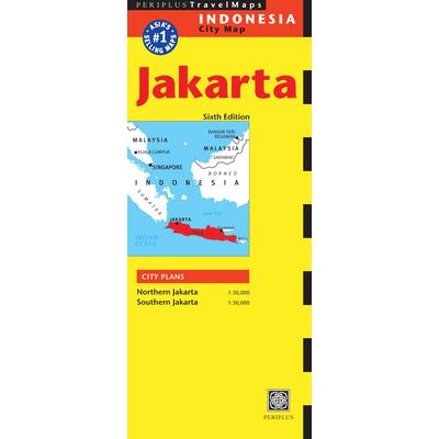
Jakarta Travel Map
The Jakarta Travel Map from Periplus is designed as a convenient, easy-to-use tool for travelers. Created using durable coated paper, this map is made to open and fold multiple times, whether it's the entire map that you want to view or one panel at a time. Following highways and byways, this map will show you how to maneuver your way to banks, gardens, hotels, golf courses, museums, monuments, restaurants, churches and temples, movie theaters, shopping centers and more! This 6th edition includes maps and plans that are scaled to: City Plans: Northern Jakarta 1:30,000 Southern Jakarta 1:30,000Periplus Travel Maps cover most of the major cities and travel destinations in the Asia-Pacific region. The series includes an amazing variety of fascinating destinations, from the multifaceted subcontinent of India to the bustling city-state of Singapore and the 'western style' metropolis of Sydney to the Asian charms of Bali. All titles are continuously updated, ensuring they keep up with the considerable changes in this fast-developing part of the world. This extensive geographical reach and attention to detail mean that Periplus Travel Maps are the natural first choice for anyone traveling in the region.
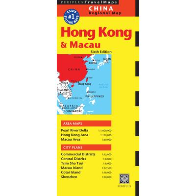
Periplus Hong Kong & Macau Travel Map
The Hong Kong & Macau Travel Map from Periplus is designed as a convenient, easy-to-use tool for travelers. It is created using durable coated paper and is made to open and fold multiple times, whether it's the entire map that you want to view or one panel at a time. Following highways and byways, this map will show you how to maneuver your way to banks, gardens, hotels, golf courses, museums, monuments, restaurants, churches and temples, movie theaters, shopping centers and more! This 6th edition includes maps and plans that are scaled to: Area Maps: Pearl River Delta 1:1,000,000 Hong Kong Area 1:110,000 Macau Area 1:60,000City Plans: Commercial Districts 1:15,000 Central District 1:8,000 Tsim Sha Tsui 1:8,000 Macau Island 1:12,500 Cotai Island 1:18,000 Shenzhen 1:30,000Periplus Travel Maps cover most of the major cities and travel destinations in the Asia-Pacific region. The series includes an amazing variety of fascinating destinations, from the multifaceted subcontinent of India to the bustling city-state of Singapore and the 'western style' metropolis of Sydney to the Asian charms of Bali. All titles are continuously updated, ensuring they keep up with the considerable changes in this fast-developing part of the world. This extensive geographical reach and attention to detail mean that Periplus Travel Maps are the natural first choice for anyone traveling in the region.
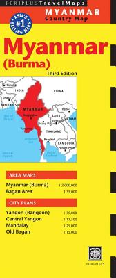
Periplus Myanmar Travel Map
The Myanmar (Burma) Travel Map from Periplus is designed as a convenient, easy-to-use tool for travelers. Created using durable coated paper, this map is made to open and fold multiple times, whether it's the entire map that you want to view or one panel at a time. Following highways and byways, this map will show you how to maneuver your way to banks, gardens, hotels, golf courses, museums, monuments, restaurants, churches and temples, movie theaters, shopping centers and more! This 3rd edition includes maps and plans that are scaled to: Area Maps: Myanmar (Burma) 1:2,000,000 Bagan Area 1:35,000City Plans: Yangon (Rangoon) 1:35,000 Central Yangon 1:17,500 Mandalay 1:25,000 Old Bagan 1:15,000Periplus Travel Maps cover most of the major cities and travel destinations in the Asia-Pacific region. The series includes an amazing variety of fascinating destinations, from the multifaceted subcontinent of India to the bustling city-state of Singapore and the 'western style' metropolis of Sydney to the Asian charms of Bali. All titles are continuously updated, ensuring they keep up with the considerable changes in this fast-developing part of the world. This extensive geographical reach and attention to detail mean that Periplus Travel Maps are the natural first choice for anyone traveling in the region.
Periplus Lombok & Sumbawa Travel Map
The Lombok & Sumbawa Travel Map from Periplus is designed as a convenient, easy-to-use tool for travelers. Created using durable coated paper, this map is made to open and fold multiple times, whether it's the entire map that you want to view or one panel at a time. Following highways and byways, this map will show you how to maneuver your way to banks, gardens, hotels, golf courses, museums, monuments, restaurants, churches and temples, movie theaters, shopping centers and more! This 4th edition includes maps and plans that are scaled to: Area Maps: Lombok 1:180,000 Sumbawa & Komodo 1:650,000 Komodo & Rinca 1:425,000City Plans: Mataram 1:25,000 Gili Islands 1:25,000 Senggigi 1:25,000 Kuta 1:25,000 Bima 1:25,000 Sumbawa Besar 1:25,000 Labuhan Bajo 1:25,000Periplus Travel Maps cover most of the major cities and travel destinations in the Asia-Pacific region. The series includes an amazing variety of fascinating destinations, from the multifaceted subcontinent of India to the bustling city-state of Singapore and the 'western style' metropolis of Sydney to the Asian charms of Bali. All titles are continuously updated, ensuring they keep up with the considerable changes in this fast-developing part of the world. This extensive geographical reach and attention to detail mean that Periplus Travel Maps are the natural first choice for anyone traveling in the region.
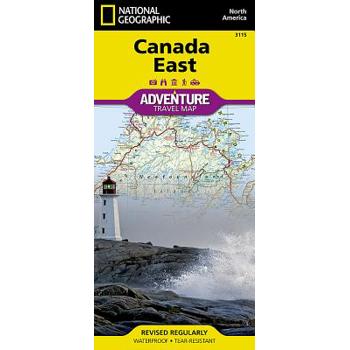
Canada East
- Waterproof - Tear-Resistant - Travel MapExplore the rich cultural history and many recreation activities available in Canada's eastern territories with National Geographic's Canada East Adventure Map. Designed to meet the needs of adventure travelers with its detailed, accurate information, this map includes the location of cities and towns with a user-friendly index and a clearly marked road network complete with distances and designations for roads, motorways, and expressways. Secondary routes are also included for those seeking to explore the stark wilderness of Newfoundland, the fertile farms of Prince Edward Island, or Nova Scotia's hidden coves and beaches. This map contains hundreds of diverse and unique recreational, ecological, cultural, and historic destinations. Whether you seek the quaint harbor gem of Halifax, the majestic city life of Toronto, or the old world charm of Montreal and Quebec City, you'll find it a perfect companion to a guidebook.On the front side of the print map you'll find routes leading to the stunning Niagara Falls, Canada's largest city of Toronto, Algonquin Provincial Park (Canada's largest national park), and the northern regions of Ontario and the Labrador Peninsula. The far eastern provinces on the reverse side are playgrounds for active exploring and scenic beauty, including Quebec, New Brunswick, Prince Edward Island, Nova Scotia, Newfoundland, and the mighty St. Lawrence River.Every Adventure Map is printed on durable synthetic paper, making them waterproof, tear-resistant and tough -- capable of withstanding the rigors of international travel.Map Scale = 1:2,100,000Sheet Size = 25.5" x 37.75"Folded Size = 4.25" x 9.25"
National Geographic: Scandinavia Classic Wall Map - Laminated (23.5 X 30.25 Inches)
National Geographic's wall map of Scandinavia is one of the largest and most detailed maps of the region. The signature Classic style design uses a bright, easy-to-read color palette. This map features thousands of place names, accurate political boundaries, national parks, and major infrastructure networks such as roads, superhighways, airports, canals, ferry routes, and high-speed and passenger railroads. The region's diverse terrain is detailed through accurate shaded relief, coastal bathymetry, and symbolism for water features and other land forms. Elevations of major peaks and depth soundings are expressed in meters. Inset maps provide detail of Iceland, the Faroe Islands, and Jan Mayen. In addition to Norway, Sweden, and Finland, coverage includes Denmark, Lithuania, Latvia, Estonia, and Kaliningrad Oblast. The map is encapsulated in heavy-duty 1.6 mil laminate which makes the paper much more durable and resistant to the swelling and shrinking caused by changes in humidity. Laminated maps can be framed without the need for glass, so the frames can be much lighter and less expensive. Map Scale = 1:2,763,000Sheet Size = 23.5" x 30.25"
National Geographic Adventure Map Austria
- Waterproof - Tear-Resistant - Travel MapNational Geographic's Adventure Map of Austria is an invaluable tool for travelers seeking to explore the baroque architecture, quaint mountain villages, and rugged alpine terrain of this remarkable country. Cities and towns are easy to find with the map's helpful index. Motorways, highways, and other roads are clearly designated and include distance in kilometers so travelers can easily plan their best route. With specialty content to include hundreds of diverse and unique recreational, ecological, cultural, and historical destinations, this map is a perfect companion to a guidebook. World Heritage sites, wildlife parks, botanical gardens, castles, archeological sites, monuments, zoos, golf courses, and museums are clearly indicated so travelers can take advantage of Austria's many natural attractions and activities.The western half of Austria is shown on the front side of the print map from its borders with Liechtenstein, Switzerland, Italy, and Germany, and details the provinces of Vorarlberg, Tirol, Salzburg, and the western half of K瓣rnten. The reverse side covers the eastern portion of the country from its borders with Czech Republic, Slovakia, Hungary, and Slovenia and includes the states of Steiermark, Ober繹sterreich. Nieder繹sterreich, Burgenland, Wien and the eastern half of K瓣rnten.Every Adventure Map is printed on durable synthetic paper, making them waterproof, tear-resistant and tough -- capable of withstanding the rigors of international travel.Map Scale = 1:415,000Sheet Size = 37.75" x 25.5"Folded Size = 4.25" x 9.25"
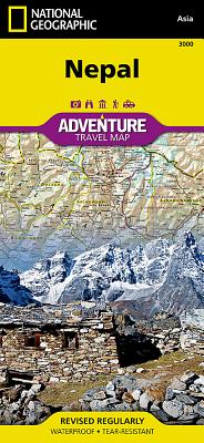
Nepal
- Waterproof - Tear-Resistant - Travel MapExplore the mystical reaches of the highest points on Earth with National Geographic's Nepal Adventure Map. This expertly crafted map includes the locations of thousands of cities and towns with an index for easily locating them, plus a clearly marked road network complete with distances and designations for highways, major roadways, secondary roads, scenic routes, and more. Classic trekking routes, main trails, and local trails are marked as well as areas for river rafting/kayaking and mountain biking. Hundreds of points of interest and diverse and unique destinations are highlighted including World Heritage sites, archeological sites, temples, monasteries, campsites, and more.The front side of the print map offers a detailed topographic and trekking map of central and eastern Nepal, including border regions with China and India. Mountaineers will stay on course with marked trails through the Himalayan Range, including Everest (the tallest mountain in the world), and the surrounding national parks and wildlife reserves. An inset of the Himalayas has been annotated to show elevation. The backside includes the western portion of Nepal, from the city of Mahendranagar in the west, to the Shey-Phoksundo National Park and Dhorpatan Hunting Reserve in the east. A detailed inset of Kathmandu and Patan City provide valuable locations of goods and services for casual tourists and seasoned trekkers alike. Every Adventure Map is printed on durable synthetic paper, making them waterproof, tear-resistant and tough -- capable of withstanding the rigors of international travel.Map Scale = 1:625,000Sheet Size = 37.75" x 25.5"Folded Size = 4.25" x 9.25"
World Classic Poster Size Map
Expertly researched and designed, National Geographic's World Wall Map is the authoritative map of the world by which other reference maps are measured. Product Features: Signature Classic style map with bright, easy to read color palette with blue oceans and colorful bordersBackground shows mountain ranges and valleys in subtle shaded relief with mountain ranges labeled Major water bodies including rivers, lakes, glaciers, oceans, seas, gulfs, bays, straits, and bathymetryClearly defined international boundaries, cities, islands, airports, and physical featuresThousands of place names carefully and artfully placed to maintain legibility in heavily populated areasUp-to-date international boundaries and territorial control reflect de facto status on the groundMeticulously researched using multiple authoritative sources including the U.N., U.S. Board on Geographic Names, and policies of individual governments.Accurate place names use a combination of conventional English names, official national names, and standard transliterations for non-Latin alphabets. Drawn in Winkel Tripel projection with distortions minimized unlike other World maps (e.g. Greenland is shown the same size as Argentina, not South America)Corner inset maps feature vegetation, land use, population density, and north and south polar regionsThe 36" x 24" poster size supports easy and affordable framing and mounting, and takes less wall space than standard wall maps.The map is packaged in a two inch diameter tube with a label showing a thumbnail of the map with dimensions and other pertinent information.Map Scale = 1:37,213,000Sheet Size = 36" x 24"
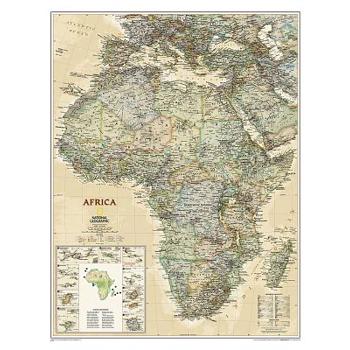
Africa Executive
Expertly researched and designed, National Geographic's Africa Wall Map is the authoritative map of Africa by which other reference maps are measured. Product Features: Antique-style "executive" color palette Background shows mountain ranges and valleys in subtle shaded relief with mountain ranges labeled Major water bodies including rivers, lakes, glaciers, oceans, seas, gulfs, bays, straits, and bathymetryClearly defined international boundaries, cities, islands, airports, and physical featuresThousands of place names carefully and artfully placed to maintain legibility in heavily populated areasUp-to-date international boundaries and territorial control reflect de facto status on the groundMeticulously researched using multiple authoritative sources including the United Nations and policies of individual governments.Accurate place names use a combination of conventional English names, official national names, and standard transliterations for non-Latin alphabets. Major landforms including deserts, lava fields, swamps, dry salt lakes, intermittent lakes, salt deserts, and areas below sea level Inset maps of the 10 island nations surrounding Africa and climate and terrain topographic map of the continent Countries shown include: Algeria, Angola, Benin, Botswana, Burkina Faso, Burundi, Cameroon, Cape Verde, Central African Republic, Chad, Democratic Republic of the Congo, Republic of Congo, C繫te d'Ivoire, Djibouti, Egypt, Equatorial Guinea, Eritrea, Ethiopia, Gabon, Gambia, Ghana, Guinea, Guinea-Bissau, Kenya, Liberia, Libya, Madagascar, Malawi, Mali, Mauritania, Morocco, Mozambique, Namibia, Niger, Nigeria, Rwanda, Senegal, Sierra Leone, Somalia, South Africa, Sudan, South Sudan, Tanzania, Togo, Tunisia, Uganda, Zambia, and Zimbabwe. The island nations shown are: Canary Islands, Madeira Islands, Comoros, Seychelles, Mauritius, Rodrigues, Reunion, Sao Tome and Principe, Bioko, and Cape Verde.The map is encapsulated in heavy-duty 1.6 mil laminate which makes the paper much more durable and resistant to the swelling and shrinking caused by changes in humidity. Laminated maps can be framed without the need for glass, so the frames can be much lighter and less expensive. Map Scale = 1:14,244,000Sheet Size = 24" x 30.75"
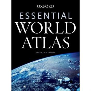
Essential World Atlas
With superbly crafted maps covering the entire globe, this new edition of Oxford's Essential World Atlas offers thorough geographical coverage at an affordable price. In addition to a unique city-mapping program, the Essential Atlas features dozens of thematic maps, charts, and graphs that explain many fundamental concepts in human geography. The new Seventh Edition also includes coverage of up-to-the-minute political and topographical changes. Essential World Atlas is packed with collateral information, such as statistics on the area, population, and annual income of every country in the world. Metro maps of dozens of cities provide detailed information on tourist attractions, public transportation, and other aspects of interest to the traveler. Enhancing its utility, the map section is fully indexed, allowing for quick reference. The Atlas also boasts a selection of stunning satellite images that provide an impression of our world from above, offering insight into how cities expand and rivers create life in the desert. Finally, the atlas includes a thematic "World in Focus" section, easy-to-use indices, survey data, and colorful illustrations of flags from around the world. Meticulously crafted and thoroughly updated, the Seventh Edition of Oxford's Essential World Atlas is an indispensable resource for students, teachers, armchair travelers, tourists, and anyone else curious about the far-flung corners of the globe.
Periplus Singapore Travel Map
The Singapore Travel Map from Periplus is designed as a convenient, easy-to-use tool for travelers. Created using durable coated paper, this map is made to open and fold multiple times, whether it's the entire map that you want to view or one panel at a time. Following highways and byways, this map will show you how to maneuver your way to banks, gardens, hotels, golf courses, museums, monuments, restaurants, churches and temples, movie theaters, shopping centers and more! This 12th edition includes maps and plans that are scaled to: Area Maps: Singapore Island 1:55,000 Sentosa 1:25,000City Plans: Singapore City 1:20,000 Central District 1:12,500Periplus Travel Maps cover most of the major cities and travel destinations in the Asia-Pacific region. The series includes an amazing variety of fascinating destinations, from the multifaceted subcontinent of India to the bustling city-state of Singapore and the 'western style' metropolis of Sydney to the Asian charms of Bali. All titles are continuously updated, ensuring they keep up with the considerable changes in this fast-developing part of the world. This extensive geographical reach and attention to detail mean that Periplus Travel Maps are the natural first choice for anyone traveling in the region.
Historic Maps and Views of San Francisco
Historic Maps and Views of San Francisco? contains twenty-four historic maps and views of San Francisco and its environs? Dating from the 1800s through the present? Ready for framing in a custom format or in a standard 11? x 14? frame. These stunning and fascinating images from The Granger Collection showcase San Francisco when it was still known as Yerba Buena, maps and ariel views of the expansion after the Gold Rush, a turn-of-the century photo of Chinatown at midnight, the Tower of Jewels at the Panama-Pacific Exposition in 1915, and the construction of the Golden Gate Bridge. Each image's original printing information is provided, as well as additional information that places it in historic context and further illuminates its qualities. Each image is exquisitely reproduced to show off its color and detail. The perfect gift for lovers of travel, history, or art.
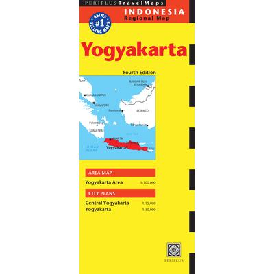
Periplus Travel Map Indonesia Regional Map
The Yogyakarta Travel Map from Periplus is designed as a convenient, easy-to-use tool for travelers. Created using durable coated paper, this map is made to open and fold multiple times, whether it's the entire map that you want to view or one panel at a time. Following highways and byways, this map will show you how to maneuver your way to banks, gardens, hotels, golf courses, museums, monuments, restaurants, churches and temples, movie theaters, shopping centers and more! This 4th edition includes maps and plans that are scaled to: Area Map: Yogyakarta Area 1:100,000City Plans: Central Yogyakarta 1:15,000 Yogyakarta 1:30,000Periplus Travel Maps cover most of the major cities and travel destinations in the Asia-Pacific region. The series includes an amazing variety of fascinating destinations, from the multifaceted subcontinent of India to the bustling city-state of Singapore and the 'western style' metropolis of Sydney to the Asian charms of Bali. All titles are continuously updated, ensuring they keep up with the considerable changes in this fast-developing part of the world. This extensive geographical reach and attention to detail mean that Periplus Travel Maps are the natural first choice for anyone traveling in the region.


