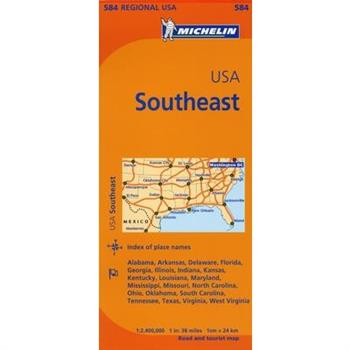
Michelin Map Southeast U.s.
Michelin regional maps each contain practical road and route information. Special Michelin reads-like-a-book format for easy use in folding and unfolding. Useful information for planning trips, including gas stations, 24-hour service stations, toll gates, rest areas and service plazas. Clear, precise cartography. Icons pinpoint important travel information.
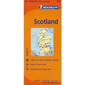
Michelin Map Scotland
Michelin regional maps each contain practical road and route information. Special Michelin reads-like-a-book format for easy use in folding and unfolding. Useful information for planning trips, including gas stations, 24-hour service stations, toll gates, rest areas and service plazas. Clear, precise cartography. Icons pinpoint important travel information.
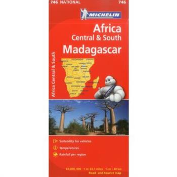
Michelin South Central and Madagascar Map
Renowned for over 100 years for their clear, accurate and easy to read mapping, Michelin Country maps give travelers an overall picture of their route, with practical road and travel information. The series' revamped cover, still in Michelin's traditional red for the country map collection, sports a simple mini-map for easy orientation, as well as a colorful destination photo.
Michelin Map Central Italy
Michelin regional maps each contain practical road and route information. Special Michelin reads-like-a-book format for easy use in folding and unfolding. Useful information for planning trips, including gas stations, 24-hour service stations, toll gates, rest areas and service plazas. Clear, precise cartography. Icons pinpoint important travel information.
Michelin Spain North, Basque Country, Navarra, La Rioja
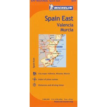
Michelin Map East, Valencia Murcia, Spain
Michelin Map 733 Portugal
Renowned for over 100 years for their clear, accurate and easy-to-read mapping, Michelin country maps give travelers an overall picture of their route, with practical road and travel information; and city maps containing extensive street indexes orient them quickly so they can find their way to their destination.
Michelin Road Atlas Europe
The newly updated Michelin Europe Road Atlas is the ideal take-along for travelers driving through Europe. Covering more than 40 countries, the atlas contains an extensive place name index and 70+ large-scale urban maps. The atlas's grid-style format allows for highly detailed mapping on a manageable page size, while a driving regulations chart provides valuable road safety information. NEW: Travelers will find more sightseeing points of interest from Michelin's Green Guide travel series, clearly highlighted on the map pages. Travel with confidence in Europe with a Michelin atlas.
National Geographic: United States Executive Wall Map (Poster Size: 36 X 24 Inches)
Expertly researched and designed, National Geographic's United States wall map is the standard by which other reference maps of the U.S. are measured.Product Features: Antique-style "executive" color palette All 50 states with insets for Hawaiian Islands and Alaska plus inset showing relative size of AlaskaClearly defined state and country boundaries, cities, islands, national parks, and physical featuresThousands of place names carefully and artfully placed to maintain legibility in heavily populated areasBackground shows mountain ranges and valleys in subtle shaded relief with mountain ranges labeled Major water bodies including rivers, lakes, gulfs, bays, straits, and ocean bathymetryTransportation routes including interstate highways, major state routes, airports, waterways, canals, and ferriesThe 36" x 24" poster size supports easy and affordable framing and mounting, and takes less wall space than standard wall maps.The map is packaged in a two inch diameter tube with a label showing a thumbnail of the map with dimensions and other pertinent information.Map Scale = 1:5,410,000Sheet Size = 36" x 24"
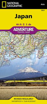
National Geographic Japan Map
- Waterproof - Tear-Resistant - Travel MapExplore the Land of the Rising Sun with National Geographic's expertly researched Japan Adventure Map. The user-friendly design combined with unparalleled detail provides adventure travelers the ultimate tool for exploring this island nation. Coverage includes the four main islands of Hokkaido, Honshu, Shikoku and Kyushu, as well as the southeastern tip of the Korean Peninsula. Inset maps cover Okinawa and many of the other Ryukyu Islands. Some popular destinations include the cities of Tokyo, Kyoto and Nara, Mount Fuji, the Hiroshima Peace Memorial and Himeji Castle. The map is the perfect compliment to National Geographic's Japan Traveler Guide or any other guidebook.Hundreds of highlighted cultural, historical and recreational points of interest, including UNESCO World Heritage Sites, National Parks, botanical gardens, castles, churches, Buddhist temples, Shinto shrines, caves, waterfalls, hot springs, ski area and beaches, will guide you to popular tourist hot spots as well as to hidden gems away from major tourist hubs. Cities and towns can be easily found with the help of a clear and convenient index. A road network complete with distances and designations for motorways, expressways, major roads and secondary roads, will help find select a suitable route, including one off the beaten path. Other transportation features include airports, ferries routes, harbors, railroads and high-speed trains.Every Adventure Map is printed on durable synthetic paper, making them waterproof, tear-resistant and tough -- capable of withstanding the rigors of international travel.Map Scale = 1:1,300,000Sheet Size = 37.75" x 25.5"Folded Size = 4.25" x 9.25"
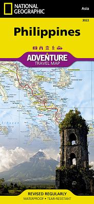
National Geographic Philippines Map
- Waterproof - Tear-Resistant - Travel MapThe Philippines, an archipelago of over 7,000 islands in southeast Asia, offer an extraordinary fusion of cultures and rich biodiversity. National Geographic's Philippines Adventure Map provides global travelers with the perfect combination of detail and perspective in a highly functional travel tool. Each of the three principal geographic divisions of the country -- Luzon, Visayas, and Mindanao -- are detailed. The front side of the print map shows Luzon and includes an inset of the Batanes province. The Visayan Islands, Mindanao, and an inset of the province of Tawi-Tawi are shown on the reverse side.Cities and towns are easy to find with the map's helpful index. Highways and major roads as well as minor and secondary roads are clearly designated and include distance in kilometers so travelers can easily plan their best route. National parks and reserves, World Heritage sites, hot springs, beaches, points of interest, and areas for surfing and diving are indicated so travelers can take advantage of the Philippines' many natural attractions and activities. The locations of airports, airfields, railroads, and ferry routes take the guesswork out of travel around the islands.Every Adventure Map is printed on durable synthetic paper, making them waterproof, tear-resistant and tough -- capable of withstanding the rigors of international travel.Map Scale = 1:1,300,000Sheet Size = 37.75" x 25.5"Folded Size = 4.25" x 9.25"
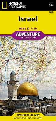
Israel
- Waterproof - Tear-Resistant - Travel MapNational Geographic's Israel Adventure Map is the perfect travel companion for Holy Land adventure travelers. This expertly researched map details the country with unparalleled information not found in traditional road maps. Hundreds of diverse and unique recreational, ecological, cultural, and historic destinations are pinpointed, including many hidden gems, such as Islamic and Jewish sacred sites, churches, mosques, archeological site, beaches, hotels, hostels, airports and harbors. A clearly marked network of both primary and secondary roads, shown with distances, along with an index of cities and towns will guide you on your adventure, while mapped hiking trails, including The Israel Trail, will help you get off the beaten path.This comprehensive map covers Israel in its entirety and complements any guidebook to the region. Also shown are Palestinian areas in the West Bank and Gaza Strip and bordering areas in Jordan, Syria and Lebanon. The country's three most populated cities Jerusalem, Tel-Aviv and Haifa can be found on the map's northern side, along with the Sea of Galilee (Kinneret), Nazareth, the Golan Heights and most of the Dead Sea. The map's southern side covers the cities of Be'ersheva, Hebron, Bethlehem and Eilat along with the Gaza Strip, Dead Sea, the ancient fortification of Masada and the Jordanian city of Aqaba. Every Adventure Map is printed on durable synthetic paper, making them waterproof, tear-resistant and tough -- capable of withstanding the rigors of international travel.Map Scale = 1:275,000Sheet Size = 25.5" x 37.75"Folded Size = 4.25" x 9.25"
National Geographic: Russia Classic Wall Map (30.25 X 23.5 Inches)
National Geographic's political map of Russia and the independent states of the former Soviet Union is one of the most authoritative maps of region. This Classic style wall map features a bright color palette with blue oceans and the country's terrain detailed in stunning shaded relief that has been a hallmark of National Geographic maps for over 75 years. Thousands of place names, accurate political boundaries, bodies of water, and major infrastructure networks such as roadways, airports, canals, oil pipelines, and railroads are detailed. Coastal bathymetry is shown with depth curves and soundings, and the boundaries of Northern Sea shipping routes are marked as well. Coverage also includes Norway, Sweden, Finland, Denmark, Latvia, Lithuania, Estonia, Ukraine, Belarus, Georgia, Armenia, Azerbaijan, Turkmenistan, Uzbekistan, Kazakhstan, Kyrgyzstan, Tajikistan, Afghanistan, Mongolia, North Korea, South Korea, and Japan, as well as portions of Germany, Poland, Iran, Pakistan, and China. The map is packaged in a two inch diameter tube with a label showing a thumbnail of the map with dimensions and other pertinent information.Map Scale = 1:12,376,000Sheet Size = 30.25" x 23.5"
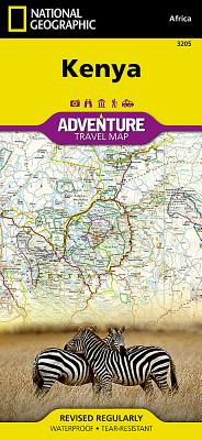
National Geographic Kenya Map
- Waterproof - Tear-Resistant - Travel MapExplore the diverse and iconic landscapes and many unique recreation activities available in this exciting country with National Geographic's Kenya Adventure Map. Designed to meet the needs of adventure travelers with its detailed, accurate information, this map includes the location of cities and towns with a user-friendly index and a clearly marked road network complete with distances and designations for expressways and roads. Scenic routes, four-wheel-drive tracks, and other trails are shown for those seeking to explore more remote regions. National parks, World Heritage sites, forts, archeological sites, campsites, hot springs, beaches, diving areas, and more are clearly indicated so travelers can take advantage of Kenya's many natural and historical attractions.The front side of the Kenya print map details the southern region of the country, from The Indian Ocean to the east, to the bordering country of Tanzania to the southwest. The reverse side of the map details the northern region, showing the bordering country of Ethiopia to the north, Somalia to the east, and Uganda to the west. Travel aids such as the locations of airports, airfields, railways, petrol stations, park entrances, and border crossings take the guesswork out of travel around the country.Every Adventure Map is printed on durable synthetic paper, making them waterproof, tear-resistant and tough -- capable of withstanding the rigors of international travel.Map Scale = 1:1,040,000Sheet Size = 37.75" x 25.5"Folded Size = 4.25" x 9.25"
National Geographic: United States Classic Wall Map (Poster Size: 36 X 24 Inches)
Expertly researched and designed, National Geographic's United States wall map is the standard by which other reference maps of the U.S. are measured.Product Features: Signature Classic styling with bright, easy to read color palette with blue water and colorful state bordersAll 50 states with insets for Hawaiian Islands and Alaska plus inset showing relative size of AlaskaClearly defined state and country boundaries, cities, islands, national parks, and physical featuresThousands of place names carefully and artfully placed to maintain legibility in heavily populated areasBackground shows mountain ranges and valleys in subtle shaded relief with mountain ranges labeled Major water bodies including rivers, lakes, gulfs, bays, straits, and ocean bathymetryTransportation routes including interstate highways, major state routes, airports, waterways, canals, and ferriesThe 36" x 24" poster size supports easy and affordable framing and mounting, and takes less wall space than standard wall maps.The map is packaged in a two inch diameter tube with a label showing a thumbnail of the map with dimensions and other pertinent information.Map Scale = 1:5,410,000Sheet Size = 36" x 24"
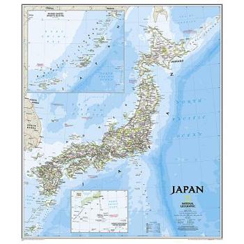
Japan Classic
The signature Classic style map of Japan features a bright color palette with blue oceans and the country's terrain detailed in stunning shaded relief that has been a hallmark of National Geographic wall maps for over 75 years. The map includes thousands of place names, accurate boundaries, national parks, and major infrastructure networks such as roads, highways, airports, and railroads. Coastal bathymetry is shown with depth curves and soundings. Inset maps provide detail of Japan's Southern Outer Islands and the Ryukyu Islands. Information about the 2011 Tohoku earthquake and tsunami is included as well.The map is packaged in a two inch diameter tube with a label showing a thumbnail of the map with dimensions and other pertinent information.Map Scale = 1:3,115,000Sheet Size = 25" x 29"
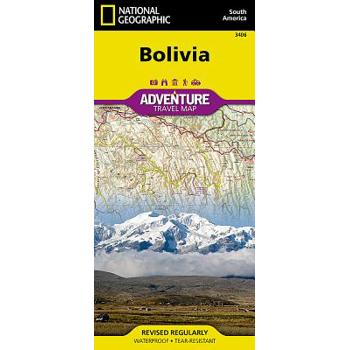
Bolivia Adventure Travel Map
- Waterproof - Tear-Resistant - Travel MapLet National Geographic's Bolivia Adventure Map guide you as you explore this South American country with one of the highest levels of biodiversity in the world. Quickly find your destination with the aid of a user-friendly index of cities, towns and protected areas. Then plan your route using the mapped road network, complete with distances and designations for major and secondary roads as well as tracks and trails for those seeking to travel off the beaten path. Other travel network features include airports, airfields, railroads, ferry routes and border crossings. In addition, hundreds of cultural, historical, ecological and recreational points of interest are pinpointed, such as camping areas, archeological sites, geysers, spas, churches and UNESCO World Heritage Sites. The map's north side covers the country from its northern borders with Brazil and Peru down to the capital of La Paz, including Madidi and Noel Kempff Mercado National Parks, Tiwanaku and Lake Titicaca. While the south side covers the more mountainous southern half of the country from La Paz to the borders with Paraguay, Chile and Argentina. Included are the cities of Potosi and Sucre, Eduardo Avaroa Andean Fauna National Reserve and the world's largest salt flat, Salar de Uyuni. With such an abundance of specialized content, along with its topographic features, this map is the perfect compliment to any guidebook to the country. Every Adventure Map is printed on durable synthetic paper, making them waterproof, tear-resistant and tough -- capable of withstanding the rigors of international travel.Map Scale = 1:1,415,000Sheet Size = 37.75" x 25.5"Folded Size = 4.25" x 9.25"
Banff North [banff and Yoho National Parks]
- Waterproof - Tear-Resistant - Topographic MapNational Geographic's Trails Illustrated map of Banff North delivers unmatched detail for outdoor enthusiasts exploring the unparalleled mountain scenery and abundance of recreational opportunities of the Canadian Rockies. Expertly researched and created in cooperation with Parks Canada and others, the map covers the northern and western areas of Banff National Park as well as Yoho and Kootenay National Parks, Siffleur and White Goat Wilderness Areas, Kootenay Plains Provincial Park and the southeastern tip of Jasper National Park. Many popular recreation points of interest are shown, including Lakes Louise and O'Hara as well as the scenic Icefields Parkway, displayed with distance markers.Explore the area by following the map to trailheads and then along precisely mapped trails, shown with distance markers in miles and kilometers and labeled for hiking, biking and horseback riding. To aid in your navigation the map shows glaciers and icefields, contour lines and elevations, labeled peaks and passes, areas of rock debris and water features. Find suitable areas for exploration, according to your area of interest, with labeled campgrounds and campsites, backcountry lodging and cabins, horse camps and corrals, biking and skiing areas, river access points, fishing areas, lookout towers and scenic viewpoints. The map also includes background information about the area, bear safety tips and essential contact information.Every Trails Illustrated map is printed on "Backcountry Tough" waterproof, tear-resistant paper. A full UTM grid is printed on the map to aid with GPS navigation.Other features found on this map include: Banff National Park, Lake Louise.Map Scale = 1:100,000Sheet Size = 37.75" x 25.5"Folded Size = 4.25" x 9.25"
National Geographic: Germany Classic Wall Map (23.5 X 30.25 Inches)
National Geographic's map of Germany is as attractive as it is functional. Rendered in the Classic style with colorful, clearly defined international borders, shaded relief, and easy-to-read fonts, this map includes thousands of place names. Major infrastructure such as airports, major roadways, canals, high-speed and passenger railroads, as well as oil fields and pipelines are noted. Coastal bathymetry on the North and Baltic seas is shown with depth curves and soundings. Coverage also includes Luxembourg and portions of Denmark, Poland, Czech Republic, Austria, Switzerland, France, Belgium and the Netherlands. The map is packaged in a two inch diameter tube with a label showing a thumbnail of the map with dimensions and other pertinent information.Map Scale = 1:1,375,000Sheet Size = 23.5" x 30.25"













![Banff North [banff and Yoho National Parks] Banff North [banff and Yoho National Parks]](https://cdn.kingstone.com.tw/english/images/product/6598/9781566956598.jpg)

