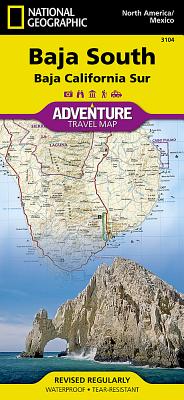
National Geographic Adventure Map Baja South
- Waterproof - Tear-Resistant - Travel MapLocated in Northwestern Mexico, the Baja California Peninsula is a popular travel destination for its abundant recreation and conservation opportunities. National Geographic's Baja South Adventure Map covers with unparalleled detail the state of Baja California Sur, in more sparsely populated southern half of the peninsula are some of the Gulf of California Islands. The northern side of the map covers the UNESCO World Heritage Site, Rock Paintings of the Sierra de San Francisco, Bahia Loreto and El Vizcaino. The southern side covers the state capital La Paz, Cabo San Lucas, San Jose del Cabo and Corredor Los Cabos. Inset maps give extensive detail to these popular areas. Cultural, historical, recreational and ecological points of interest, a road network and topographic features are all combined on this easy to use and expertly researched map. With such specialized content, this map is the perfect compliment to any guidebook. Pinpointed are missions, ruins, museums, lighthouses, scenic viewpoints, wildlife viewing spots, beaches and areas for surfing, diving, fishing, kayaking, sailing, windsurfing, snorkeling and whale watching. The detailed road network includes not only major highways and toll roads but also gravel and dirt roads, to help you get off the beaten path. Moreover, a table of distances is provided as are ferry routes, railroads and an index of protected areas and select towns.Every Adventure Map is printed on durable synthetic paper, making them waterproof, tear-resistant and tough -- capable of withstanding the rigors of international travel.Map Scale = 1:450,000 & 1:75,000Sheet Size = 37.75" x 25.5"Folded Size = 4.25" x 9.25"
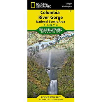
Columbia River Gorge National Scenic Area
- Waterproof - Tear-Resistant - Topographic MapThe magnificent Multnomah Falls is just one of many natural, cultural, and recreational attractions in the Columbia River Gorge Scenic Area. The 80-mile-long gorge contains diverse ecosystems ranging from the lush Oneonta Gorge Rain Forest to the arid Celilo Grasslands. Expertly researched and created in partnership with local land management agencies, National Geographic's Trails Illustrated map of Columbia River Gorge provides an unparalleled tool for exploring this breathtaking region. Some of the key areas of interest featured on the map include the White Salmon, Klickitat, Sandy, and Lower Deschutes rivers; Yacolt Burn State Forest; Maryhill, Columbia Hills, and Rooster Rock state parks; Mark O. Hatfield Wilderness; and portions of Mount Hood and Gifford-Pinchot national forests. With miles of clearly marked trails including the Pacific Crest National Trail and the Oregon National Historic Trail, and such scenic roadways as the Historic Columbia River Highway and Yakima Scenic Byway, this map will prove invaluable whether you're taking in the scenery on foot or by car. A helpful list of waterfalls makes it easy to take in these natural wonders in your travels. Many recreation features are noted as well, including campgrounds, trailheads, interpretive trails, boat launches, and areas for fishing, windsurfing, and swimming. The map base includes contour lines and elevations for summits. Every Trails Illustrated map is printed on "Backcountry Tough" waterproof, tear-resistant paper. A full UTM grid is printed on the map to aid with GPS navigation.Other features found on this map include: Bonneville Dam, Bull Run Reservoir Number One, Camas, Columbia Hills, Deschutes River, Gifford Pinchot National Forest, Gresham, Hood River, Klickitat River, Lake Celilo, Mark O. Hatfield Wilderness, Mount Defiance, Mt. Hood National Forest, Multnomah Falls, Shellrock Mountain, The Dalles, Troutdale, Washougal, White Salmon River.Map Scale = 1:75,000Sheet Size = 37.75" x 25.5"Folded Size = 4.25" x 9.25"
Pocket World Atlas
A handy pocket-sized book, conveniently bound in a durable yet flexible laminated cover, this new edition of the Pocket World Atlas contains full-color digitally produced maps as well as the latest statistics for countries and cities. The maps are carefully colored to show terrain as well as elevation, and the latest changes to major transportation routes and administrative boundaries are clearly depicted. A 64-page index follows the maps and contains more than 15,000 entries of places and geographical features, and the atlas also boasts such unique features as 24 city plans, a gazetteer of nations, maps of time zones and flight paths, and world climate averages.
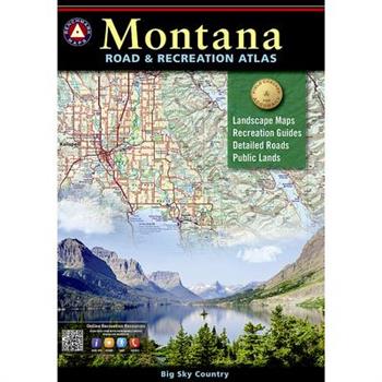
Montana Road & Recreation Atlas
Montana is the crown jewel of the American West. Experience Big Sky Country with Benchmark's completely new 3rd edition Montana Road & Recreation Atlas. No other map product can better portray Montana's rugged peaks, majestic rivers, and expansive plains. Large-scale Landscape MapsTM reveal landforms with amazing realism and detail, clearly showing the state's vast network of roads, waterways, and recreation landmarks. A 30-page Recreation Guide provides regional maps with public land detail and lists a wide range of outdoor activities. Arranged by category and boasting unequalled insight and detail, it is the ideal tool for planning and executing Montana exploration.
Rand McNally Utica, Rome & Syracuse New York Street Guide
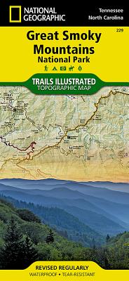
National Geographic Trails Illustrated Great Smoky Mountains National Park, Tennessee/Nort
- Waterproof - Tear-Resistant - Topographic MapAmerica's most visited national park and a UNESCO World Heritage Site, Great Smoky Mountains National Park is both renowned for its diversity of plant and animal life and rich in remnants of Southern Appalachian mountain culture. National Geographic's Trails Illustrated map of the park combines unparalleled detail and valuable information for outdoor enthusiasts seeking to explore all the area has to offer with particular attention shown to backcountry campsites, shelters, and stream crossings. A detailed profile of the Appalachian National Scenic Trail, which snakes along the ridge of the Great Smoky Mountains, provides a handy tool for hikers. The map features many key points of interest as well, including Cades Cove, Fontana Lake, Maryville, and Gatlinburg. With over 800 miles of mapped trails, the Great Smoky Mountains National Park map can guide you off the beaten path and back again. The clearly marked trails include mileages between intersections. The map base includes contour lines and elevations for summits, passes and many lakes. Some of the many recreation features include: visitor centers, campgrounds, trail shelters, trailheads, boat ramps, scenic overlooks, interpretive trails and quiet walkways.Every Trails Illustrated map is printed on "Backcountry Tough" waterproof, tear-resistant paper. A full UTM grid is printed on the map to aid with GPS navigation.Other features found on this map include: Cherokee National Forest, Chilhowee Mountain, Kuwohi, Fontana Lake, Great Smoky Mountains, Maryville, Mount Chapman, Mount Le Conte, Nantahala National Forest, Newfound Gap, Old Black, Pisgah National Forest, Waynesville.Map Scale = 1:70,000Sheet Size = 37.75" x 25.5"Folded Size = 4.25" x 9.25"


