Yellowstone National Park
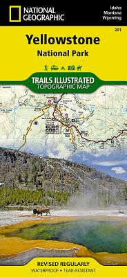
- Waterproof - Tear-Resistant - Topographic MapNational Geographic's Trails Illustrated map of Yellowstone National Park is designed to meet the needs of outdoor enthusiasts by combining valuable information with unmatched detail of America's first national park. Expertly researched and created in partnership with local land management agencies, this map features key points of interest including Mammoth Hot Springs, Canyon Village, Yellowstone Lake, Yellowstone Falls, Grant Village, and Old Faithful geyser area.With over 1,000 miles of mapped trails, the Yellowstone National Park map can guide you off the beaten path and back again. The clearly marked trails include mileages between intersections. Trail summaries provide elevation, duration, and difficulty for a variety of suggested hikes. The map base includes contour lines and elevations for summits, passes and many lakes. The bathymetry of Yellowstone Lake is shown with both contours and hill shading. Some of the many recreation features include: campgrounds, trailheads, boat ramps, marinas, scenic overlooks and interpretive trails.Every Trails Illustrated map is printed on "Backcountry Tough" waterproof, tear-resistant paper. A full UTM grid is printed on the map to aid with GPS navigation.Other features found on this map include: Absaroka-Beartooth Wilderness, Beartooth Mountains, Big Game Ridge, Buffalo Plateau, Colter Peak, Craig Pass, Crowfoot Ridge, Custer National Forest, Eagle Peak, Emigrant Peak, Gallatin National Forest, Grand Teton National Park, Granite Peak, Granite Range, Grouse Mountain, Heart Lake, Hurricane Mesa, Jedediah Smith Wilderness, John D. Rockefeller, Jr. Memorial Parkway, Lake Plateau, Lamar River, Lee Metcalf Wilderness, Lewis Lake, Lower Falls of the Yellowstone River, Mount Hancock, Mount Holmes, Mount Sheridan, Mount Wallace, Mount Washburn, North Absaroka Wilderness, Pilot Peak, Pitchstone Plateau, Ramshorn Peak, Red Mountains, Saddle Mountain, Shoshone Lake, Shoshone National Forest, Targhee National Forest, Teton National Forest, Teton Wilderness, Thorofare Plateau, Washakie Wilderness, Yellowstone Lake, Yellowstone National Park.Map Scale = 1:126,720Sheet Size = 37.75" x 25.5"Folded Size = 4.25" x 9.25"
National Geographic: World Satellite Wall Map (43.5 X 30.5 Inches)
National Geographic's striking satellite map of The World is a visually stunning image that makes a wonderful addition to the wall of any office or study. This detailed composite map draws from more than 500 satellite images to give one-kilometer detail and consistent representation of Earth's natural colors and terrain. Inset maps detail the biosphere, surface temperature, and the polar regions. The beauty and complexity of Earth's landscapes, both above and below the oceans, is revealed with the Global Satellite Mosaic which was produced for National Geographic Society by NASA's Jet Propulsion Laboratory.The map is packaged in a two inch diameter tube with a label showing a thumbnail of the map with dimensions and other pertinent information.Map Scale = 1:38,931,000Sheet Size = 43.5" x 30.5"
National Geographic Destination Map Washington D.C.
- Waterproof - Tear-Resistant - Travel MapThe national's capital and home to many of the country's most treasured monuments and museums, Washington D. C. is a popular destination for business and leisure travelers. National Geographic's City Destination map of Washington D. C. is a comprehensive guide to the city, combining an easy-to-read road map with an informative and well researched travel guide. The map covers the city from Georgetown, through the White House, National Mall and Capitol, to the Washington Navy Yard, along with parts of Northern Virginia, the Potomac River and its many bridges.Pinpointed on the map are hundreds of points of interest, including monuments, hotels, places of worship, parks, police stations, hospitals, notable buildings and metro stations. Many of the city's most popular attractions are depicted in 3D, including the Lincoln Memorial, Washington Monument and White House. An inset map outlines the neighboring area of Old Town Alexandria. A comprehensive metro map along with diagrams of Dulles and Reagan National Airports are shown along with background information of the transit system. To assist in your navigation of the area, a user friendly index of streets, government buildings, monuments, museums, parks, hotels and metro stations is also provided.Every Destination Map is printed on durable synthetic paper, making them waterproof, tear-resistant and tough -- capable of withstanding the rigors of any kind of travel.Map Scale = 1:11,300Sheet Size = 24.75" x 17.75"Folded Size = 4" x 8.75"
Rand McNally Johnstown/Altoona State College, Pennsylvania
North Korea, South Korea, the Forgotten War: 2 Sided [tubed]
This two-sided map of North Korea and South Korea explores the historical and ongoing political challenges of this region. One side displays a detailed political map and inset maps on population, economy, and armaments. The reverse side features pictures and maps of the Korean War, as well as a colorful relief map that reveals the rugged physical geography of the Korean peninsula. New place-names introduced by the South Korean government are shown--changing places such as Pusan to Busan and Cheju to Jeju. Map is printed on premium quality paper stock, rolled, and packaged in a clear, hard plastic tube.Map Scale = 1:1,357,000Sheet Size = 23.25" x 35.75"





















![North Korea, South Korea, the Forgotten War: 2 Sided [tubed] North Korea, South Korea, the Forgotten War: 2 Sided [tubed]](https://cdn.kingstone.com.tw/english/images/product/9955/9780792249955m.jpg)


